Category:Antony Passage
Jump to navigation
Jump to search
hamlet in Cornwall, United Kingdom  | |||||
| Upload media | |||||
| Instance of | |||||
|---|---|---|---|---|---|
| Location | Saltash, Cornwall, South West England, England | ||||
 | |||||
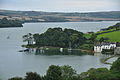
English: Antony Passage is a hamlet in south-east Cornwall, England. It stands beside the tidal section of St Germans River (a tributary of the River Tamar) on the opposite bank to Antony village.
Subcategories
This category has the following 2 subcategories, out of 2 total.
A
- Antony Passage harbour (11 F)
F
- Forder viaduct (38 F)
Media in category "Antony Passage"
The following 63 files are in this category, out of 63 total.
-
 Antony Passage (3129).jpg 4,288 × 2,848; 7 MB
-
 Antony Passage (6490).jpg 4,288 × 2,848; 6.23 MB
-
 Antony Passage (6491).jpg 4,288 × 2,848; 5.19 MB
-
 Antony Passage (6505).jpg 4,288 × 2,848; 5.37 MB
-
 Antony Passage (9387).jpg 4,288 × 2,848; 6.34 MB
-
 Antony Passage - geograph.org.uk - 1192296.jpg 640 × 480; 82 KB
-
 Antony Passage - geograph.org.uk - 2427152.jpg 640 × 427; 120 KB
-
 Antony Passage - geograph.org.uk - 2973417.jpg 1,200 × 802; 1.06 MB
-
 Antony Passage - geograph.org.uk - 2996496.jpg 1,024 × 685; 651 KB
-
 Antony Passage - geograph.org.uk - 3866832.jpg 800 × 561; 152 KB
-
 Antony Passage - geograph.org.uk - 4032934.jpg 1,920 × 1,434; 459 KB
-
 Antony Passage - geograph.org.uk - 4033091.jpg 1,920 × 1,346; 385 KB
-
 Antony Passage - geograph.org.uk - 4038246.jpg 1,920 × 1,442; 319 KB
-
 Antony Passage - geograph.org.uk - 5018806.jpg 640 × 426; 46 KB
-
 Antony Passage - geograph.org.uk - 5659759.jpg 640 × 426; 48 KB
-
 Antony Passage - geograph.org.uk - 5838111.jpg 1,024 × 681; 106 KB
-
 Antony Passage - geograph.org.uk - 6031204.jpg 1,024 × 681; 127 KB
-
 Antony Passage and Forder Lake (9388).jpg 4,288 × 2,848; 4.92 MB
-
 Antony Passage and Lynher River - geograph.org.uk - 3444063.jpg 1,024 × 768; 142 KB
-
 Antony Passage at sunset (9372).jpg 4,288 × 2,848; 6.11 MB
-
 Antony Passage at sunset (9391).jpg 4,288 × 2,848; 4.97 MB
-
 Antony Passage at sunset (9393).jpg 4,288 × 2,848; 6 MB
-
 Antony Passage at sunset (9394).jpg 4,288 × 2,848; 4.94 MB
-
 Antony Passage quay - geograph.org.uk - 66296.jpg 640 × 386; 110 KB
-
 Antony Passage, Cornwall.jpg 5,152 × 3,864; 12.98 MB
-
 Antony Passage.jpg 3,373 × 2,616; 3.01 MB
-
 Churchtown Farm Wildlife Reserve, Saltash.jpg 3,066 × 1,254; 1.57 MB
-
 Footpath from Antony Passage - geograph.org.uk - 3866856.jpg 640 × 425; 148 KB
-
 Footpath from Antony Passage - geograph.org.uk - 3866869.jpg 640 × 425; 69 KB
-
 Footpath to Antony Passage - geograph.org.uk - 4032452.jpg 1,920 × 1,328; 342 KB
-
 Forder Creek - geograph.org.uk - 1191436.jpg 640 × 357; 58 KB
-
 Forder Creek, Churchtown Nature Reserve.jpg 3,072 × 2,048; 2.27 MB
-

-
 Foreshore at Antony Passage - geograph.org.uk - 2433260.jpg 640 × 427; 122 KB
-
 Harbour wall, Antony Passage - geograph.org.uk - 4153716.jpg 1,920 × 1,306; 521 KB
-
 Harbour, Antony Passage - geograph.org.uk - 4032960.jpg 1,920 × 1,315; 614 KB
-
 Harbour, Antony Passage - geograph.org.uk - 4033074.jpg 1,920 × 1,415; 483 KB
-
 Heading towards Saltash - geograph.org.uk - 469879.jpg 640 × 427; 104 KB
-
 Helipad jetty, Antony Passage - geograph.org.uk - 4032708.jpg 1,920 × 1,283; 399 KB
-
 Jetty, Antony Passage - geograph.org.uk - 4033146.jpg 1,920 × 1,310; 648 KB
-
 Main street in Antony Passage - geograph.org.uk - 2426973.jpg 640 × 427; 142 KB
-
 Mill Pond - geograph.org.uk - 5542279.jpg 640 × 426; 49 KB
-
 Mill Pond and Antony Passage - geograph.org.uk - 5542276.jpg 640 × 426; 62 KB
-

-
 Mill pond embankment - geograph.org.uk - 5645385.jpg 640 × 426; 54 KB
-
 Mill pond Embankment, Antony passage - geograph.org.uk - 5838108.jpg 1,024 × 681; 89 KB
-
 Mill Pond, Antony Passage - geograph.org.uk - 5838109.jpg 1,024 × 681; 82 KB
-
 Mill Pond, Antony Passage - geograph.org.uk - 5838110.jpg 1,024 × 515; 64 KB
-
 Mill pond, Antony Passage - geograph.org.uk - 6031205.jpg 1,024 × 681; 138 KB
-
 Old Bridge Support - geograph.org.uk - 344883.jpg 640 × 429; 98 KB
-

-
 Old Railway Bridge Support - geograph.org.uk - 344870.jpg 640 × 419; 124 KB
-
 Old railway line, near Antony Passage - geograph.org.uk - 2434904.jpg 427 × 640; 162 KB
-
 Path to Antony Passage - geograph.org.uk - 4032575.jpg 1,920 × 1,395; 848 KB
-
 Postbox, Antony Passage - geograph.org.uk - 4033130.jpg 1,920 × 1,337; 546 KB
-
 Public footpath near Anthony Passage - geograph.org.uk - 2452095.jpg 427 × 640; 113 KB
-
 Small Harbour at Antony Pssage - geograph.org.uk - 3866851.jpg 800 × 532; 135 KB
-
 Stone steps at Antony Passage - geograph.org.uk - 2427178.jpg 640 × 427; 104 KB
-
 Tidal Mill, Antony Passage - geograph.org.uk - 1192093.jpg 640 × 480; 102 KB
-

-

-
 Trees beside Marsh Combe - geograph.org.uk - 1192405.jpg 640 × 493; 151 KB
-
 Warship, River Lynher - geograph.org.uk - 5659761.jpg 640 × 426; 44 KB
.jpg)
.jpg)
.jpg)
.jpg)
.jpg)


.jpg)

.jpg)
.jpg)
.jpg)
.jpg)


