File:Finland Ostrobothnia Region.svg
Jump to navigation
Jump to search

Size of this PNG preview of this SVG file: 481 × 600 pixels. Other resolutions: 192 × 240 pixels | 385 × 480 pixels | 616 × 768 pixels | 821 × 1,024 pixels | 1,642 × 2,048 pixels | 1,000 × 1,247 pixels.
Original file (SVG file, nominally 1,000 × 1,247 pixels, file size: 62 KB)
Captions
Captions
Add a one-line explanation of what this file represents
Summary
[edit]| Description |
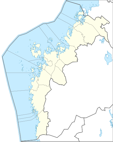
Suomi: Kartta Pohjanmaan maakunnasta. Bounding box 20.1658 61.9216, 23.7440 64.0093 English: Map of Ostrobothnia Region, Finland. Bounding box 20.1658 61.9216, 23.7440 64.0093 |
|||
| Date | ||||
| Source | Own work | |||
| Author | Josutus | |||
| Permission (Reusing this file) |
|

Licensing
[edit]
I, the copyright holder of this work, hereby publish it under the following license:
This file is licensed under the Creative Commons Attribution-Share Alike 3.0 Unported license.
- You are free:
- to share – to copy, distribute and transmit the work
- to remix – to adapt the work
- Under the following conditions:
- attribution – You must give appropriate credit, provide a link to the license, and indicate if changes were made. You may do so in any reasonable manner, but not in any way that suggests the licensor endorses you or your use.
- share alike – If you remix, transform, or build upon the material, you must distribute your contributions under the same or compatible license as the original.
File history
Click on a date/time to view the file as it appeared at that time.
| Date/Time | Thumbnail | Dimensions | User | Comment | |
|---|---|---|---|---|---|
| current | 16:39, 29 January 2021 | | 1,000 × 1,247 (62 KB) | Fenn-O-maniC (talk | contribs) | Reverted to version as of 16:35, 29 January 2021 (UTC) Wrong file |
| 16:39, 29 January 2021 |  | 1,000 × 1,062 (65 KB) | Fenn-O-maniC (talk | contribs) | Added Isokyrö | |
| 16:35, 29 January 2021 |  | 1,000 × 1,247 (62 KB) | Fenn-O-maniC (talk | contribs) | Removed Isokyrö | |
| 21:09, 17 February 2014 |  | 1,000 × 1,247 (57 KB) | Josutus (talk | contribs) | Projection fix | |
| 18:50, 17 February 2014 |  | 1,000 × 1,238 (58 KB) | Josutus (talk | contribs) | User created page with UploadWizard |
You cannot overwrite this file.
File usage on Commons
There are no pages that use this file.
File usage on other wikis
The following other wikis use this file:
- Usage on en.wikipedia.org
- Ostrobothnia (region)
- Module:Location map/data/Finland Ostrobothnia
- Module:Location map/data/Finland Ostrobothnia/doc
- Vaasa railway station
- Tervajoki railway station
- Vaskiluoto railway station
- Module:Location map/data/Ostrobothnia
- Module:Location map/data/Ostrobothnia/doc
- Hietalahti Pesäpallo Stadium
- Usage on fi.wikipedia.org
- Susiluola
- Pohjanmaan maakunta
- Moikipää
- Tervajoki
- Kaukaluoto
- Tuovila
- Tast
- Pännäinen
- Hankmo
- Sepänkylä (Mustasaari)
- Harrström
- Iskmo
- Karperö
- Norra Vallgrund
- Riimala
- Merikaarto
- Käyttäjä:Josutus/testit
- Malline:Sijaintikartta Pohjanmaan maakunta
- Ollisbackenin–Brantbackenin muinaisjäännösalue
- Veikkaala
- Kåtabackenin jätinkirkko
- Jäknabackenin jätinkirkko
- Kejsmolandsbackenin jätinkirkko
- Honkobackharjun jätinkirkko
- Snårbackenin jätinkirkko
- Högryggenin jätinkirkko
- Racklen jätinkirkko
- Hembackenin jätinkirkko
- Svedjebackenin jätinkirkko
- Tallbackharjun jätinkirkot
- Skaftung
- Murikka
- Kristiinankaupungin keskustaajama
- Lapväärtin kirkonkylä
- Metsälä (Siipyy)
- Siipyyn kirkonkylä
- Bäckeshällornan jätinkirkko
- Höysälänjärven jätinkirkko
- Tavoman jätinkirkko
- Vaasan keskustaajama
- Pietarsaaren keskustaajama
View more global usage of this file.