File:February 2021 nor'easter 2021-02-01 2126Z.jpg
Jump to navigation
Jump to search
Size of this preview: 520 × 600 pixels. Other resolutions: 208 × 240 pixels | 416 × 480 pixels | 666 × 768 pixels | 888 × 1,024 pixels | 1,739 × 2,006 pixels.
Original file (1,739 × 2,006 pixels, file size: 2.47 MB, MIME type: image/jpeg)
Captions
Captions
Add a one-line explanation of what this file represents
Summary
[edit]
| Description |
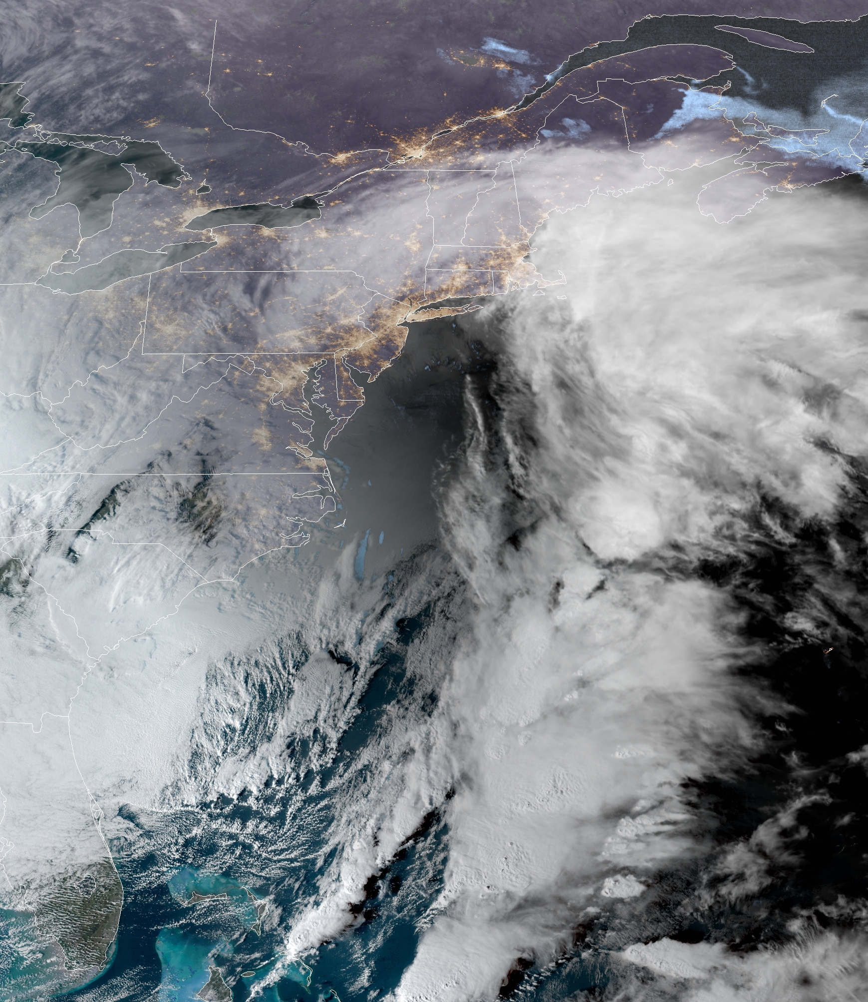
English: GOES-16 true-color satellite image of a powerful nor'easter impacting the Northeastern United States on February 1, 2021. Image taken at 21:26Z (4:26 p.m. EST). |
| Date | |
| Source | https://cdn.star.nesdis.noaa.gov/GOES16/ABI/CONUS/GEOCOLOR/20210322126_GOES16-ABI-CONUS-GEOCOLOR-5000x3000.jpg |
| Author | National Oceanic and Atmospheric Administration |
Licensing
[edit]
This image is in the public domain because it contains materials that originally came from the U.S. National Oceanic and Atmospheric Administration, taken or made as part of an employee's official duties.
|
File history
Click on a date/time to view the file as it appeared at that time.
| Date/Time | Thumbnail | Dimensions | User | Comment | |
|---|---|---|---|---|---|
| current | 22:40, 1 February 2021 | | 1,739 × 2,006 (2.47 MB) | MarioProtIV (talk | contribs) | Uploaded a work by National Oceanic and Atmospheric Administration from https://cdn.star.nesdis.noaa.gov/GOES16/ABI/CONUS/GEOCOLOR/20210322126_GOES16-ABI-CONUS-GEOCOLOR-5000x3000.jpg with UploadWizard |
You cannot overwrite this file.
File usage on Commons
There are no pages that use this file.