Category:GOES 16 pictures
Jump to navigation
Jump to search
Media in category "GOES 16 pictures"
The following 200 files are in this category, out of 564 total.
(previous page) (next page)-
 02L 2022-06-27 1950Z.jpg 1,550 × 2,000; 4.84 MB
-
 02L 2022-06-28 1230Z.jpg 1,550 × 2,000; 4.36 MB
-
 02L 2022-06-28 1610Z.jpg 1,550 × 2,000; 4.24 MB
-
 16L 2017-10-04 GOES-16.png 1,920 × 1,080; 1.34 MB
-
2018 Bomb Cyclone Blizzard - Center of the Storm Satellite Imagery January 4, 2018.webm 4.2 s, 1,440 × 1,080; 3.81 MB
-
 20180728 00Z GOES16 vis 93E.tiff 1,800 × 1,801; 12.38 MB
-
 20180728 06Z GOES16 ir 93E.tiff 1,800 × 1,801; 12.38 MB
-
 20180728 12Z GOES16 ir 93E.tiff 1,801 × 1,800; 12.38 MB
-
 20180728 18Z GOES16 vis 93E.tiff 1,799 × 1,800; 12.37 MB
-
 20180729 00Z GOES16 vis 10E.tif 1,800 × 1,801; 12.38 MB
-
 20180729 06Z GOES16 ir 93E.tiff 1,801 × 1,800; 12.38 MB
-
 20180729 12Z GOES16 ir 93E.tiff 1,800 × 1,801; 12.38 MB
-
 20180729 18Z GOES16 vis 93E.tiff 1,801 × 1,800; 12.38 MB
-
 20180730 00Z GOES16 vis 93E.tiff 1,801 × 1,799; 12.37 MB
-
 20180730 06Z GOES16 ir 93E.tiff 1,800 × 1,801; 12.38 MB
-
 20180730 12Z GOES16 ir 93E.tiff 1,801 × 1,800; 12.38 MB
-
 20180730 18Z GOES16 vis 93E.tiff 1,801 × 1,800; 12.38 MB
-
 20180731 00Z GOES16 vis 93E.tiff 1,801 × 1,800; 12.38 MB
-
 20180731 06Z GOES16 ir 93E.tiff 1,800 × 1,801; 12.38 MB
-
 20180731 12Z GOES16 ir 93E.tiff 1,800 × 1,801; 12.38 MB
-
 20180731 18Z GOES16 vis 10E.tiff 1,801 × 1,800; 12.38 MB
-
 20180801 00Z GOES16 vis 10E.tiff 1,799 × 1,801; 12.37 MB
-
 20180801 06Z GOES16 ir 10E.tiff 1,801 × 1,800; 12.38 MB
-
 20180801 12Z GOES16 ir 10E.tiff 1,801 × 1,800; 12.38 MB
-
 20180801 18Z GOES16 vis 10E.tiff 1,801 × 1,800; 12.38 MB
-
 20180802 00Z GOES16 vis 10E.tiff 1,801 × 1,800; 12.38 MB
-
 20180802 06Z GOES16 ir 10E.tiff 1,801 × 1,800; 12.38 MB
-
 20180802 12Z GOES16 ir 10E.tiff 1,800 × 1,801; 12.38 MB
-
 20180802 18Z GOES16 vis 10E.tiff 1,801 × 1,800; 12.38 MB
-
 20180803 00Z GOES16 vis 10E.tiff 1,801 × 1,800; 12.38 MB
-
 20180803 06Z GOES16 ir 10E.tiff 1,800 × 1,799; 12.37 MB
-
 20180803 12Z GOES16 ir 10E.tiff 1,801 × 1,800; 12.38 MB
-
 20180803 18Z GOES16 vis 10E.tiff 1,801 × 1,800; 12.38 MB
-
 20180804 00Z GOES16 vis 10E.tiff 1,800 × 1,801; 12.38 MB
-
 20180804 06Z GOES16 ir 10E.tiff 1,801 × 1,800; 12.38 MB
-
 20180804 12Z GOES16 ir 10E.tiff 1,801 × 1,800; 12.38 MB
-
 20180804 18Z GOES16 vis 10E.tiff 1,801 × 1,800; 12.38 MB
-
 20180805 00Z GOES16 vis 10E.tiff 1,801 × 1,800; 12.38 MB
-
 20180810 1200Z GOES16 ir 14E.tif 389 × 389; 148 KB
-
 20180810 1800Z GOES16 vis 14E.tif 1,557 × 1,557; 2.31 MB
-
 20180811 0000Z GOES16 vis 14E.tif 1,557 × 1,557; 2.31 MB
-
 20180811 0600Z GOES16 ir 14E.tif 389 × 389; 148 KB
-
 20180811 1200Z GOES16 ir 14E.tif 389 × 389; 148 KB
-
 20180811 1800Z GOES16 vis 14E.tif 1,557 × 1,557; 2.31 MB
-
 20180812 0000Z GOES16 vis 14E.tif 1,557 × 1,557; 2.31 MB
-
 20180812 0600Z GOES16 ir 14E.tif 389 × 389; 148 KB
-
 20180812 1200Z GOES16 ir 14E.tif 389 × 389; 148 KB
-
 20180812 1800Z GOES16 vis 14E.tif 1,557 × 1,557; 2.31 MB
-
 20180813 0000Z GOES16 vis 14E.tif 1,557 × 1,557; 2.31 MB
-
 20180813 0600Z GOES16 ir 14E.tif 389 × 389; 148 KB
-
 20180813 1200Z GOES16 ir 14E.tif 389 × 389; 148 KB
-
 20180813 1800Z GOES16 vis 14E.tif 1,557 × 1,557; 2.31 MB
-
 20180814 0000Z GOES16 vis 14E.tif 1,557 × 1,557; 2.31 MB
-
 20180814 0600Z GOES16 ir 14E.tif 389 × 389; 148 KB
-
 20180814 1200Z GOES16 ir 14E.tif 389 × 389; 148 KB
-
 20180814 1800Z GOES16 vis 14E.tif 1,557 × 1,557; 2.31 MB
-
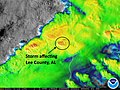 2019-03-03 GOES 16 Lee County Alabama Tornado.jpg 640 × 480; 81 KB
-
2019-03-03 GOES 16 Lee County Alabama Tornado.webm 6.4 s, 640 × 480; 1.33 MB
-
2023 Atlantic Hurricane Season Wraps Up (NESDIS 2023-11-28 2023 11 28 Atlantic Hurricane Season Wraps Up NO TEXT).webm 2 min 16 s, 3,840 × 2,160; 346.75 MB
-
2023 Atlantic Hurricane Season Wraps Up (NESDIS 2023-11-28 2023 11 28 Atlantic Hurricane Season Wraps Up).webm 2 min 16 s, 3,840 × 2,160; 360.67 MB
-
2023 Satellite Imagery- A Year in Review (NESDIS 2024-01-03 2024 01 05 2023 A Year In Review).webm 2 min 20 s, 3,840 × 2,160; 232.96 MB
-
2023 Satellite Imagery- A Year in Review (NESDIS 2024-01-03 2024 01 05 2023 A YearIn Review NO TEXT).webm 2 min 20 s, 3,840 × 2,160; 240.21 MB
-
A Look Back at Debby (NESDIS 2024-08-15 2024 08 15 Hurricane-Debby).webm 2 min 8 s, 3,840 × 2,160; 419.64 MB
-
A Look Back at Debby (NESDIS 2024-08-15 2024 08 15 Hurricane-Debby-text-free).webm 2 min 8 s, 3,840 × 2,160; 429.62 MB
-
 A Satellite View of a Back-door Cold Front (14295309881).jpg 3,600 × 3,000; 1.54 MB
-
 A View of Deadly Minnesota Thunderstorms from Earth Orbit (NESDIS 2020-07-10).gif 1,920 × 1,080; 143.35 MB
-
 Active MDR in June.jpg 9,006 × 3,195; 38.69 MB
-

-
 Alberto 2018-05-25 1147Z.png 1,000 × 1,000; 1.59 MB
-
 Alberto 2018-05-25 1257Z.jpg 600 × 600; 108 KB
-
 Alberto 2018-05-25 1600Z.png 3,400 × 3,400; 10.58 MB
-
 Alberto 2018-05-25 1630Z (Full size).jpg 798 × 296; 248 KB
-
 Alberto 2018-05-25 1630Z.jpg 798 × 624; 545 KB
-
 Alberto 2018-05-25 231635Z.png 500 × 280; 191 KB
-
 Alberto 2018-05-26 2130Z.jpg 3,774 × 2,505; 5.3 MB
-
 Alberto 2018-05-28 0440Z.jpg 500 × 500; 54 KB
-
 Alberto 2018-05-28 1345Z (Full size).jpg 798 × 296; 218 KB
-
 Alberto 2018-05-28 1345Z.jpg 798 × 655; 555 KB
-
 Alberto 2018-05-28 1515Z.jpg 2,000 × 2,000; 4.3 MB
-
 Annular Solar Eclipse of October 14, 2023 as viewed from GOES-16.jpg 10,848 × 10,848; 89.62 MB
-
 Artemis 1 Launch from GOES 16.gif 1,100 × 619; 12.97 MB
-
 As expected Harvey has intensified into a Hurricane (35973025253).jpg 1,920 × 1,080; 628 KB
-
 Beryl 2018-07-06 1200Z.png 1,600 × 1,600; 3.83 MB
-
 Beryl 2018-07-06 1215Z.jpg 703 × 703; 682 KB
-
 Beryl 2018-07-06 1815Z.jpg 798 × 695; 354 KB
-
 Blas 2022-06-17 1540Z.jpg 1,550 × 2,000; 4.07 MB
-
 Blas 2022-06-20 1910Z.jpg 1,550 × 2,000; 3.97 MB
-
 Bud 2018-06-11 1015Z.jpg 1,105 × 868; 366 KB
-
 Bud 2018-06-11 NOAA.jpg 616 × 372; 64 KB
-
 Bud 2018-06-12 NOAA (Daylight).jpg 800 × 551; 476 KB
-
 Bud 2018-06-12 NOAA.jpg 931 × 524; 54 KB
-
 Bud 2018-06-14 2000Z.jpg 798 × 296; 219 KB
-
 Bud and 04E 2018-06-15 1145Z.jpg 798 × 702; 289 KB
-
 Bud Cat 3 and TS comparison.jpg 600 × 273; 38 KB
-
California’s Oak Fire Near Yosemite Spreads Rapidly (NESDIS 2022-07-28 2022 07 28 OakFireThreatensYosemite TWITTER).webm 1 min 24 s, 1,920 × 1,080; 57.99 MB
-
California’s Oak Fire Near Yosemite Spreads Rapidly (NESDIS 2022-07-28 2022 07 28 OakFireThreatensYosemite UHD).webm 1 min 24 s, 3,840 × 2,160; 133.14 MB
-

-
 Category 5 Hurricane Willa Heads Toward Mexico (30576904637).png 1,920 × 1,080; 2.91 MB
-

-
 Celia 2022-06-17 1540Z.jpg 1,200 × 1,500; 2.61 MB
-
 Celia 2022-06-19 1340Z.jpg 1,550 × 2,000; 4.91 MB
-
 Central U.S. storm system 2019-05-20 1330Z.jpg 1,920 × 1,080; 747 KB
-
 Chris 2018-07-11 1445Z.png 743 × 743; 840 KB
-
 Cindy 2017-06-22 1931Z.png 1,682 × 1,487; 4.74 MB
-
 Cindy Geostationary VIS-IR 2017.png 1,581 × 1,549; 4.45 MB
-

-
 Clouds Associated with Tropical Disturbance Bubble Up Over Louisiana (48251040312).jpg 1,920 × 1,080; 1.8 MB
-
 Colin 2022-07-02 1211Z.jpg 1,650 × 2,100; 4.74 MB
-
 Convection in Puerto Rico on October 6, 2017.gif 1,142 × 703; 3.03 MB
-
 Coral Reefs Discovered where Amazon River Flows into the Atlantic Ocean (23782381768).png 1,920 × 1,080; 3.12 MB
-
 Cosme 2019-07-06 1510Z.jpg 1,536 × 1,536; 4.07 MB
-
 Cristobal 2020-06-08 GOES-16 (full).jpg 4,096 × 4,096; 3.21 MB
-
 Cristobal 2020-06-08 GOES-16.jpg 4,463 × 2,975; 2.71 MB
-
 Daniel 2018-06-24 1500Z.jpg 798 × 671; 294 KB
-
 Danielle 2022-09-04 2000Z.jpg 1,550 × 2,000; 5.06 MB
-

-
 Deadly Tornadoes Tear Through Tennessee (NESDIS 2020-03-03 Tornado-gif).gif 600 × 360; 5.04 MB
-

-

-
 Delta Intensifies into a Major Hurricane (50428786942).jpg 1,920 × 1,080; 1.73 MB
-

-
 Dora 2017-06-26 1215Z.jpg 798 × 592; 151 KB
-
 Dora 2017-06-26 1445Z.jpg 798 × 592; 197 KB
-
 Dorian 2019-08-26 1008Z.jpg 1,920 × 1,080; 1.51 MB
-
 Dorian 2019-08-27 and Large Saharan Dust Plume Blows Across the Atlantic.jpg 1,920 × 1,080; 2.15 MB
-
 Dorian 2019-08-29 1450Z.jpg 1,920 × 1,080; 1.91 MB
-
 Dorian 2019-08-29 1500Z.jpg 5,109 × 3,174; 2.44 MB
-
 Dorian 2019-08-31 1600Z.jpg 3,723 × 2,482; 5.3 MB
-
 Dorian 2019-09-01 1800Z.tiff 2,799 × 2,800; 29.92 MB
-
 Dorian 2019-09-02 0000Z.tiff 559 × 560; 1.2 MB
-
 Dorian 2019-09-02 0600Z.tiff 559 × 560; 1.2 MB
-
 Dorian 2019-09-02 1200Z.tiff 2,799 × 2,799; 29.91 MB
-
 Dorian 2019-09-02 1400Z.jpg 1,920 × 1,080; 1.92 MB
-
 Dorian 2019-09-02 1700Z.png 1,108 × 567; 1.22 MB
-
 Dorian 2019-09-05 1205Z.jpg 2,400 × 2,400; 652 KB
-
 Dorian 2019-09-06 1220Z.jpg 1,920 × 1,080; 1.82 MB
-
 Dorian, Fernand, Gabrielle and Juliette 2019-09-02 1700Z (zoom).jpg 3,108 × 2,119; 2.35 MB
-
 Dorian, Fernand, Gabrielle and Juliette 2019-09-02 1700Z.jpg 5,424 × 5,424; 4.83 MB
-
 Early January 2018 Nor'easter 2018-01-04 1345Z.jpg 2,858 × 2,795; 6.34 MB
-
 Earth 2024-01-15 1810Z.jpg 10,848 × 10,848; 18.5 MB
-
Earth from Orbit- 2021 Hurricane Season Has Begun (NESDIS 2021-06-03 2021 06 03 HurricaneSeasonHasBegun NO TEXT UHD).webm 1 min 17 s, 3,840 × 2,160; 346.78 MB
-
Earth from Orbit- 2021 Hurricane Season Has Begun (NESDIS 2021-06-03 2021 06 03 HurricaneSeasonHasBegun UHD).webm 1 min 17 s, 3,840 × 2,160; 314.21 MB
-
Earth from Orbit- 2022 Hurricane Season Begins (NESDIS 2022-06-09 2022 06 09 HurricaneSeasonBegins2022 TWITTER).webm 1 min 38 s, 1,920 × 1,080; 149.57 MB
-
Earth from Orbit- 2022 Hurricane Season Begins (NESDIS 2022-06-09 2022 06 09 HurricaneSeasonBegins2022 UHD).webm 1 min 38 s, 3,840 × 2,160; 361.57 MB
-
Earth from Orbit- Actinoform Clouds (NESDIS 2021-06-10 2021 06 10 Actinoform Clouds UHD CLEAN NoText).webm 1 min 17 s, 3,840 × 2,160; 399.26 MB
-
Earth from Orbit- Actinoform Clouds (NESDIS 2021-06-10 2021 06 10 Actinoform Clouds UHD).webm 1 min 17 s, 3,840 × 2,160; 277.4 MB
-
Earth from Orbit- Alaska Ablaze (NESDIS 2022-06-30 2022 06 30 AlaskaAblaze TWITTER).webm 1 min 22 s, 1,920 × 1,080; 63.07 MB
-
Earth from Orbit- Alaska Ablaze (NESDIS 2022-06-30 2022 06 30 AlaskaAblaze UHD NO TEXT).webm 1 min 22 s, 3,840 × 2,160; 128.17 MB
-
Earth from Orbit- Hurricane Fiona Leaves Wake of Destruction (NESDIS 2022-09-22).webm 2 min 15 s, 3,840 × 2,160; 376.34 MB
-
Earth from Orbit- Hurricane Ida Causes Days of Destruction (NESDIS 2021-09-02 EfO Ida final with CIMMS).webm 2 min 53 s, 3,840 × 2,160; 341.62 MB
-
Earth from Orbit- Hurricane Ida Causes Days of Destruction (NESDIS 2021-09-02 EfO Ida no titles).webm 2 min 53 s, 3,840 × 2,160; 373.8 MB
-
Earth from Orbit- Hurricane Sam Powers Across the Atlantic (NESDIS 2021-09-30 2021 09 30 HurricaneSamPowersAcrossAtlantic NO TEXT UHD).webm 2 min 6 s, 3,840 × 2,160; 321.4 MB
-
Earth from Orbit- Hurricane Sam Powers Across the Atlantic (NESDIS 2021-09-30 2021 09 30 HurricaneSamPowersAcrossAtlantic TWITTER).webm 2 min 5 s, 1,920 × 1,080; 149.27 MB
-
 Earth from Orbit- NOAA Satellites Help Us Prepare for Severe Weather (52737254648).png 1,920 × 1,080; 2.76 MB
-
 Earth from Orbit- NOAA Satellites Monitor Severe Weather and Smoke (53061798238).png 1,920 × 1,080; 3.31 MB
-
 Earth from Orbit- NOAA Satellites Track Blazing Wildfires in Chile (52679478313).png 1,920 × 1,080; 2.75 MB
-
 Earth from Orbit- Rope Clouds (NESDIS 2023-02-02 20210426 RopeCloudStill).png 1,318 × 796; 2.01 MB
-
Earth from Orbit- Spring Snowstorm Hits U S (NESDIS 2022-04-15 2022 04 14 SpringSnow TWITTER).webm 1 min 57 s, 1,920 × 1,080; 175.97 MB
-
Earth from Orbit- Spring Snowstorm Hits U S (NESDIS 2022-04-15 2022 04 14 SpringSnowstorm UHD NO TEXT).webm 1 min 57 s, 3,840 × 2,160; 432.96 MB
-
Earth from Orbit- Summer Solstice (NESDIS 2022-06-24 2022 06 24 SummerSolstice TWITTER).webm 1 min 30 s, 1,920 × 1,080; 112.42 MB
-
Earth from Orbit- Summer Solstice (NESDIS 2022-06-24 2022 06 24 SummerSolstice UHD).webm 1 min 30 s, 3,840 × 2,160; 271.2 MB
-
Earth from Orbit- Tracking Fires from Space (NESDIS 2021-03-11).webm 1 min 0 s, 3,840 × 2,160; 77.55 MB
-
Earth from Orbit- Vernal Equinox (NESDIS 2022-03-25 2022 03 24 VernalEquinox TWITTER).webm 2 min 9 s, 1,920 × 1,080; 219.5 MB
-
Earth from Orbit- Vernal Equinox (NESDIS 2022-03-25 2022 03 24 VernalEquinox UHD NO TEXT).webm 2 min 9 s, 3,840 × 2,160; 654.68 MB
-
 Earth from Orbit- Violent Storms Tear Through the South (52781785896).png 1,920 × 1,080; 2.09 MB
-
Earth from Orbit- When Lightning Strikes (NESDIS 2022-08-18 2022 08 18 WhenLightningStrikes TWITTER).webm 1 min 47 s, 1,920 × 1,080; 116.34 MB
-
Earth from Orbit- When Lightning Strikes (NESDIS 2022-08-18 2022 08 18 WhenLightningStrikes UHD NO TEXT).webm 1 min 47 s, 3,840 × 2,160; 258.46 MB
-
 Earth June Solstice 2022.jpg 10,848 × 10,848; 109.53 MB
-
 Earth viewed by GOES-16 2023-03-11 1700Z.jpg 10,848 × 10,848; 127.79 MB
-
 Emily 2017-07-31 1230Z.jpg 917 × 698; 264 KB
-

-

-
 Estelle 2022-07-16 1400Z.jpg 1,550 × 2,000; 4.45 MB
-
 Eta 2020-11-03 1700Z.jpg 2,806 × 2,189; 1.67 MB
-
 Everything From Snow to Flooding Rain Across the U S (NESDIS 2019-12-23).jpg 1,920 × 1,080; 1.76 MB
-
 Explosion of Falcon 9 B1046 as seen by GOES 16.gif 1,366 × 625; 314 KB
-
 Falcon 9 Flight 77 plume GOES.gif 1,366 × 654; 6.66 MB
-
 Falcon 9 Flight 78 plume GOES.gif 1,366 × 653; 5.91 MB
-
 February 2021 nor'easter 2021-02-01 2126Z.jpg 1,739 × 2,006; 2.47 MB
-
 February 6-8, 2021 Nor'easter.jpg 2,470 × 2,940; 1.93 MB
-
 Final Pre-Operational GOES-16 Image (25001901108).jpg 1,109 × 660; 234 KB
-
 Fires Ignite Near Oil Tank Facility On Lake Maracaibo (NESDIS 2020-04-30).gif 1,191 × 670; 29.89 MB
-
 First Named Storm of 2019 Atlantic Hurricane Season (40936142943).jpg 1,920 × 1,080; 978 KB
-
 Five Named Atlantic Storms, 2020 (50700750536).jpg 3,840 × 2,160; 2.42 MB
-
 Florence 2018-09-12 1145Z.jpg 1,920 × 1,080; 576 KB
-
 Florence 2018-09-14 1330Z.png 2,000 × 2,000; 5.24 MB
-
 Florence 2018-09-15 1145Z.jpg 1,920 × 1,080; 584 KB
-
 Florence Strengthens to a Category 4 Hurricane (29678024287).png 1,920 × 1,080; 3.79 MB
-
Full Path of East Coast Nor'Easter Blizzard Captured by Satellite January 4, 2018.webm 12 s, 1,440 × 1,080; 8.97 MB
-
 Geocolor Image of Hurricane Irma.jpg 1,619 × 976; 259 KB
-
 Geostationary Satellite imagery.png 10,000 × 10,030; 103.99 MB
-
 GOES 16 1750z 2021-06-15.jpg 10,848 × 10,848; 85.54 MB
-
 GOES 16 2017-09-10 1515Z.jpg 10,848 × 10,848; 125.6 MB
-
 GOES 16 2021-07-04 2150Z.jpg 10,848 × 10,848; 66.43 MB
-
 GOES 16 2021-08-16 1430Z.jpg 10,204 × 7,544; 12.94 MB
-
 GOES 16 2021-08-16 1430Z.png 5,102 × 3,793; 41.51 MB
-
 GOES 16 2021-08-25 2010Z.jpg 12,428 × 6,518; 13.69 MB
-
 GOES 16 2021-08-27 1700Z.jpg 9,456 × 10,228; 11.68 MB
-
 GOES 16 2021-08-28 1400Z.jpg 10,000 × 7,726; 13.42 MB
-
 GOES 16 2021-09-01 1750Z.jpg 7,500 × 4,019; 5.86 MB


.jpg)
.gif)
.gif)


.jpg)


.jpg)


.gif)
.png)
.jpg)


.gif)
.jpg)


.png)

.jpg)


.gif)
.gif)
.gif)
.gif)
.jpg)
.gif)


.jpg)


.png)
.png)
.png)
.png)
.png)


.gif)
.gif)


.jpg)


.jpg)
.gif)
.jpg)
.jpg)


.png)


.jpg)
.jpg)