File:Farthing Gate cottages at Eastry, Kent, England.jpg
Jump to navigation
Jump to search

Size of this preview: 800 × 508 pixels. Other resolutions: 320 × 203 pixels | 640 × 406 pixels | 1,066 × 677 pixels.
Original file (1,066 × 677 pixels, file size: 721 KB, MIME type: image/jpeg)
Captions
Captions
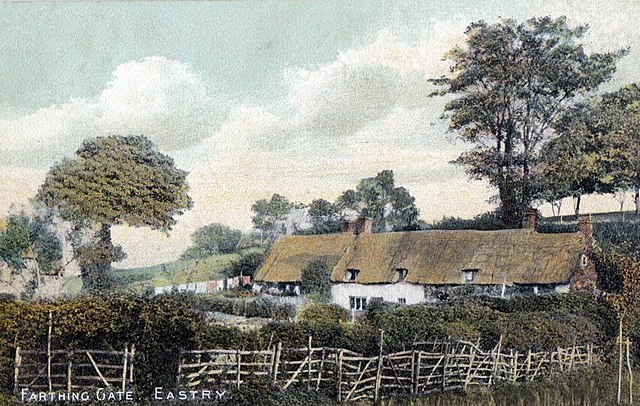
Farthing Gate cottages at Eastry, Kent, England
Summary
[edit]
| Description |
English: Row of thatched cottages at Farthing Gate on Brook Street at the east of the village of Eastry in Kent, England. Farthing Gate appears not to be on any modern map, but from earlier maps was (is?) centred at a right angled bend in Brook Street 300 yards east from St Mary's Church. The cottages might have been converted to the tiled roof semi-detached houses shown under the geotag. The boundary fencing in the picture appears to have been constructed from a series of seven-bar gates. |
| Date | between 1900 and 1910 |
| Source | Vintage postcard |
| Author | Unknown author |
| Object location | | View this and other nearby images on: OpenStreetMap |
|---|
Licensing
[edit]
|
This work is in the public domain in its country of origin and other countries and areas where the copyright term is the author's life plus 70 years or fewer. This work is in the public domain in the United States because it was published (or registered with the U.S. Copyright Office) before January 1, 1929. | |
| This file has been identified as being free of known restrictions under copyright law, including all related and neighboring rights. | |
File history
Click on a date/time to view the file as it appeared at that time.
| Date/Time | Thumbnail | Dimensions | User | Comment | |
|---|---|---|---|---|---|
| current | 20:39, 21 March 2018 | | 1,066 × 677 (721 KB) | Acabashi (talk | contribs) | User created page with UploadWizard |
You cannot overwrite this file.
File usage on Commons
There are no pages that use this file.