Category:Eastry
Jump to navigation
Jump to search
English: Eastry is a village and civil parish to the southwest of the town of Sandwich, in Kent, England. The parish contains the hamlet of Buttsole which is conjoined to the south of Eastry village.
Nederlands: Eastry is een plaats en civil parish in het bestuurlijke gebied Dover, in het Engelse graafschap Kent. De plaats telt 2168 inwoners.

village in Kent, England, UK  | |||||
| Upload media | |||||
| Instance of | |||||
|---|---|---|---|---|---|
| Location | Dover, Kent, South East England, England | ||||
| Population |
| ||||
| Said to be the same as | Eastry (Wikimedia duplicated page, civil parish) | ||||
 | |||||
Subcategories
This category has the following 15 subcategories, out of 15 total.
B
- Brook Cottage, Eastry (4 F)
- Brook House, Eastry (2 F)
- Buttsole (16 F)
C
- Eastry Court (2 F)
E
- Eastry War Memorial (1 F)
- Eastry Windmill (8 F)
F
- Fairfield House, Eastry (1 F)
- The Five Bells, Eastry (5 F)
G
- Gore Court, Dover (2 F)
- Great Selson (2 F)
H
L
- Little Selson (2 F)
M
O
- Oasts in Eastry (8 F)
- Old Selson House (2 F)
Media in category "Eastry"
The following 200 files are in this category, out of 589 total.
(previous page) (next page)-
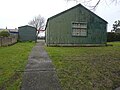
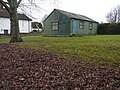
 10th Deal Eastry Scout Group HQ - geograph.org.uk - 2203651.jpg 3,072 × 2,304; 1.78 MB
-
 Lower Street, Eastry, Kent, England.jpg 1,588 × 1,007; 1.37 MB
-
 Church Street, Eastry, Kent.jpg 1,075 × 671; 527 KB
-
 2, Gore Farm, Gore Lane - geograph.org.uk - 6042597.jpg 3,264 × 2,448; 2.91 MB
-
 2, St Mary’s Close - geograph.org.uk - 4720441.jpg 3,264 × 2,448; 2.41 MB
-
 Eastry Court gateway at Eastry, Kent, England.jpg 3,000 × 2,000; 5.57 MB
-
 Eastry, Kent England - Church Road path and wall.jpg 3,000 × 2,000; 6.38 MB
-
 A corner at The Cross, Eastry - geograph.org.uk - 4028211.jpg 640 × 428; 120 KB
-
 A field of wild flowers near the A256 - geograph.org.uk - 2383124.jpg 640 × 480; 195 KB
-
 A glimpse of Gore Cottage - geograph.org.uk - 4024599.jpg 640 × 480; 194 KB
-
 A stunning field of wild flowers - geograph.org.uk - 2383116.jpg 640 × 480; 219 KB
-
 A256 - geograph.org.uk - 5796151.jpg 640 × 426; 78 KB
-
 A256 - geograph.org.uk - 5796152.jpg 640 × 426; 68 KB
-
 A256 Eastry Bypass - geograph.org.uk - 4520639.jpg 2,272 × 1,704; 774 KB
-
 Albion Place - geograph.org.uk - 5796112.jpg 640 × 426; 74 KB
-
 Albion Road, Eastry - geograph.org.uk - 4519837.jpg 2,272 × 1,704; 764 KB
-
 Alternative route - geograph.org.uk - 1098263.jpg 640 × 480; 211 KB
-
 Antiques, Foxborough Hill - geograph.org.uk - 5786647.jpg 640 × 426; 95 KB
-
 Approaching Eastry from the WSW - geograph.org.uk - 5647026.jpg 3,264 × 2,448; 3.76 MB
-

-
 Aumbrey Cottages, Eastry - geograph.org.uk - 6478722.jpg 1,024 × 684; 410 KB
-
 Bank Cottage, Eastry - geograph.org.uk - 2269262.jpg 3,072 × 2,304; 2.1 MB
-
-
 Becket's, historic building of Kent - geograph.org.uk - 1115047.jpg 480 × 640; 200 KB
-
 Beckets, Woodnesborough Lane - geograph.org.uk - 6057870.jpg 3,264 × 2,448; 2.88 MB
-
 Black Lane - geograph.org.uk - 4176745.jpg 3,888 × 2,592; 6.4 MB
-
 Black Lane - geograph.org.uk - 4289930.jpg 427 × 640; 194 KB
-
 Black Lane - geograph.org.uk - 4290030.jpg 427 × 640; 199 KB
-
 Black Lane - geograph.org.uk - 4290032.jpg 640 × 427; 194 KB
-
 Black Lane - geograph.org.uk - 4290040.jpg 640 × 427; 197 KB
-
 Black Lane from Thorton Lane - geograph.org.uk - 4289855.jpg 640 × 427; 191 KB
-
 Blazing Donkey Hotel - geograph.org.uk - 2269299.jpg 3,072 × 2,304; 1.55 MB
-
 Boundary stone on Eastry parish boundary - geograph.org.uk - 3130412.jpg 640 × 480; 223 KB
-
 Bowman - geograph.org.uk - 5786802.jpg 640 × 426; 62 KB
-
 Bridleway near Cherry Tree Farm - geograph.org.uk - 2269295.jpg 3,072 × 2,304; 2.43 MB
-
 Bridleway to North Court Plantation - geograph.org.uk - 2220591.jpg 3,072 × 2,304; 1.63 MB
-
 Bridleway to Pike Road - geograph.org.uk - 2428114.jpg 3,072 × 2,304; 2.15 MB
-
 Bridleway to Thornton Wood - geograph.org.uk - 2220636.jpg 3,072 × 2,304; 3.44 MB
-
 Brook St - geograph.org.uk - 5796145.jpg 640 × 426; 113 KB
-
 Brook St - geograph.org.uk - 5796479.jpg 640 × 457; 99 KB
-
 Brook Street, Eastry - geograph.org.uk - 4520609.jpg 2,272 × 1,704; 826 KB
-
 Brook Street, Eastry - geograph.org.uk - 4520627.jpg 2,272 × 1,704; 1.01 MB
-
 Brook Street, Eastry - geograph.org.uk - 4520630.jpg 2,272 × 1,704; 1.18 MB
-
 Brook Street, Eastry - geograph.org.uk - 4520633.jpg 2,272 × 1,704; 926 KB
-
 Building behind the former Bull Inn, 7 High Street - geograph.org.uk - 4781854.jpg 2,448 × 3,264; 1.7 MB
-
 Butcher's shop at Eastry, Kent, England.jpg 1,339 × 1,047; 516 KB
-
 Byway - geograph.org.uk - 3832772.jpg 800 × 530; 377 KB
-
 Byway on The Downs - geograph.org.uk - 1970099.jpg 1,024 × 768; 289 KB
-
 Byway on the Thornton Downs - geograph.org.uk - 2428154.jpg 3,072 × 2,304; 2.56 MB
-
 Byway to Eastry (2) - geograph.org.uk - 2203645.jpg 3,072 × 2,304; 2.03 MB
-
 Byway to Eastry - geograph.org.uk - 2203643.jpg 3,072 × 2,304; 1.98 MB
-
 Car Park, The Blazing Donkey - geograph.org.uk - 5801159.jpg 640 × 426; 100 KB
-
 Chest Tomb of Thomas Rammell - geograph.org.uk - 5796128.jpg 640 × 426; 122 KB
-
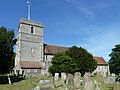
 Church of St Mary - geograph.org.uk - 5796116.jpg 640 × 426; 89 KB
-
 Church of St Mary - geograph.org.uk - 5796123.jpg 640 × 426; 83 KB
-
 Church of St Mary - geograph.org.uk - 5796125.jpg 426 × 640; 102 KB
-
 Church of St Mary - geograph.org.uk - 5796130.jpg 640 × 426; 93 KB
-
 Church of St Mary - geograph.org.uk - 5796140.jpg 640 × 426; 115 KB
-
 Church of St Mary - geograph.org.uk - 5796142.jpg 640 × 425; 67 KB
-
 Church of St Mary - geograph.org.uk - 5796476.jpg 426 × 640; 114 KB
-
 Church of St Mary - geograph.org.uk - 5796485.jpg 640 × 425; 99 KB
-
 Church Street in the snow - geograph.org.uk - 2056757.jpg 640 × 480; 139 KB
-
 Church Street, Eastry - geograph.org.uk - 4520601.jpg 2,272 × 1,704; 780 KB
-
 Church Street, Eastry - geograph.org.uk - 4520605.jpg 2,272 × 1,704; 900 KB
-
 Church Street, Eastry - geograph.org.uk - 4520625.jpg 2,272 × 1,704; 848 KB
-
 Churchyard, Church of St Mary - geograph.org.uk - 5796132.jpg 640 × 426; 100 KB
-
 Churchyard, Church of St Mary - geograph.org.uk - 5796134.jpg 640 × 426; 116 KB
-
 Churchyard, Eastry - geograph.org.uk - 6478855.jpg 1,024 × 768; 509 KB
-
 Churchyard, Eastry - geograph.org.uk - 6478884.jpg 1,024 × 768; 465 KB
-
 Cobblers Cottage - geograph.org.uk - 5796056.jpg 640 × 426; 76 KB
-

-
 Conversion of the Bull Inn, 7, High Street - geograph.org.uk - 4663636.jpg 2,448 × 3,264; 1.97 MB
-
 Cooks Lea, Eastry - geograph.org.uk - 4519829.jpg 2,272 × 1,704; 897 KB
-
 Cooks Lea, Eastry - geograph.org.uk - 4519832.jpg 2,272 × 1,704; 820 KB
-
 Corner of Church St and Brook St - geograph.org.uk - 5796054.jpg 640 × 426; 80 KB
-
 Corner of High St - geograph.org.uk - 5796061.jpg 640 × 426; 67 KB
-
 Cottage near Venson Farm - geograph.org.uk - 5737578.jpg 4,320 × 3,240; 5.33 MB
-
 Cottage on Lower Street, Eastry - geograph.org.uk - 5437188.jpg 2,220 × 1,610; 825 KB
-
 Cottages, Church St - geograph.org.uk - 5796106.jpg 640 × 426; 64 KB
-
 Country road - geograph.org.uk - 4342653.jpg 640 × 480; 60 KB
-
 Country road - geograph.org.uk - 4342656.jpg 640 × 480; 58 KB
-
 Course of Black Lane - geograph.org.uk - 4290043.jpg 427 × 640; 184 KB
-
 Course of Black Lane - geograph.org.uk - 4639200.jpg 640 × 478; 190 KB
-
 Crop Fields and Pylons - geograph.org.uk - 1970158.jpg 1,024 × 683; 288 KB
-
 Crop fields south of Eastry - geograph.org.uk - 2847488.jpg 640 × 480; 72 KB
-
 Cycle path alongside A256 Dover Road - geograph.org.uk - 4289656.jpg 3,888 × 2,592; 6.11 MB
-

-
 Demolition at the former Eastry Hospital - geograph.org.uk - 3749040.jpg 946 × 709; 196 KB
-
 Derelict building behind the Bull Inn, 7, High Street - geograph.org.uk - 4663648.jpg 2,448 × 3,264; 1.84 MB
-
 Derelict building, High Street - geograph.org.uk - 6057879.jpg 2,285 × 3,264; 2.35 MB
-
 Derelict hospital on Mill Lane, Eastry - geograph.org.uk - 5437187.jpg 2,304 × 1,728; 830 KB
-
 Development site, Gore Lane - geograph.org.uk - 5876125.jpg 3,264 × 2,448; 1.9 MB
-
 Direction Sign – Signpost - geograph.org.uk - 6599643.jpg 473 × 1,024; 164 KB
-
 Dismantled railway near Eastry - geograph.org.uk - 1514584.jpg 640 × 480; 68 KB
-

-
 Donkey pasture - geograph.org.uk - 5801147.jpg 640 × 425; 46 KB
-
 Dover Road - geograph.org.uk - 2847323.jpg 640 × 480; 64 KB
-
 Drainless Rd - geograph.org.uk - 5786671.jpg 640 × 426; 50 KB
-
 Drainless Road, Eastry - geograph.org.uk - 5439290.jpg 2,304 × 1,728; 867 KB
-
 Early graffiti in Eastry caves - geograph.org.uk - 2573588.jpg 1,600 × 1,200; 361 KB
-
 Eastry - geograph.org.uk - 5786841.jpg 640 × 426; 58 KB
-
 Eastry - geograph.org.uk - 5796122.jpg 640 × 426; 98 KB
-
 Eastry Bowling Club - geograph.org.uk - 5796121.jpg 640 × 426; 96 KB
-
 Eastry Bowling Club, Church Street - geograph.org.uk - 5645929.jpg 3,264 × 2,448; 3.92 MB
-
 Eastry Bowling Club, Church Street - geograph.org.uk - 5645936.jpg 3,264 × 2,448; 3.91 MB
-
 Eastry bypass opening celebrations - geograph.org.uk - 2302525.jpg 640 × 453; 167 KB
-
 Eastry C of E primary school - geograph.org.uk - 1115066.jpg 640 × 480; 143 KB
-
 Eastry chalk caves - geograph.org.uk - 2573578.jpg 1,200 × 1,600; 434 KB
-
 Eastry church - geograph.org.uk - 6478804.jpg 1,024 × 768; 360 KB
-
 Eastry church tower and churchyard - geograph.org.uk - 6478820.jpg 768 × 1,024; 432 KB
-
 Eastry Cross Cottage, High Street - geograph.org.uk - 4052108.jpg 1,109 × 831; 202 KB
-
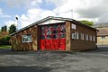 Eastry fire station - geograph.org.uk - 1284589.jpg 640 × 427; 245 KB
-
 Eastry High Street - geograph.org.uk - 1470496.jpg 640 × 467; 70 KB
-
 Eastry High Street - geograph.org.uk - 1470525.jpg 640 × 462; 78 KB
-
 Eastry High Street - geograph.org.uk - 1470549.jpg 640 × 488; 63 KB
-
 Eastry High Street - geograph.org.uk - 1470581.jpg 640 × 477; 72 KB
-
 Eastry Hospital Chapel - geograph.org.uk - 2203680.jpg 3,072 × 2,304; 2.3 MB
-
 Eastry Hospital in Mill Lane - geograph.org.uk - 1469091.jpg 640 × 483; 66 KB
-
 Eastry Hospital in Mill Lane - geograph.org.uk - 1469103.jpg 640 × 495; 80 KB
-
 Eastry hospital on Mill Lane - geograph.org.uk - 568905.jpg 640 × 480; 58 KB
-
 Eastry Hospital, Mill Lane - geograph.org.uk - 5646996.jpg 2,448 × 3,264; 2.14 MB
-
 Eastry old fire station - geograph.org.uk - 1284596.jpg 640 × 427; 204 KB
-
 Eastry Post Office - geograph.org.uk - 4519867.jpg 2,272 × 1,704; 743 KB
-
 Eastry Post Office - geograph.org.uk - 5786777.jpg 640 × 426; 69 KB
-
 Eastry station site geograph-3447602-by-Ben-Brooksbank.jpg 2,310 × 1,573; 3.32 MB
-
 Eastry Village Hall - geograph.org.uk - 2203660.jpg 3,072 × 2,304; 1.64 MB
-
 Eastry Village Hall - geograph.org.uk - 3832960.jpg 800 × 530; 390 KB
-
 Eastry Village Hall - geograph.org.uk - 4519865.jpg 2,272 × 1,704; 865 KB
-
 Eastry Village Hall - geograph.org.uk - 5786788.jpg 640 × 426; 74 KB
-
 Eastry Village Hall - geograph.org.uk - 5786797.jpg 640 × 425; 67 KB
-
 Easy to miss footpath - geograph.org.uk - 1581588.jpg 640 × 480; 166 KB
-
 Empty greenhouses on Foxborough Hill - geograph.org.uk - 2272181.jpg 3,072 × 2,304; 1.5 MB
-
 Entering Eastry - geograph.org.uk - 5786694.jpg 640 × 426; 90 KB
-

-

-
 Entrance to badger set on footpath - geograph.org.uk - 602845.jpg 640 × 480; 213 KB
-

-
 Entrance to Centenary Gardens - geograph.org.uk - 407341.jpg 640 × 480; 64 KB
-
 Entrance to commercial premises, Eastry - geograph.org.uk - 6476750.jpg 1,024 × 768; 466 KB
-
 Entrance to Eastry Cof E primary school - geograph.org.uk - 1115058.jpg 640 × 480; 191 KB
-
 Extension graveyard, Eastry - geograph.org.uk - 6478901.jpg 1,024 × 768; 420 KB
-
 Fallow field north of Heronden - geograph.org.uk - 6476821.jpg 1,024 × 768; 378 KB
-
 Farm building - geograph.org.uk - 5786657.jpg 640 × 425; 100 KB
-
 Farm Machinery at Statenborough Farm - geograph.org.uk - 1983122.jpg 1,024 × 768; 202 KB
-
 Farm road and bridleway, Thornton Farm - geograph.org.uk - 2594845.jpg 640 × 480; 167 KB
-
 Farm road from Little Selson Farm - geograph.org.uk - 2096820.jpg 640 × 480; 118 KB
-
 Farm road from Thornton Farm - geograph.org.uk - 2220612.jpg 3,072 × 2,304; 1.84 MB
-
 Farm road towards Drainless Road - geograph.org.uk - 2096825.jpg 640 × 480; 132 KB
-
 Farm track off Thornton Lane - geograph.org.uk - 4024486.jpg 640 × 480; 166 KB
-
 Farm track to Thornton Lane - geograph.org.uk - 2220583.jpg 3,072 × 2,304; 2.2 MB
-
 Farmland - geograph.org.uk - 4342662.jpg 640 × 480; 82 KB
-
 Farmland by the Roman Road - geograph.org.uk - 5781674.jpg 640 × 426; 92 KB
-
 Farmland near Statenborough - geograph.org.uk - 2108863.jpg 640 × 480; 142 KB
-
 Farmland, Foxborough Hill - geograph.org.uk - 5781670.jpg 640 × 426; 68 KB
-
 Farmland, Gore Lane - geograph.org.uk - 5932223.jpg 3,264 × 2,448; 2.78 MB
-
 Farmland, Gore Lane - geograph.org.uk - 5932234.jpg 3,264 × 2,448; 3.8 MB
-
 Farthing Gate cottages at Eastry, Kent, England.jpg 1,066 × 677; 721 KB
-
 Farthingate - geograph.org.uk - 5796143.jpg 640 × 426; 90 KB
-
 Field and paddock off Foxborough Hill - geograph.org.uk - 2109454.jpg 640 × 480; 136 KB
-
 Field boundary near Foxborough Hill - geograph.org.uk - 2109463.jpg 640 × 480; 141 KB
-
 Field by Pike Road near Betteshanger - geograph.org.uk - 5441056.jpg 2,244 × 1,646; 971 KB
-
 Field by Pike Road, Eastry - geograph.org.uk - 5441053.jpg 2,294 × 1,716; 1,006 KB
-
 Field by Thornton Road - geograph.org.uk - 5446248.jpg 2,304 × 1,728; 876 KB
-
 Field gate - geograph.org.uk - 5587711.jpg 640 × 480; 117 KB
-
 Field near Buttsole, Eastry - geograph.org.uk - 5441054.jpg 2,302 × 1,724; 938 KB
-
 Field of beet - geograph.org.uk - 5568971.jpg 640 × 480; 131 KB
-
 Fields and Pylon - geograph.org.uk - 1970129.jpg 1,024 × 768; 236 KB
-
 Fingerpost on the corner of Pike Road - geograph.org.uk - 5441057.jpg 2,304 × 1,728; 878 KB
-
 First signs of the winter wheat - geograph.org.uk - 3130420.jpg 640 × 480; 178 KB
-
 Fiveways, Eastry - geograph.org.uk - 6478699.jpg 1,024 × 768; 367 KB
-
 Footpath across a field near Eastry Park - geograph.org.uk - 3159455.jpg 640 × 480; 201 KB
-
 Footpath across field - geograph.org.uk - 5796136.jpg 640 × 426; 96 KB
-

-

-
 Footpath from Eastry Church - geograph.org.uk - 2850784.jpg 640 × 480; 99 KB
-
 Footpath from Northbourne Road to Eastry - geograph.org.uk - 4180770.jpg 3,888 × 2,592; 3.77 MB
-
 Footpath junction near Cherry Tree Farm - geograph.org.uk - 2269287.jpg 3,072 × 2,304; 2.38 MB
-
 Footpath junction near Eastry - geograph.org.uk - 2272164.jpg 3,072 × 2,304; 3.49 MB
-
 Footpath junction on the Elvington Byway - geograph.org.uk - 2220675.jpg 3,072 × 2,304; 1.61 MB
-
 Footpath near Foxborough Hill - geograph.org.uk - 5127150.jpg 2,592 × 1,936; 1.41 MB
-

-

-
 Footpath sign, Black Lane - geograph.org.uk - 4289889.jpg 427 × 640; 191 KB
-
 Footpath through the barley - geograph.org.uk - 1327768.jpg 640 × 480; 165 KB
-
 Footpath to Eastry - geograph.org.uk - 1327772.jpg 640 × 480; 162 KB
-
 Footpath to Long Drove - geograph.org.uk - 2269258.jpg 3,072 × 2,304; 1.74 MB
-
 Footpath to Lower Street - geograph.org.uk - 812603.jpg 640 × 480; 227 KB
-
 Footpath to Tickenhurst Shave (2) - geograph.org.uk - 2203939.jpg 3,072 × 2,304; 2.19 MB
-
 Footpath to Tickenhurst Shave - geograph.org.uk - 2203935.jpg 3,072 × 2,304; 1.45 MB
-
 Former Bull Inn, 7 High Street - geograph.org.uk - 4781847.jpg 2,448 × 3,264; 1.65 MB
-
 Former Eastry Hospital, Mill Lane - geograph.org.uk - 3661522.jpg 1,142 × 856; 218 KB
-
 Former Eastry Hospital, Mill Lane - geograph.org.uk - 3750025.jpg 1,077 × 807; 206 KB
-
 Former Hammill brickworks - geograph.org.uk - 6478598.jpg 1,024 × 512; 235 KB
-
 Former Woodnesborough Colliery buildings - geograph.org.uk - 6478594.jpg 1,024 × 512; 230 KB
-
 Former workhouse and church, Eastry - geograph.org.uk - 407323.jpg 640 × 480; 131 KB
-
 Formerly The Bull - geograph.org.uk - 5786822.jpg 640 × 425; 37 KB
-
 Foxborough Hill - geograph.org.uk - 5781671.jpg 640 × 425; 56 KB
-
 Foxborough Tyre Company - geograph.org.uk - 5786641.jpg 640 × 426; 63 KB
-
 Frosted allotments at Eastry - geograph.org.uk - 1116215.jpg 640 × 480; 206 KB
-
 Glasshouses - geograph.org.uk - 5786659.jpg 640 × 426; 70 KB


_-_geograph.org.uk_-_2203645.jpg)


_-_geograph.org.uk_-_2203939.jpg)


