File:Fall River Village ; Map of the town of Fall River, Bristol County, Massachusetts (14775362187).jpg
Jump to navigation
Jump to search

Size of this preview: 474 × 600 pixels. Other resolutions: 190 × 240 pixels | 379 × 480 pixels | 607 × 768 pixels | 809 × 1,024 pixels | 1,581 × 2,000 pixels.
Original file (1,581 × 2,000 pixels, file size: 3.23 MB, MIME type: image/jpeg)
Captions
Captions
Add a one-line explanation of what this file represents
Summary
[edit].jpg&action=edit§ion=1)
| Description |
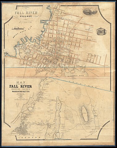
Zoom into this map at maps.bpl.org. Author: Walling, Henry Francis Publisher: Gillet, A. G. Date: 1850 Location: Fall River (Mass.) Dimensions: 47 x 68 cm and 41 x 71 cm, on sheet 99 x 73 cm Scale: 1:3,960 and 1:19,800 Call Number: G3764.F3 1850 .W35 |
| Date | |
| Source | Fall River Village ; Map of the town of Fall River, Bristol County, Massachusetts |
| Author | Norman B. Leventhal Map Center |
Licensing
[edit].jpg&action=edit§ion=2)
This file is licensed under the Creative Commons Attribution 2.0 Generic license.
- You are free:
- to share – to copy, distribute and transmit the work
- to remix – to adapt the work
- Under the following conditions:
- attribution – You must give appropriate credit, provide a link to the license, and indicate if changes were made. You may do so in any reasonable manner, but not in any way that suggests the licensor endorses you or your use.
| This image was originally posted to Flickr by Norman B. Leventhal Map Center at the BPL at https://flickr.com/photos/24528911@N05/14775362187. It was reviewed on 23 October 2017 by FlickreviewR and was confirmed to be licensed under the terms of the cc-by-2.0. |
File history
Click on a date/time to view the file as it appeared at that time.
| Date/Time | Thumbnail | Dimensions | User | Comment | |
|---|---|---|---|---|---|
| current | 14:30, 23 October 2017 | | 1,581 × 2,000 (3.23 MB) | Ser Amantio di Nicolao (talk | contribs) | Transferred from Flickr via Flickr2Commons |
You cannot overwrite this file.
File usage on Commons
There are no pages that use this file.
.jpg&oldid=896900635)