File:FRAC31555 67Fi2 - Pyrénées. Arratille. Pic Bernat-Barrau.tif
Jump to navigation
Jump to search

Size of this JPG preview of this TIF file: 794 × 600 pixels. Other resolutions: 318 × 240 pixels | 636 × 480 pixels | 1,017 × 768 pixels | 1,280 × 967 pixels | 2,560 × 1,933 pixels | 2,884 × 2,178 pixels.
Original file (2,884 × 2,178 pixels, file size: 18 MB, MIME type: image/tiff)
Captions
Captions
Add a one-line explanation of what this file represents
Summary
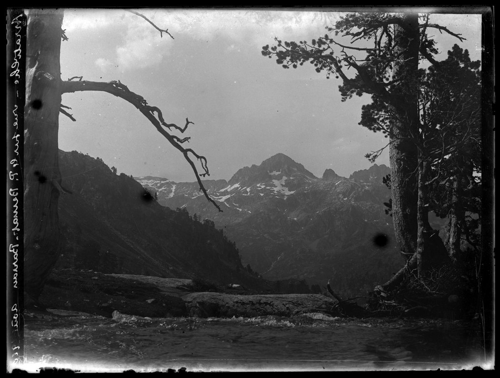
[edit]| Ludovic Gaurier: Français : Pyrénées, Pic Bernat-Barrau depuis le vallon d'Arratille
( |
|||||||||||||||||||||
|---|---|---|---|---|---|---|---|---|---|---|---|---|---|---|---|---|---|---|---|---|---|
| Artist |
|
||||||||||||||||||||
| Title |
Français : Pyrénées, Pic Bernat-Barrau depuis le vallon d'Arratille |
||||||||||||||||||||
| Date | 1910 | ||||||||||||||||||||
| Medium | photograph | ||||||||||||||||||||
| Dimensions | height: 9 cm (3.5 in); width: 12 cm (4.7 in) | ||||||||||||||||||||
| Collection |
|
||||||||||||||||||||
| Accession number | |||||||||||||||||||||
| Object history |
Français : Achat à M. Philippe Terrancle le 26/07/2013. |
||||||||||||||||||||
| Source/Photographer |
|
||||||||||||||||||||
| Permission (Reusing this file) |
|
||||||||||||||||||||


| Annotations | This image is annotated: View the annotations at Commons |
| Object location | | View this and other nearby images on: OpenStreetMap |
|---|
| Camera location | | View this and other nearby images on: OpenStreetMap |
|---|
File history
Click on a date/time to view the file as it appeared at that time.
| Date/Time | Thumbnail | Dimensions | User | Comment | |
|---|---|---|---|---|---|
| current | 21:05, 4 January 2019 |  | 2,884 × 2,178 (18 MB) | Don-vip (talk | contribs) |
You cannot overwrite this file.
File usage on Commons
The following 2 pages use this file: