File:FIRM, flood insurance rate map and street index, borough of Carteret, New Jersey, Middlesex County LOC 93683624.jpg
Jump to navigation
Jump to search

Size of this preview: 695 × 599 pixels. Other resolutions: 278 × 240 pixels | 557 × 480 pixels | 891 × 768 pixels | 1,188 × 1,024 pixels | 2,375 × 2,048 pixels | 8,940 × 7,708 pixels.
Original file (8,940 × 7,708 pixels, file size: 9.1 MB, MIME type: image/jpeg)
Captions
Captions
Add a one-line explanation of what this file represents
Summary
[edit]| Description |
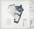
English: Relief shown by spot heights. Panel title. At head of title: National Flood Insurance Program. "Initial identification: January 9, 1974." Includes notes, street index, and directory of "Elevation reference marks." "Community-panel number 340257 0005 B." Available also through the Library of Congress Web site as a raster image. |
||
| Title | FIRM, flood insurance rate map and street index, borough of Carteret, New Jersey, Middlesex County | ||
| Shelf ID | G3814.C3G475 1992 .U5 | ||
| Date | |||
| Source | https://www.loc.gov/item/93683624/ | ||
| Author | United States. Federal Emergency Management Agency; National Flood Insurance Program (U.S.) | ||
| Permission (Reusing this file) |
|
||
| Other versions |
|
||
| Location | Carteret · New Jersey · United States | ||
| Part of | American Memory · General Maps · Catalog · Geography And Map Division | ||
| Subject | Floodplains · Flood Insurance · New Jersey · United States · Maps · Carteret · Carteret (N.J.) |

Licensing
[edit]
This image is a work of a Federal Emergency Management Agency employee, taken or made as part of that person's official duties. As works of the U.S. federal government, all FEMA images are in the public domain in the United States. Additional media usage information may be found at https://www.fema.gov/photo-video-audio-use-guidelines
|
File history
Click on a date/time to view the file as it appeared at that time.
| Date/Time | Thumbnail | Dimensions | User | Comment | |
|---|---|---|---|---|---|
| current | 19:24, 15 May 2018 | | 8,940 × 7,708 (9.1 MB) | Fæ (talk | contribs) | LOC Maps https://www.loc.gov/item/93683624/ #9123 |
You cannot overwrite this file.
File usage on Commons
The following page uses this file: