File:Fürst-Pückler-Weg Karte Etappe 8.png
Jump to navigation
Jump to search
No higher resolution available.
Fürst-Pückler-Weg_Karte_Etappe_8.png (795 × 514 pixels, file size: 337 KB, MIME type: image/png)
Captions
Captions
Add a one-line explanation of what this file represents
Summary
[edit]| Description |
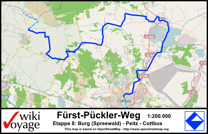
English: Map of cycle path Fürst-Pückler-Weg leg 8, Brandenburg, Germany Deutsch: Karte der Etappe 8 des Radweges Fürst-Pückler-Weg, Brandenburg, Deutschland |
|||||||||||||||||
| Date | ||||||||||||||||||
| Source |
Own work - self drawn map based on data from Open Street Map |
|||||||||||||||||
| Author |
|
|||||||||||||||||

Licensing
[edit]
Stefan Fussan, the copyright holder of this work, hereby publishes it under the following license:
This file is licensed under the Creative Commons Attribution-Share Alike 3.0 Unported license.
Attribution: Stefan Fussan
- You are free:
- to share – to copy, distribute and transmit the work
- to remix – to adapt the work
- Under the following conditions:
- attribution – You must give appropriate credit, provide a link to the license, and indicate if changes were made. You may do so in any reasonable manner, but not in any way that suggests the licensor endorses you or your use.
- share alike – If you remix, transform, or build upon the material, you must distribute your contributions under the same or compatible license as the original.
| This work contains information from OpenStreetMap, which is made available under the Open Database License (ODbL).
The ODbL does not require any particular license for maps produced from ODbL data. Prior to 1 August 2020, map tiles produced by the OpenStreetMap Foundation were licensed under the CC-BY-SA-2.0 license. Maps produced by other people may be subject to other licences. |
Original upload log
[edit]
| This file was imported from Wikivoyage Shared. |
The original description page was here. All following user names refer to wikivoyage-old/shared.
- 2010-05-24 08:26 DerFussi archive copy at the Wayback Machine 795×514 (344692 bytes) {{Information |Description={{en|Map of cycle path Fürst-Pückler-Weg leg 8, Brandenburg, Germany}}{{de|Karte der Etappe 8 des Radweges Fürst-Pückler-Weg, Brandenburg, Deutschland}} |Author=[[User:DerFussi|Stefan Fussan]] |Date=24. May 2010 |Source={{own}} based on [http://www.openstreetmap.org Open Street Map] |Permission= |other_versions= }} [[Category:Fürst-Pückler-Weg]] [[Category:Maps (Brandenburg)]] [[Category:Images by DerFussi]]
File history
Click on a date/time to view the file as it appeared at that time.
| Date/Time | Thumbnail | Dimensions | User | Comment | |
|---|---|---|---|---|---|
| current | 10:41, 14 November 2012 | | 795 × 514 (337 KB) | MGA73bot2 (talk | contribs) | {{BotMoveToCommons|shared.oldwikivoyage|year={{subst:CURRENTYEAR}}|month={{subst:CURRENTMONTHNAME}}|day={{subst:CURRENTDAY}}}} == {{int:filedesc}} == {{Information |description={{en|Map of cycle path Fürst-Pückler-Weg leg 8, Brandenburg, Germany}}{{d... |
You cannot overwrite this file.
File usage on Commons
There are no pages that use this file.
File usage on other wikis
The following other wikis use this file:
- Usage on de.wikivoyage.org