File:Explosion, Leak at Gulf of Mexico Oil Well 2010-04-28 lrg.jpg
Jump to navigation
Jump to search

Size of this preview: 795 × 599 pixels. Other resolutions: 318 × 240 pixels | 637 × 480 pixels | 1,019 × 768 pixels | 1,280 × 965 pixels | 2,560 × 1,930 pixels | 8,374 × 6,314 pixels.
Original file (8,374 × 6,314 pixels, file size: 16.8 MB, MIME type: image/jpeg)
Captions
Captions
Add a one-line explanation of what this file represents
| Warning | The original file is very high-resolution. It might not load properly or could cause your browser to freeze when opened at full size. |
|---|
Summary
[edit]| Description |
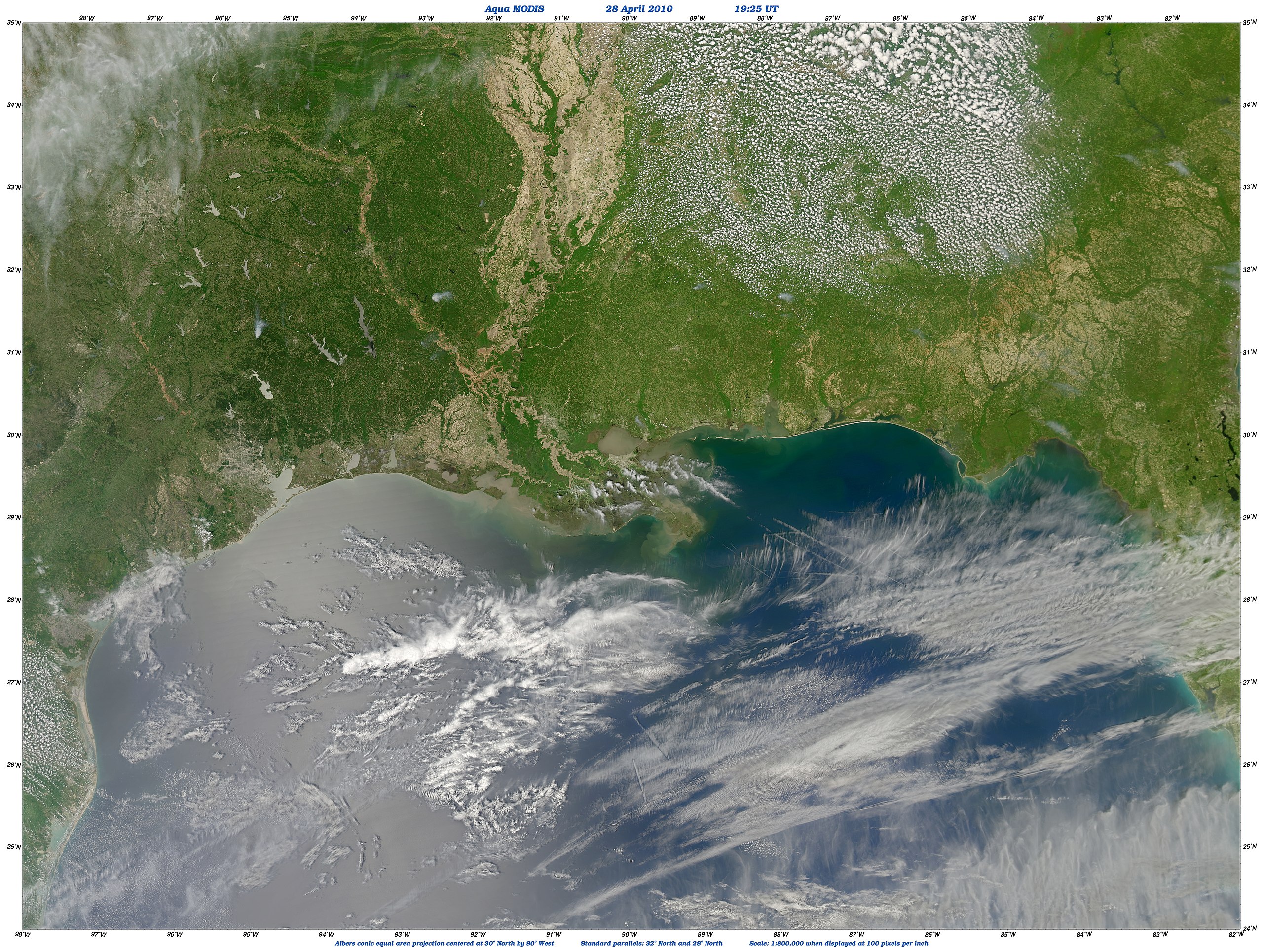
English: A damaged oil well may be leaking five times more oil into the Gulf of Mexico than officials first estimated. This view of the slick was captured by the Moderate Resolution Imaging Spectroradiometer (MODIS) on NASA’s Aqua satellite on Wednesday, April 28. The eastern part of the oily area is covered by streaks of clouds, but the reddish streaks shown in photos of the slick appear to be visible. It appears that a tendril of oil is reaching out toward the tip of the delta. |
| Date | |
| Source | http://earthobservatory.nasa.gov/NaturalHazards/view.php?id=43841&src=nha |
| Author | NASA image by Norman Kuring, Ocean Color Team, Goddard Space Flight Center. Caption by Rebecca Lindsey. |
| Other versions |
|

Licensing
[edit]
| This file is in the public domain in the United States because it was solely created by NASA. NASA copyright policy states that "NASA material is not protected by copyright unless noted". (See Template:PD-USGov, NASA copyright policy page or JPL Image Use Policy.) | ||
 |
Warnings:
|
File history
Click on a date/time to view the file as it appeared at that time.
| Date/Time | Thumbnail | Dimensions | User | Comment | |
|---|---|---|---|---|---|
| current | 11:24, 2 May 2010 | | 8,374 × 6,314 (16.8 MB) | Captain-tucker (talk | contribs) | {{Information |Description={{en|A damaged oil well may be leaking five times more oil into the Gulf of Mexico than officials first estimated. This view of the slick was captured by the Moderate Resolution Imaging Spectroradiometer (MODIS) on NASA’s Aqua |
You cannot overwrite this file.
File usage on Commons
The following page uses this file: