File:Europe. (IA bp 32334).pdf

Original file (3,085 × 2,114 pixels, file size: 2.83 MB, MIME type: application/pdf)
Captions
Captions
Summary
[edit]| Europe.
( |
|
|---|---|
| Title |
Europe. |
| Publisher |
N. Combette, Editeur, Paris |
| Description |
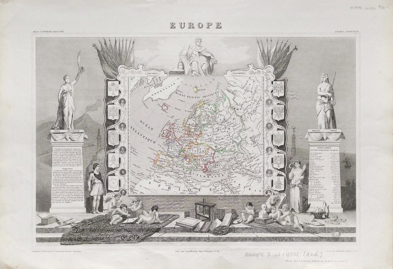
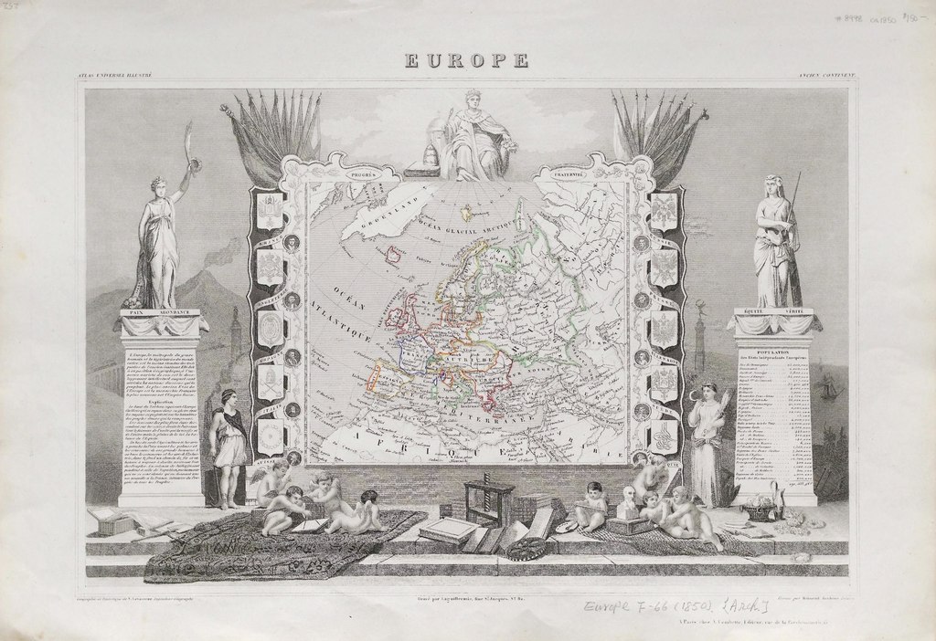
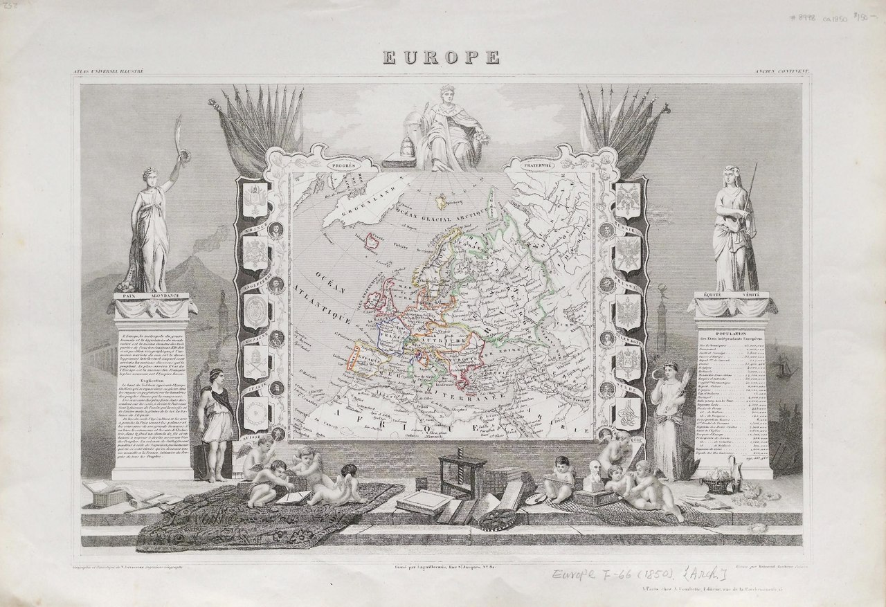
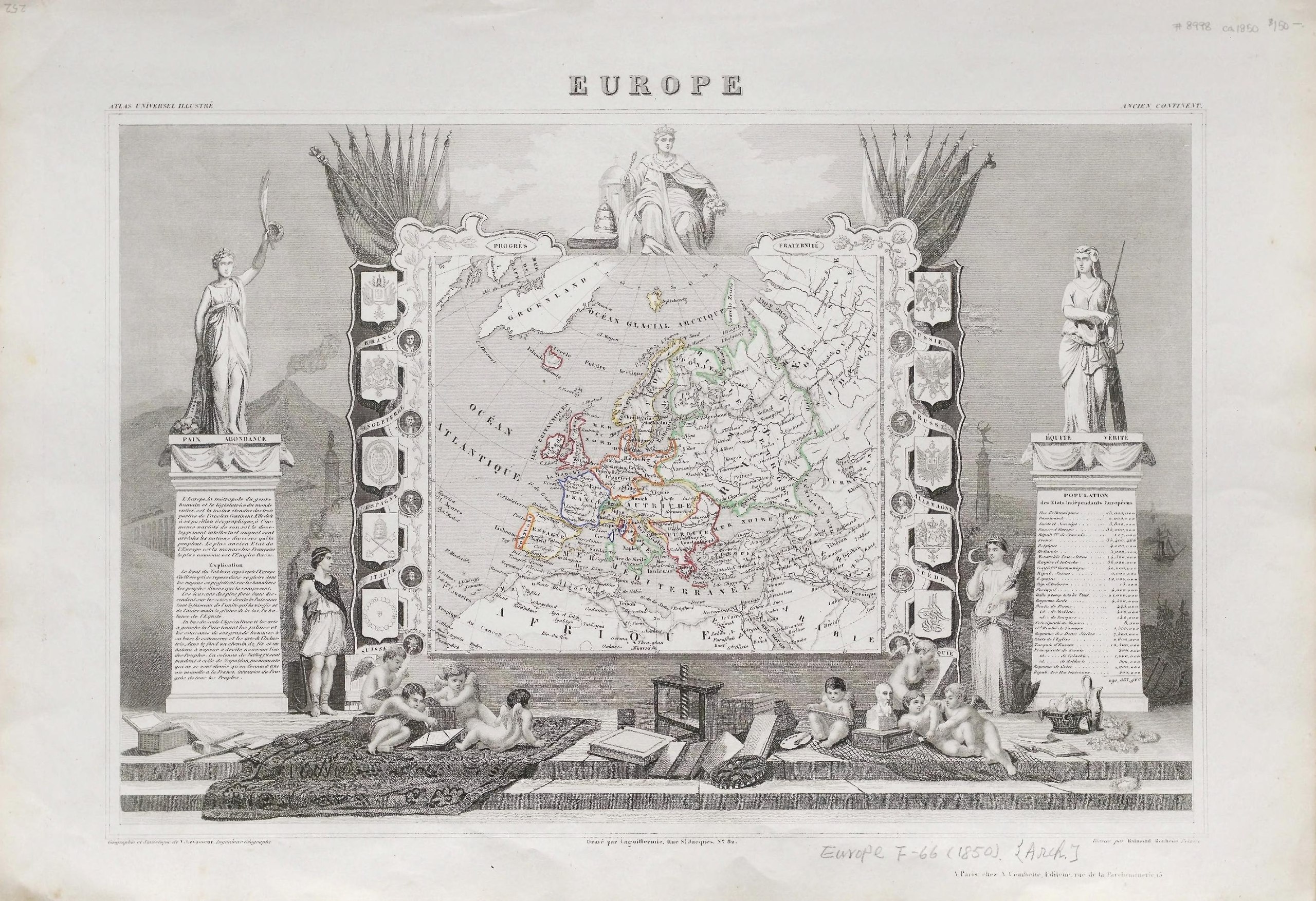
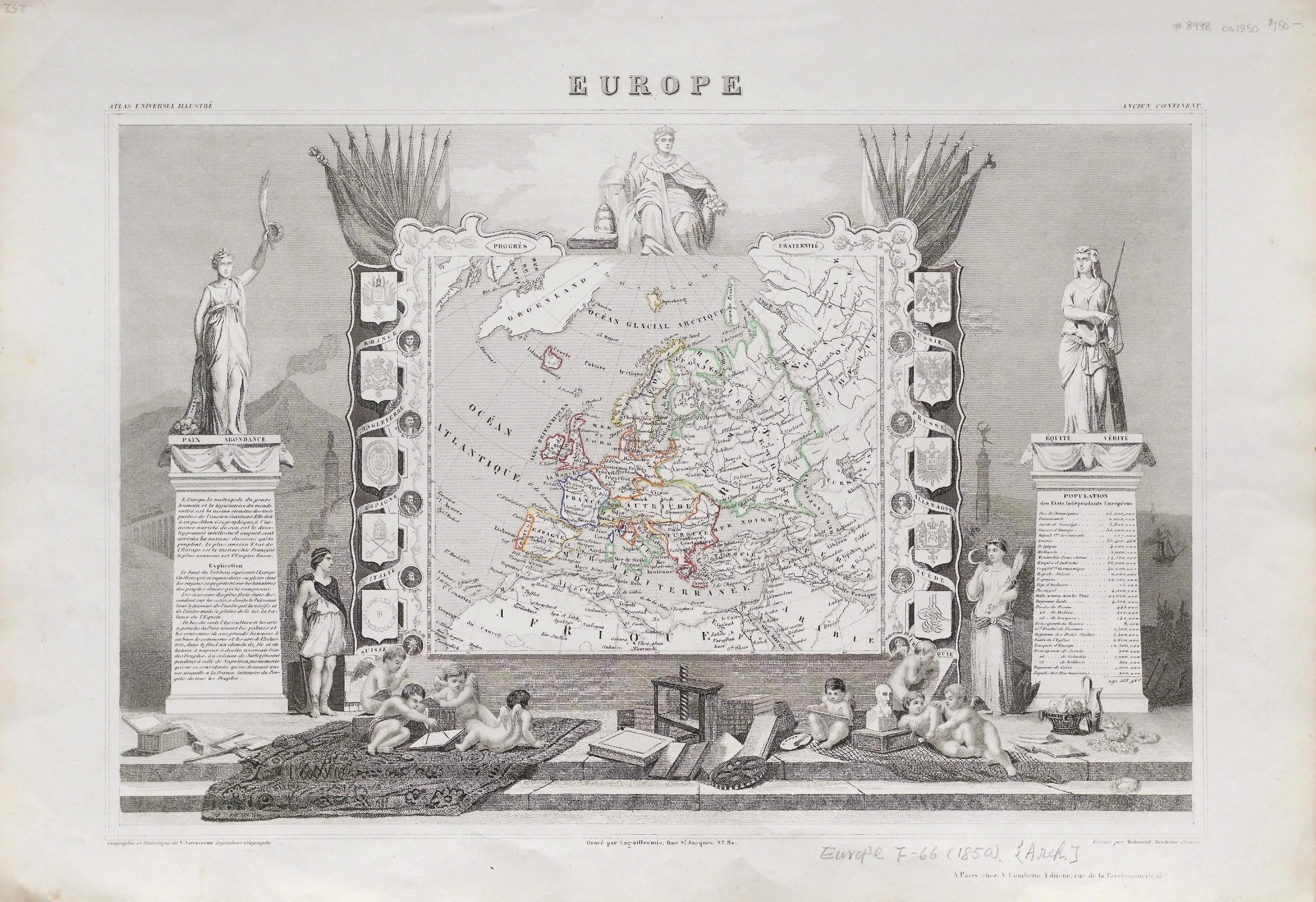
Hand-col. outlines, 28 x 42.5 cm. on atlas sheet 36.5 x 52.5 cm.;From the Whistance-Smith Collection.;"Geographie et statistique de V. Levasseur ... Grave par Laguillermie ... Illustre par Raimond Bonheur ...";"Atlas universel illustre: Ancient continent" on upper margin.;Highly decorated border with vignettes, allegorical scenes, portraits of European rulers, coats of arms, explanatory text and population statistics. Subjects: Europe--Political geography |
| Language | English |
| Publication date | [ca 1850] |
| Current location |
IA Collections: wcw_gale; wcw; university_of_alberta_libraries; toronto |
| Accession number |
bp_32334 |
| Source | |
Licensing
[edit]|
This work is in the public domain in its country of origin and other countries and areas where the copyright term is the author's life plus 70 years or fewer. | |
| This file has been identified as being free of known restrictions under copyright law, including all related and neighboring rights. | |
File history
Click on a date/time to view the file as it appeared at that time.
| Date/Time | Thumbnail | Dimensions | User | Comment | |
|---|---|---|---|---|---|
| current | 12:45, 27 August 2021 |  | 3,085 × 2,114 (2.83 MB) | Fæ (talk | contribs) | IA Query "collection:(wcw) date:[1000 TO 1899]" bp_32334 Category:William C. Wonders Map Collection (COM:IA books#query) (1850 #243) |
You cannot overwrite this file.
File usage on Commons
The following page uses this file: