File:Europe. (IA bp 32289).pdf
Jump to navigation
Jump to search

Size of this JPG preview of this PDF file: 752 × 600 pixels. Other resolutions: 301 × 240 pixels | 602 × 480 pixels | 963 × 768 pixels | 1,280 × 1,021 pixels | 2,560 × 2,042 pixels | 3,552 × 2,833 pixels.
Original file (3,552 × 2,833 pixels, file size: 3.36 MB, MIME type: application/pdf)
Captions
Captions
Add a one-line explanation of what this file represents
Summary
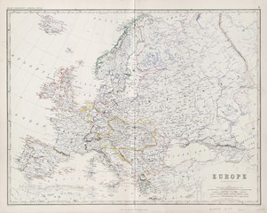
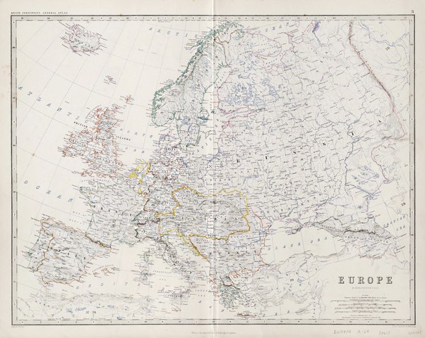
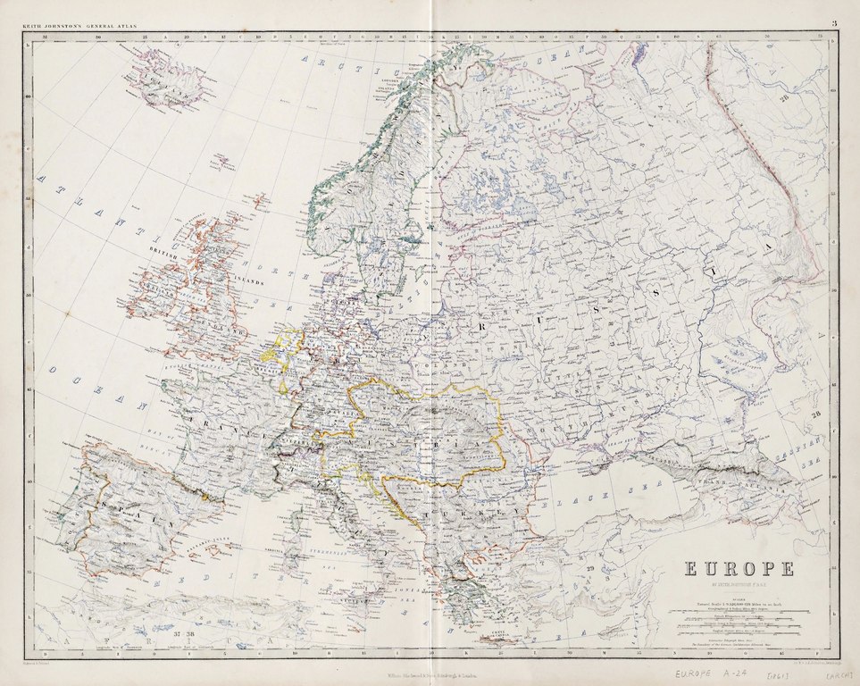
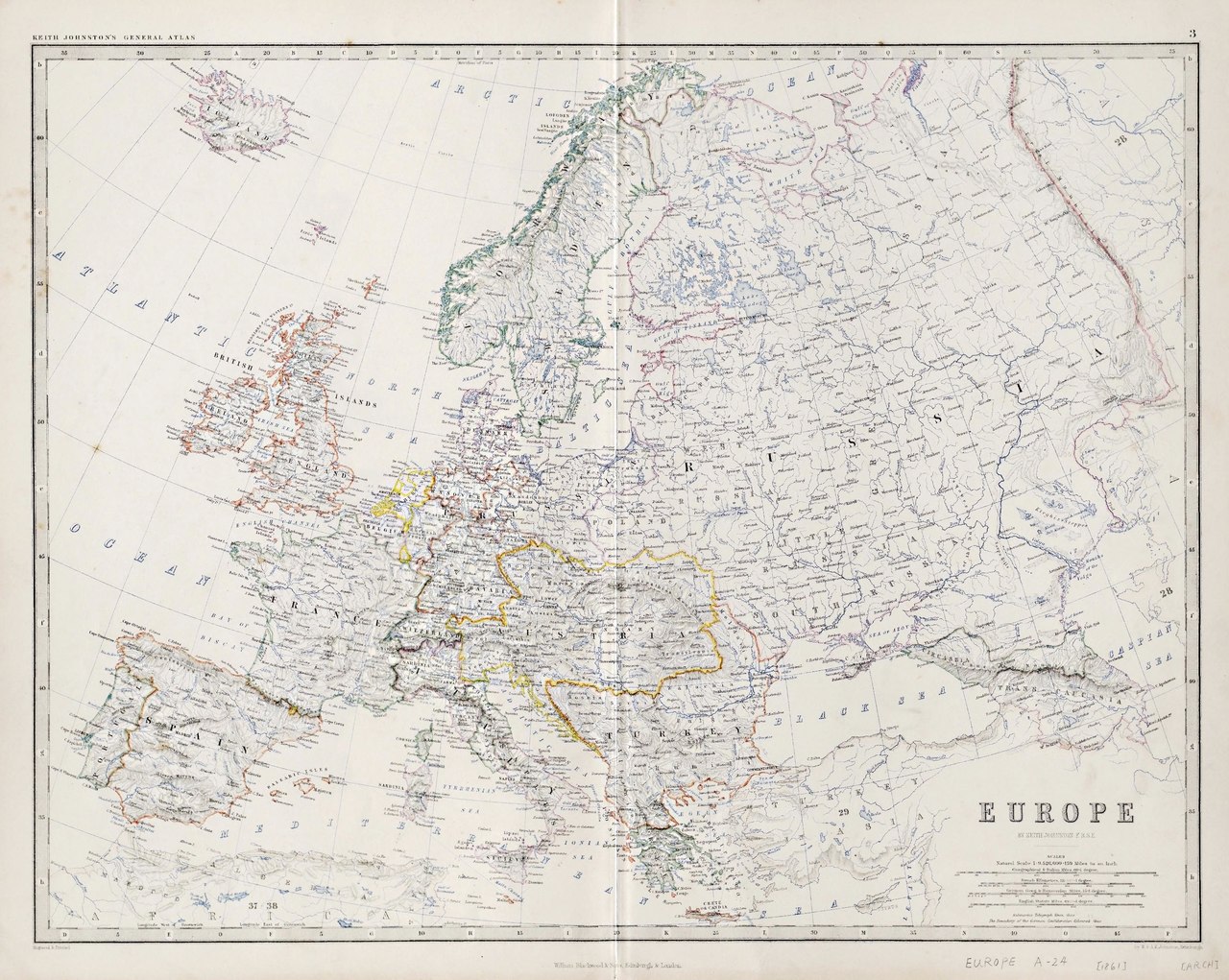
[edit]| Europe.
( |
|
|---|---|
| Title |
Europe. |
| Publisher |
William Blackwood & Sons, Edinburgh |
| Description |
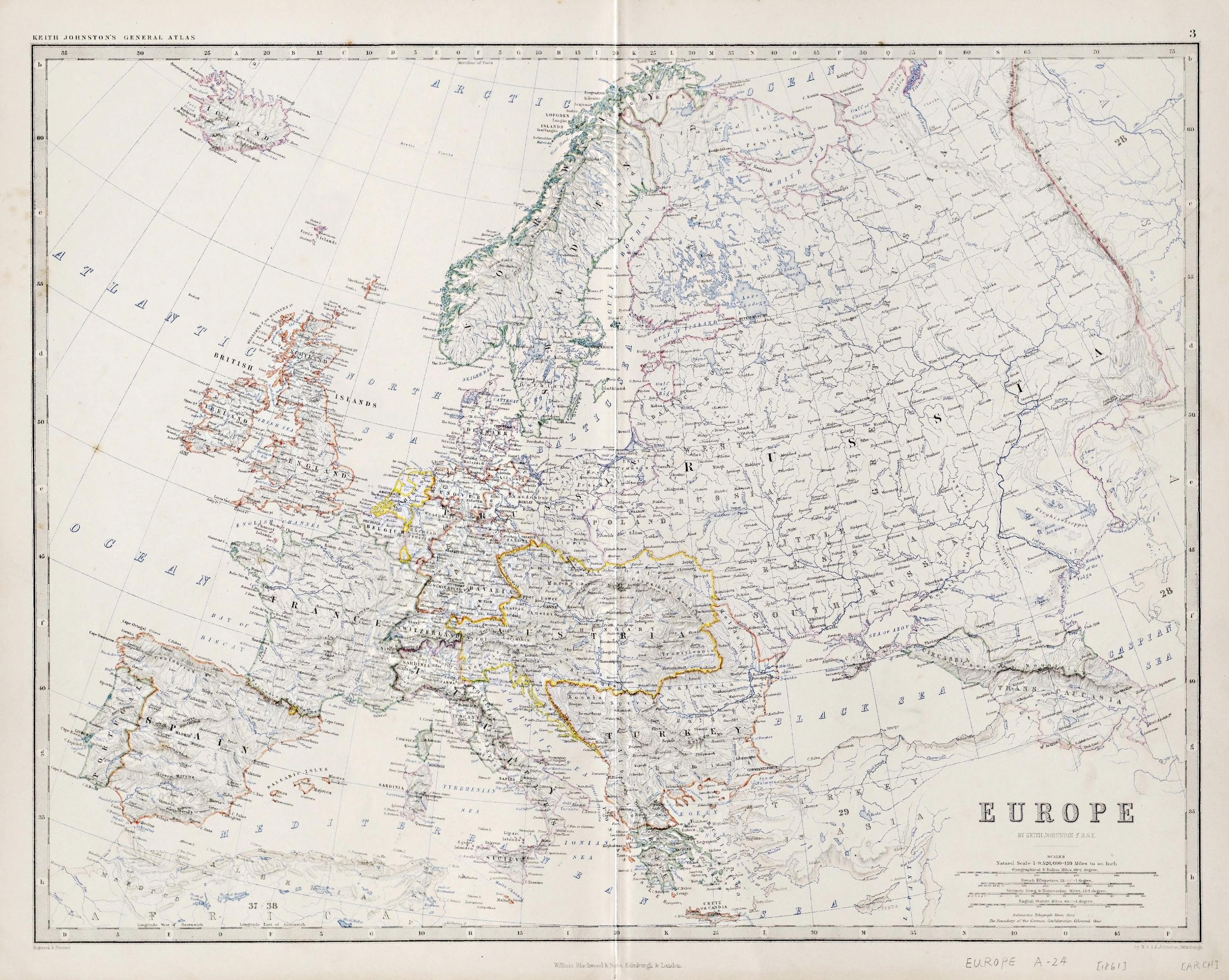
From the Whistance-Smith Collection.;Hand col. outlines, 42 x 56 cm. on folded atlas sheet 49 x 62 cm.;Shows major populated centers, hydrology, geographic features, country boundaries and hachured relief.;"Keith Johnston's general atlas" and Plate "3" along upper margin.;Engraved & printed by W. & A.K. Johnston.;By Keith Johnston F.R.S.E. Subjects: Europe--Special category |
| Language | English |
| Publication date | [1861] |
| Current location |
IA Collections: wcw_gale; wcw; university_of_alberta_libraries; toronto |
| Accession number |
bp_32289 |
| Notes | Scale: 1:9,526,000 |
| Source | |
Licensing
[edit]|
This work is in the public domain in its country of origin and other countries and areas where the copyright term is the author's life plus 70 years or fewer. | |
| This file has been identified as being free of known restrictions under copyright law, including all related and neighboring rights. | |
File history
Click on a date/time to view the file as it appeared at that time.
| Date/Time | Thumbnail | Dimensions | User | Comment | |
|---|---|---|---|---|---|
| current | 12:44, 27 August 2021 |  | 3,552 × 2,833 (3.36 MB) | Fæ (talk | contribs) | IA Query "collection:(wcw) date:[1000 TO 1899]" bp_32289 Category:William C. Wonders Map Collection (COM:IA books#query) (1861 #241) |
You cannot overwrite this file.
File usage on Commons
The following page uses this file: