File:East Canada, and New Brunswick. (IA bp 4095).pdf

Original file (2,089 × 1,612 pixels, file size: 1.13 MB, MIME type: application/pdf)
Captions
Captions
Summary
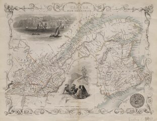
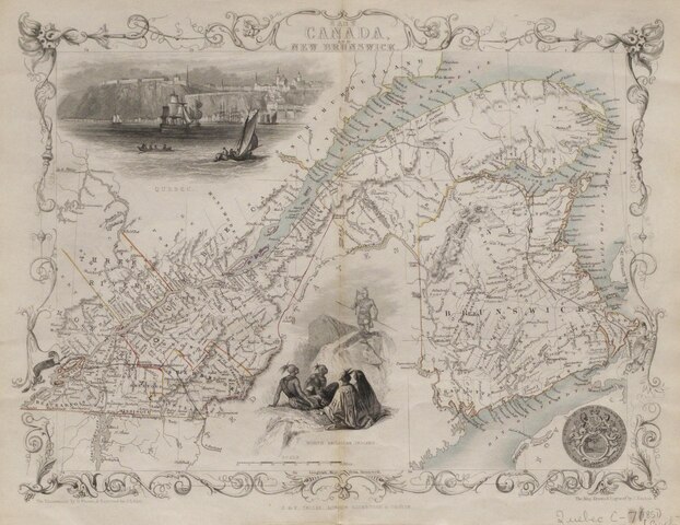
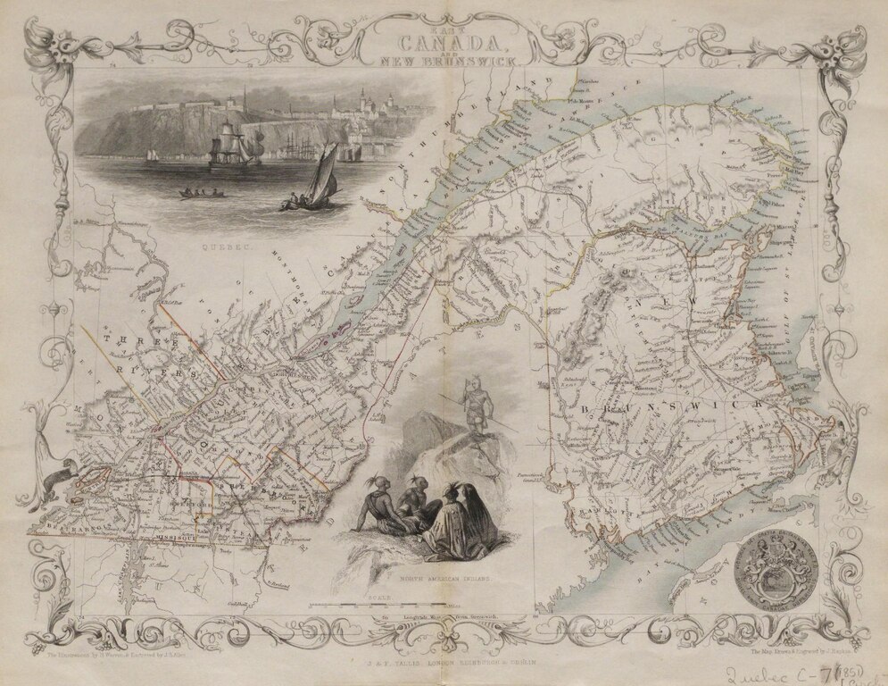
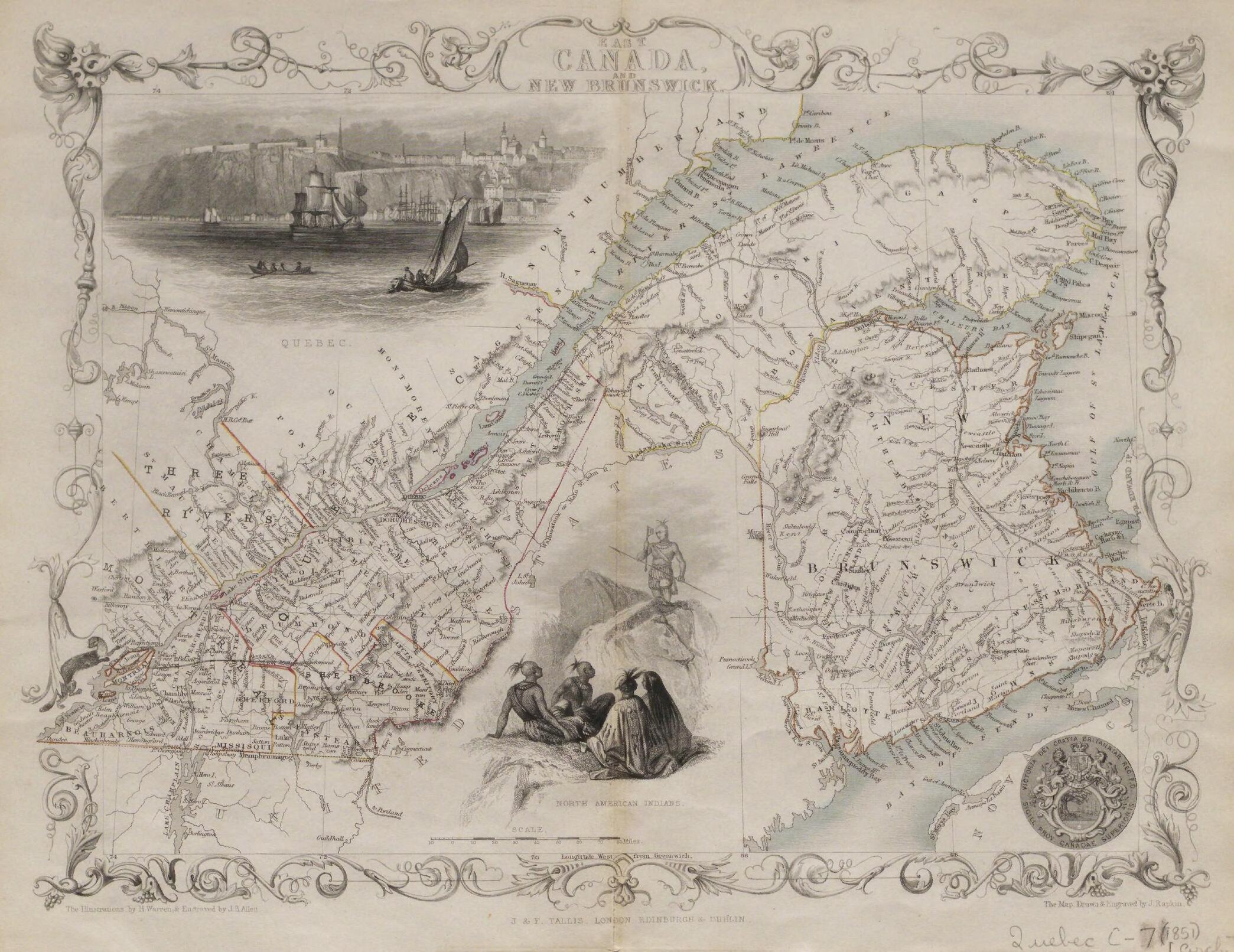
[edit]| East Canada, and New Brunswick.
( |
|
|---|---|
| Title |
East Canada, and New Brunswick. |
| Publisher |
George F. Cram, Chicago |
| Description |
"Illustrations by H. Warren & engraved by J.B. Allen".;File name: WCW_Quebec_C_7_1851.tif;Map scanned;Ornate scroll border.;"Map drawn and engraved by J. Rapkin".;Library has 2 c.;Hand-col., on folded sheet 28 x 36 cm.;Includes place names, physical features, railways and administrative boundaries (townships, counties, provinces etc.).;Illustrations "North American Indians" and view of "Quebec". Subjects: Quebec--Physical sciences |
| Language | English |
| Publication date | 1851 |
| Current location |
IA Collections: wcw_gale; wcw; university_of_alberta_libraries; toronto |
| Accession number |
bp_4095 |
| Notes | Scale: 1:2,661,120. |
| Source | |
Licensing
[edit]|
This work is in the public domain in its country of origin and other countries and areas where the copyright term is the author's life plus 70 years or fewer. | |
| This file has been identified as being free of known restrictions under copyright law, including all related and neighboring rights. | |
File history
Click on a date/time to view the file as it appeared at that time.
| Date/Time | Thumbnail | Dimensions | User | Comment | |
|---|---|---|---|---|---|
| current | 13:18, 27 August 2021 |  | 2,089 × 1,612 (1.13 MB) | Fæ (talk | contribs) | IA Query "collection:(wcw) date:[1000 TO 1899]" bp_4095 Category:William C. Wonders Map Collection (COM:IA books#query) (1851 #353) |
You cannot overwrite this file.
File usage on Commons
The following page uses this file: