File:East Approach - Gordon County Road No. 24 Bridge, Spanning New Town Creek at County Road 24, New Town, Gordon County, GA HAER GA,65-NEWTO.V,1-4.tif
Jump to navigation
Jump to search

Size of this JPG preview of this TIF file: 481 × 599 pixels. Other resolutions: 193 × 240 pixels | 385 × 480 pixels | 616 × 768 pixels | 822 × 1,024 pixels | 1,644 × 2,048 pixels | 3,995 × 4,976 pixels.
Original file (3,995 × 4,976 pixels, file size: 18.96 MB, MIME type: image/tiff)
Captions
Captions
Add a one-line explanation of what this file represents
Summary
[edit]| East Approach - Gordon County Road No. 24 Bridge, Spanning New Town Creek at County Road 24, New Town, Gordon County, GA | ||||
|---|---|---|---|---|
| Photographer |
Related names:
|
|||
| Title |
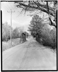
East Approach - Gordon County Road No. 24 Bridge, Spanning New Town Creek at County Road 24, New Town, Gordon County, GA |
|||
| Depicted place | Georgia; Gordon County; New Town | |||
| Date | Documentation compiled after 1968 | |||
| Dimensions | 4 x 5 in. | |||
| Current location |
Library of Congress Prints and Photographs Division Washington, D.C. 20540 USA http://hdl.loc.gov/loc.pnp/pp.print |
|||
| Accession number |
HAER GA,65-NEWTO.V,1-4 |
|||
| Credit line |
|
|||
| Notes |
|
|||
| Source | https://www.loc.gov/pictures/item/ga0554.photos.057362p | |||
| Permission (Reusing this file) |
|
|||

| Object location | | View this and other nearby images on: OpenStreetMap |
|---|
File history
Click on a date/time to view the file as it appeared at that time.
| Date/Time | Thumbnail | Dimensions | User | Comment | |
|---|---|---|---|---|---|
| current | 14:27, 14 July 2014 |  | 3,995 × 4,976 (18.96 MB) | Fæ (talk | contribs) | GWToolset: Creating mediafile for Fæ. HABS 09 July 2014 (801:1000) |
You cannot overwrite this file.
File usage on Commons
The following page uses this file: