File:Earth from Orbit- Violent Storms Tear Through the South (52781785896).png
Jump to navigation
Jump to search
Size of this preview: 800 × 450 pixels. Other resolutions: 320 × 180 pixels | 640 × 360 pixels | 1,024 × 576 pixels | 1,280 × 720 pixels | 1,920 × 1,080 pixels.
Original file (1,920 × 1,080 pixels, file size: 2.09 MB, MIME type: image/png)
Captions
Captions
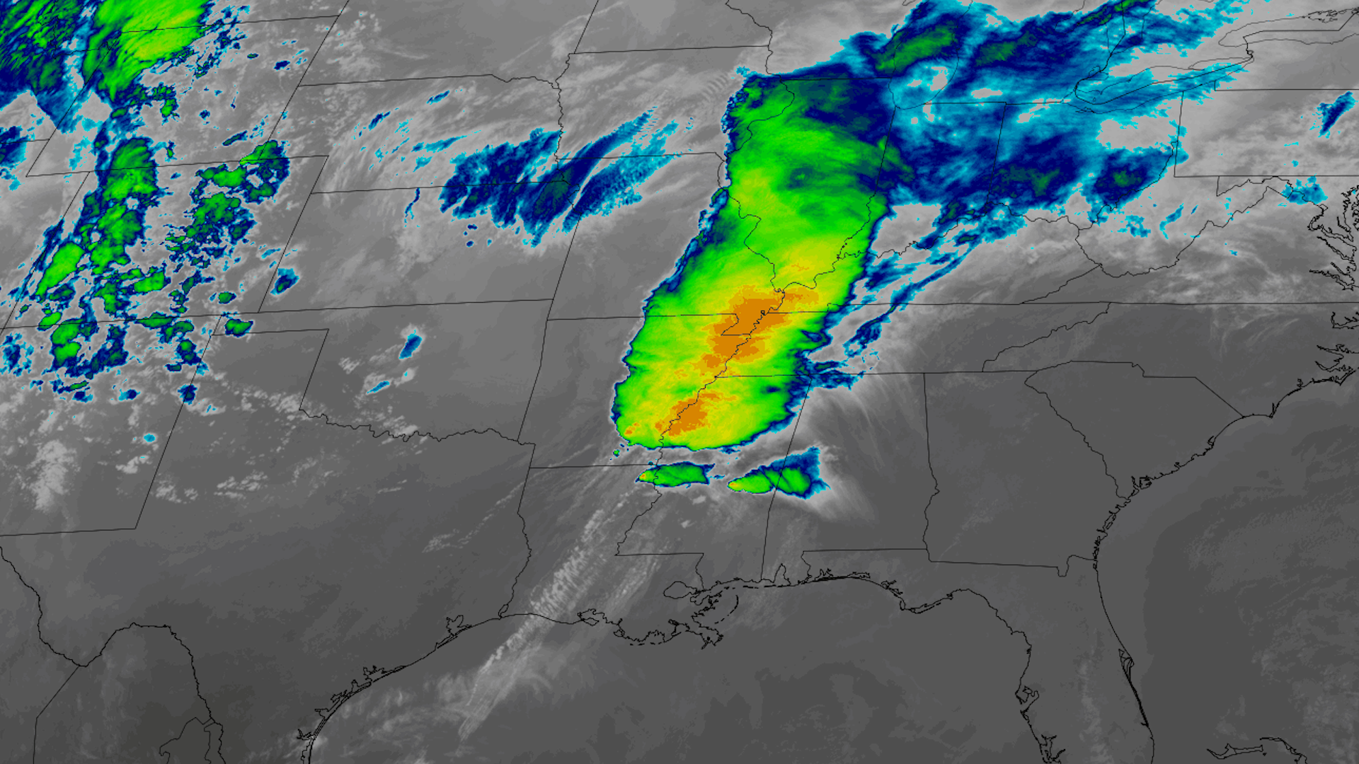
Beginning on March 24, 2023, NOAA satellites monitored severe storms that caused widespread damage from Texas to the Mid-Atlantic. The storms produced high winds, hail, flooding, and tornadoes.
Summary
[edit].png&action=edit§ion=1)
| Description |
English: Beginning on March 24, 2023, NOAA satellites monitored severe storms that caused widespread damage from Texas to the Mid-Atlantic. The storms produced high winds, hail, flooding, and tornadoes. High winds and 38 tornadoes were reported when the storms moved through Mississippi, Alabama and Tennessee. The town of Rolling Fork, Mississippi was struck by an EF-4 tornado that killed 26 people in total, injured dozens more, and damaged buildings and utilities.
GOES-16 (GOES East) monitored the storm in near real-time as it barreled across the Southeast. This infrared imagery revealed the structure of the storm and where it was the most intense. Learn more: www.nesdis.noaa.gov/news/violent-storms-tear-through-the-... |
| Date | Taken on 30 March 2023, 14:16:40 |
| Source | Earth from Orbit: Violent Storms Tear Through the South |
| Author | NOAASatellites |
| Flickr sets | GOES-16 (GOES East) Data and Imagery; Earth from Orbit |
| Flickr tags | goesr; tornadoes; satelliteimagery; noaa; severeweather; goes16; noaasatellites; goeseast; satellite; mississippi; bestof; earthfromorbit |
Licensing
[edit].png&action=edit§ion=2)
This image is in the public domain because it contains materials that originally came from the U.S. National Oceanic and Atmospheric Administration, taken or made as part of an employee's official duties.
|
| This image was originally posted to Flickr by NOAASatellites at https://flickr.com/photos/125201706@N06/52781785896. It was reviewed on 19 February 2024 by FlickreviewR 2 and was confirmed to be licensed under the terms of the Public Domain Mark. |
File history
Click on a date/time to view the file as it appeared at that time.
| Date/Time | Thumbnail | Dimensions | User | Comment | |
|---|---|---|---|---|---|
| current | 09:41, 19 February 2024 | | 1,920 × 1,080 (2.09 MB) | OptimusPrimeBot (talk | contribs) | #Spacemedia - Upload of https://live.staticflickr.com/65535/52781785896_94e66c497e_o.png via Commons:Spacemedia |
You cannot overwrite this file.
File usage on Commons
There are no pages that use this file.
.png&oldid=881562697)