File:EXTERIOR VIEW SHOWING THE OILOSTATIC TERMINALS IN THE GENERATING PLANT SWITCH YARD. - Wilson Dam and Hydroelectric Plant, Oilostatic Transmission System, Spanning Tennessee HAER ALA,17-MUSHO,2B-2.tif
Jump to navigation
Jump to search

Size of this JPG preview of this TIF file: 800 × 582 pixels. Other resolutions: 320 × 233 pixels | 640 × 466 pixels | 1,024 × 745 pixels | 1,280 × 932 pixels | 2,560 × 1,864 pixels | 5,000 × 3,640 pixels.
Original file (5,000 × 3,640 pixels, file size: 17.36 MB, MIME type: image/tiff)
Captions
Captions
Add a one-line explanation of what this file represents
Summary
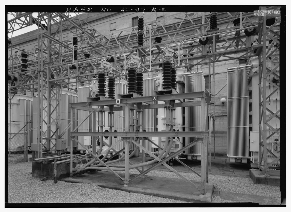
[edit]| EXTERIOR VIEW SHOWING THE OILOSTATIC TERMINALS IN THE GENERATING PLANT SWITCH YARD. - Wilson Dam and Hydroelectric Plant, Oilostatic Transmission System, Spanning Tennessee River at Wilson Dam Road (Route 133), Muscle Shoals, Colbert County, AL | ||||
|---|---|---|---|---|
| Photographer |
Lowe, Jet Related names:
|
|||
| Title |
EXTERIOR VIEW SHOWING THE OILOSTATIC TERMINALS IN THE GENERATING PLANT SWITCH YARD. - Wilson Dam and Hydroelectric Plant, Oilostatic Transmission System, Spanning Tennessee River at Wilson Dam Road (Route 133), Muscle Shoals, Colbert County, AL |
|||
| Depicted place | Alabama; Colbert County; Muscle Shoals | |||
| Date | 1994 | |||
| Dimensions | 5 x 7 in. | |||
| Current location |
Library of Congress Prints and Photographs Division Washington, D.C. 20540 USA http://hdl.loc.gov/loc.pnp/pp.print |
|||
| Accession number |
HAER ALA,17-MUSHO,2B-2 |
|||
| Credit line |
|
|||
| Notes |
|
|||
| References |
|
|||
| Source | https://www.loc.gov/pictures/item/al1188.photos.046700p | |||
| Permission (Reusing this file) |
|
|||

| Object location | | View this and other nearby images on: OpenStreetMap |
|---|
File history
Click on a date/time to view the file as it appeared at that time.
| Date/Time | Thumbnail | Dimensions | User | Comment | |
|---|---|---|---|---|---|
| current | 05:19, 1 July 2014 |  | 5,000 × 3,640 (17.36 MB) | Fæ (talk | contribs) | GWToolset: Creating mediafile for Fæ. HABS batch upload 29 June 2014 (101:150) |
You cannot overwrite this file.
File usage on Commons
The following page uses this file: