File:EGRID2010 NERC regions.jpg
Jump to navigation
Jump to search

Size of this preview: 776 × 600 pixels. Other resolutions: 311 × 240 pixels | 621 × 480 pixels | 994 × 768 pixels | 1,280 × 989 pixels | 2,560 × 1,978 pixels | 3,300 × 2,550 pixels.
Original file (3,300 × 2,550 pixels, file size: 525 KB, MIME type: image/jpeg)
Captions
Captions
Add a one-line explanation of what this file represents
| Description |
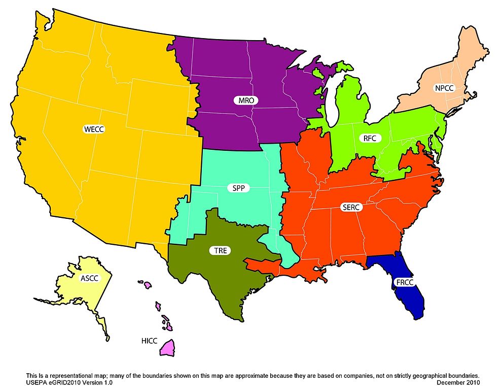
English: NERC Region Representational Map |
||||||
| Date | |||||||
| Source | U.S. Environmental Protection Agency | ||||||
| Author | U.S. Environmental Protection Agency | ||||||
| Permission (Reusing this file) |
|
||||||

File history
Click on a date/time to view the file as it appeared at that time.
| Date/Time | Thumbnail | Dimensions | User | Comment | |
|---|---|---|---|---|---|
| current | 13:29, 24 February 2011 | | 3,300 × 2,550 (525 KB) | Crisbrujis2008 (talk | contribs) | {{Information |Description ={{en|1=NERC Region Representational Map}} |Source =U.S. Environmental Protection Agency |Author =U.S. Environmental Protection Agency |Date =2010-12 |Permission ={{PD-USGov}} |other_versions = } |
You cannot overwrite this file.
File usage on Commons
There are no pages that use this file.