Category:Electric power grid maps of the United States
Jump to navigation
Jump to search
Media in category "Electric power grid maps of the United States"
The following 28 files are in this category, out of 28 total.
-
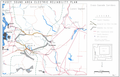
 AWEA proposed 765KV AC super grid for US wind.jpg 1,190 × 766; 119 KB
-
 BPA Cross-Cascade Corridors.png 1,282 × 822; 541 KB
-
 BPAmap.png 2,266 × 2,518; 7.15 MB
-
 EGRID NERC.png 762 × 569; 52 KB
-
 EGRID2010 eGRID subregions.jpg 3,300 × 2,550; 635 KB
-
 EGRID2010 NERC regions.jpg 3,300 × 2,550; 525 KB
-
 EGRID2012 eGRID subregion.jpg 3,300 × 2,550; 630 KB
-
 EGRID2012 NERC regions.jpg 3,300 × 2,550; 530 KB
-
 EGRIDSubregionmap.jpg 3,300 × 2,550; 1.31 MB
-
 GIC-effect-on-US-Power-System-during-100yr-Strom.png 960 × 573; 490 KB
-
 Grid locations.webp 1,462 × 1,412; 293 KB
-

-
 NERC-map-en.svg 1,730 × 1,730; 272 KB
-
 NERC-map-fr.svg 1,730 × 1,730; 267 KB
-
 Nercmap.JPG 1,021 × 750; 116 KB
-
 NERCregionmap.jpg 3,199 × 2,459; 465 KB
-
 NIETC-Mid Atlantic corridor US 2007.jpg 1,205 × 927; 491 KB
-
 NIETC-Southwest area corridor US 2007.jpg 1,207 × 930; 455 KB
-
 North America blackout 1965.png 2,289 × 1,744; 135 KB
-
 Path 15 2.GIF 500 × 1,383; 18 KB
-
 Path 15 version 2.GIF 500 × 1,383; 17 KB
-
 Path15.png 554 × 511; 113 KB
-
 Rto map.gif 503 × 334; 51 KB
-
 RTO v2.png 602 × 382; 65 KB
-
 Seattle City Light power system map, 1985 (25160240962).jpg 1,200 × 833; 288 KB
-

-
 UnitedStatesPowerGrid.jpg 1,233 × 808; 262 KB
-
 Western US electrical power transmission map.png 470 × 672; 257 KB


.jpg)

