File:Drone’s-Eye View of Gemini South's Solar Panels (iotw2049).tiff
Jump to navigation
Jump to search

Size of this JPG preview of this TIF file: 703 × 600 pixels. Other resolutions: 281 × 240 pixels | 563 × 480 pixels | 900 × 768 pixels | 1,200 × 1,024 pixels | 2,401 × 2,048 pixels | 4,144 × 3,535 pixels.
Original file (4,144 × 3,535 pixels, file size: 83.85 MB, MIME type: image/tiff)
Captions
Captions
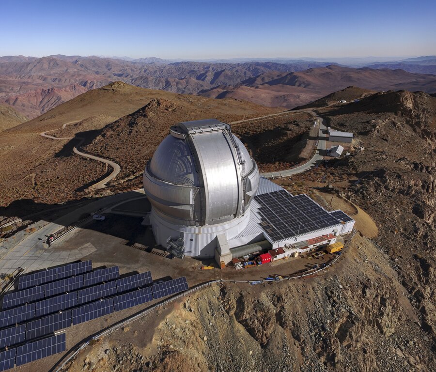
This drone footage shows an aerial view of Gemini South in the Andes of Northern Chile. Gemini South is the southern member of the pair of 8.1-meter telescopes which together comprise the international Gemini Observatory, a Program of NSF's NOIRLab.
Summary
[edit]| Description |
English: This drone footage shows an aerial view of Gemini South in the Andes of Northern Chile. Gemini South is the southern member of the pair of 8.1-meter telescopes which together comprise the international Gemini Observatory, a Program of NSF's NOIRLab. Though you might associate telescopes with darkness and starry nights, Gemini South spends its days basking in bright sunlight — hence the banks of solar panels surrounding the telescope. These panels provide roughly 28% of the power needed to run the telescope. It can be difficult to gauge the true size of observatories in aerial photographs like this. Try to spot the silver car hiding in the shadows behind Gemini South — it’s dwarfed by the telescope dome! |
| Date | 2 December 2020, 05:54 (upload date) |
| Source | Drone’s-Eye View of Gemini South's Solar Panels |
| Author | International Gemini Observatory/NOIRLab/NSF/AURA |
| Other versions |
|
.jpg)
Licensing
[edit]This media was created by the National Optical-Infrared Astronomy Research Laboratory (NOIRLab).
Their website states: "Unless specifically noted, the images, videos, and music distributed on the public NOIRLab website, along with the texts of press releases, announcements, images of the week and captions; are licensed under a Creative Commons Attribution 4.0 International License, and may on a non-exclusive basis be reproduced without fee provided the credit is clear and visible." To the uploader: You must provide a link (URL) to the original file and the authorship information if available. | |
This file is licensed under the Creative Commons Attribution 4.0 International license.
| |
File history
Click on a date/time to view the file as it appeared at that time.
| Date/Time | Thumbnail | Dimensions | User | Comment | |
|---|---|---|---|---|---|
| current | 08:31, 13 July 2023 |  | 4,144 × 3,535 (83.85 MB) | OptimusPrimeBot (talk | contribs) | #Spacemedia - Upload of https://noirlab.edu/public/media/archives/images/original/iotw2049.tif via Commons:Spacemedia |
You cannot overwrite this file.
File usage on Commons
The following page uses this file: