File:Donau-Oder-Kanal.jpg

Original file (3,425 × 2,379 pixels, file size: 3.01 MB, MIME type: image/jpeg)
Captions
Captions
Summary
[edit]
| Description |
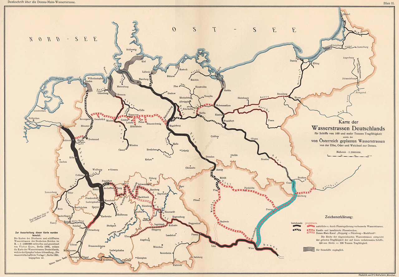
Deutsch: Karte der Wasserstrassen Deutschlands
für Schiffe von 100 und mehr Tonnen Tragfähigkeit sowie der von Österreich geplanten Wasserstrassen von der Elbe, Oder und Weichsel zur Donau. Karte (Blatt II) aus Denkschrift zu dem technischen Entwurf einer neuen Donau-Main-Wasserstrasse von Kelheim nach Aschaffenburg, bearbeitet von Eduard Faber [(† 1930)], kgl. Bauamtmann und Vorstand des technischen Amtes des Vereines für Hebung der Fluss- und Kanalschiffahrt in Bayern. Verlegt von dem Vereine für Hebung der Fluss- und Kanalschiffahrt in Bayern. 1903. Der Donau-Oder-Kanal wurde nachträglich türkis hervorgehoben. |
| Date | 1903;2010 |
| Source | http://www.digitalis.uni-koeln.de/Fabere/fabere_index.html (Stand: 14. November 2010) |
| Author | Eduard Faber († 1930) |
| Other versions | File:Denkschrift über die Donau-Main-Wasserstrasse 1903 Blatt 002.JPG |
Licensing
[edit]
|
This work is in the public domain in its country of origin and other countries and areas where the copyright term is the author's life plus 70 years or fewer.
| |
| This file has been identified as being free of known restrictions under copyright law, including all related and neighboring rights. | |
File history
Click on a date/time to view the file as it appeared at that time.
| Date/Time | Thumbnail | Dimensions | User | Comment | |
|---|---|---|---|---|---|
| current | 19:34, 14 November 2010 | | 3,425 × 2,379 (3.01 MB) | An-d (talk | contribs) | {{Information |Description={{de|1=Deutsch: Karte der Wasserstrassen Deutschlands für Schiffe von 100 und mehr Tonnen Tragfähigkeit sowie der von Österreich geplanten Wasserstrassen von der Elbe, Oder und Weichsel zur Donau. Karte (Blatt II) aus Denksch |
You cannot overwrite this file.
File usage on Commons
There are no pages that use this file.
File usage on other wikis
The following other wikis use this file:
- Usage on de.wikipedia.org
- Usage on tr.wikipedia.org