File:Dominion of Canada (Western sheet) (Ontario and Quebec). (IA bp 1393).pdf
Jump to navigation
Jump to search

Size of this JPG preview of this PDF file: 780 × 600 pixels. Other resolutions: 312 × 240 pixels | 625 × 480 pixels | 999 × 768 pixels | 1,280 × 984 pixels | 2,560 × 1,968 pixels | 2,772 × 2,131 pixels.

Original file (2,772 × 2,131 pixels, file size: 3.79 MB, MIME type: application/pdf, 2 pages)
Captions
Captions
Add a one-line explanation of what this file represents
Summary
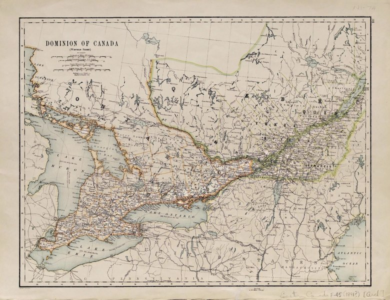
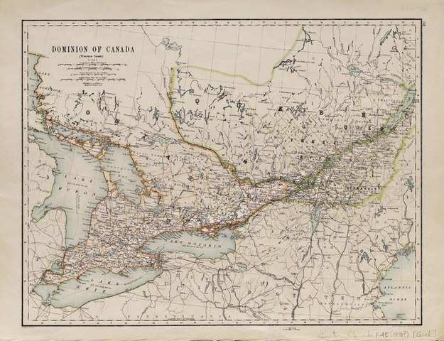
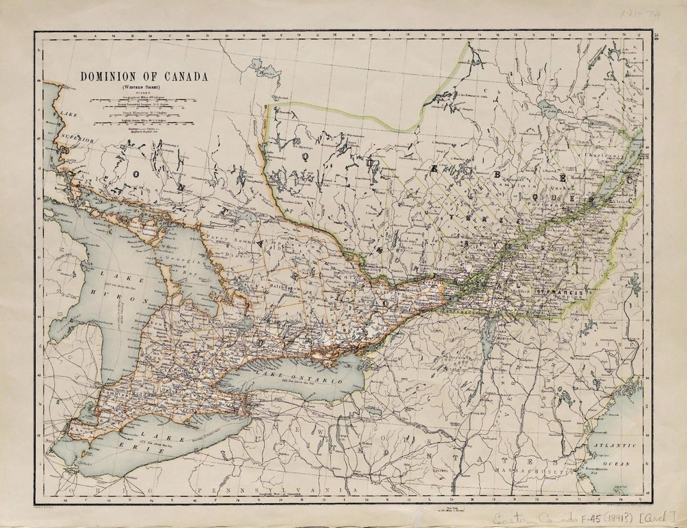
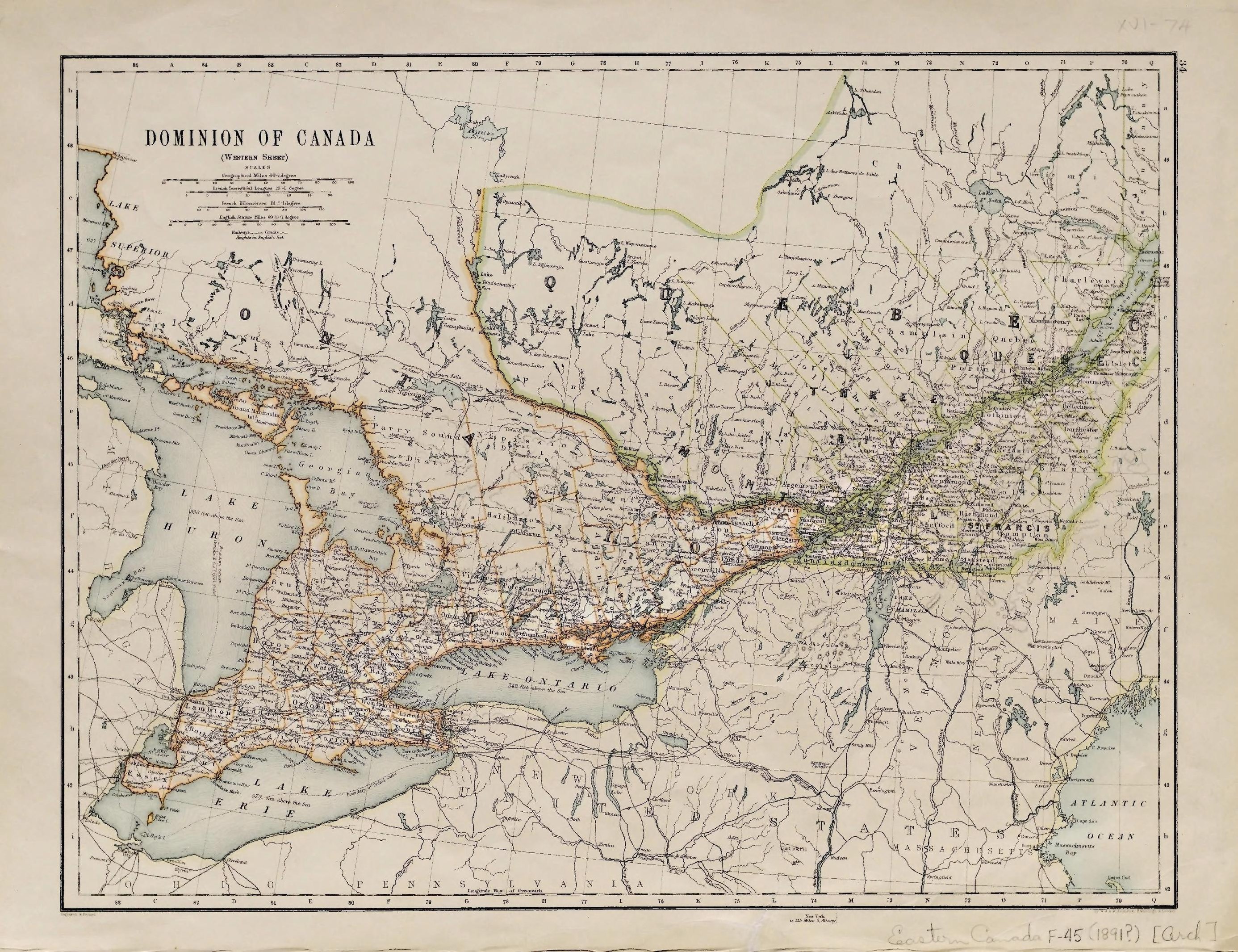
[edit]| Dominion of Canada (Western sheet) [Ontario and Quebec].
( |
|
|---|---|
| Title |
Dominion of Canada (Western sheet) [Ontario and Quebec]. |
| Publisher |
George Philip & Son, London |
| Description |
Col. in outline 31.5 x 41 cm.;Map scanned;File name: WCW_Eastern_Canada_F_45.tif;Divided into counties.;On verso: North America: shows states and provinces. Manitoba extends well into present day Ontario. Subjects: Eastern Canada--Political geography |
| Language | English |
| Publication date | [1891?] |
| Current location |
IA Collections: wcw_gale; wcw; university_of_alberta_libraries; toronto |
| Accession number |
bp_1393 |
| Notes | Scale: Ca. 1:2,800,000. |
| Source | |
Licensing
[edit]|
This work is in the public domain in its country of origin and other countries and areas where the copyright term is the author's life plus 70 years or fewer. | |
| This file has been identified as being free of known restrictions under copyright law, including all related and neighboring rights. | |
File history
Click on a date/time to view the file as it appeared at that time.
| Date/Time | Thumbnail | Dimensions | User | Comment | |
|---|---|---|---|---|---|
| current | 12:20, 27 August 2021 |  | 2,772 × 2,131, 2 pages (3.79 MB) | Fæ (talk | contribs) | IA Query "collection:(wcw) date:[1000 TO 1899]" bp_1393 Category:William C. Wonders Map Collection (COM:IA books#query) (1891 #174) |
You cannot overwrite this file.
File usage on Commons
The following page uses this file: