File:Dom-Halle Grundriss-Schoenermark-1886.tif
Jump to navigation
Jump to search

Size of this JPG preview of this TIF file: 424 × 599 pixels. Other resolutions: 170 × 240 pixels | 339 × 480 pixels | 543 × 768 pixels | 724 × 1,024 pixels | 1,449 × 2,048 pixels | 5,976 × 8,448 pixels.
Original file (5,976 × 8,448 pixels, file size: 48.15 MB, MIME type: image/tiff)
Captions
Captions
Add a one-line explanation of what this file represents
Summary
[edit]| Description |
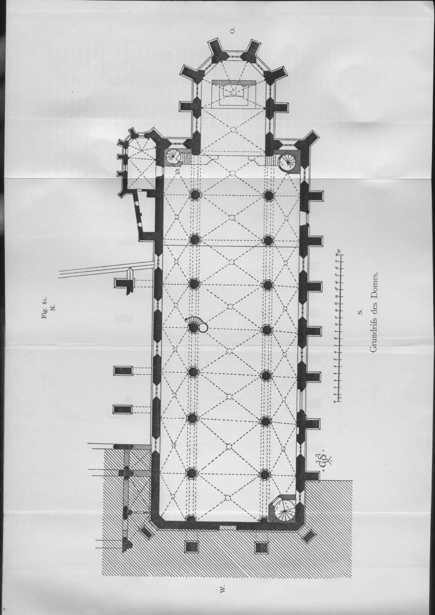
English: Floor plan of the cathedral in Halle (Neues Stift).
Deutsch: Grundriss des Doms in Halle (Neues Stift). |
| Date | |
| Source | Schönermark, Gustav: Beschreibende Darstellung der älteren Bau- und Kunstdenkmäler der Stadt Halle und des Saalekreises, Verlag Otto Hendel, Halle 1886, S. 220f., Fig. 81 |
| Author | Gustav Schönermark, 1854 bis 1910, deutscher Architekt |
| Object location | | View this and other nearby images on: OpenStreetMap |
|---|
Licensing
[edit]|
This work is in the public domain in its country of origin and other countries and areas where the copyright term is the author's life plus 70 years or fewer. | |
| This file has been identified as being free of known restrictions under copyright law, including all related and neighboring rights. | |
File history
Click on a date/time to view the file as it appeared at that time.
| Date/Time | Thumbnail | Dimensions | User | Comment | |
|---|---|---|---|---|---|
| current | 14:42, 25 January 2019 |  | 5,976 × 8,448 (48.15 MB) | Protesus (talk | contribs) | {{Information |description ={{en|1=Floor plan of the cathedral in Halle (Neues Stift).}} {{de|1=Grundriss des Doms in Halle (Neues Stift).}} |date =1886 |source =Schönermark, Gustav: Beschreibende Darstellung der älteren Bau- und Kunstdenkmäler der Stadt Halle und des Saalekreises, Verlag Otto Hendel, Halle 1886, S. 220f., Fig. 81 |author =Gustav Schönermark, 1854 bis 1910, deutscher Architekt }} Object location|51|29|03.7|N|11|57|53.7|E|DE-ST [[Category:Hallescher Do... |
You cannot overwrite this file.
File usage on Commons
The following page uses this file: