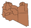
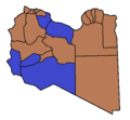
File:Districts of Libya Controlled by Gaddafi and the NTC.png
Districts_of_Libya_Controlled_by_Gaddafi_and_the_NTC.png (462 × 427 pixels, file size: 6 KB, MIME type: image/png)
Captions
Captions
Summary
[edit]| DescriptionDistricts of Libya Controlled by Gaddafi and the NTC.png |
English: Blue: Districts which neither party has overall control.
This map is based on 2011 Libyan uprising Wikipedia article map |
| Date | First uploaded 29 March 2011 |
| Source | Own work |
| Author | IJA |
| Other versions |
[edit] English: Maps of the whole country by language
English: Maps of a single area of the country
English: Historical maps
|
Licensing
[edit]| This file is made available under the Creative Commons CC0 1.0 Universal Public Domain Dedication. | |
| The person who associated a work with this deed has dedicated the work to the public domain by waiving all of their rights to the work worldwide under copyright law, including all related and neighboring rights, to the extent allowed by law. You can copy, modify, distribute and perform the work, even for commercial purposes, all without asking permission.
http://creativecommons.org/publicdomain/zero/1.0/deed.enCC0Creative Commons Zero, Public Domain Dedicationfalsefalse |
File history
Click on a date/time to view the file as it appeared at that time.
| Date/Time | Thumbnail | Dimensions | User | Comment | |
|---|---|---|---|---|---|
| current | 14:12, 20 October 2011 |  | 462 × 427 (6 KB) | Vectrex (talk | contribs) | Sirte fell, Gaddafi died |
| 20:20, 18 October 2011 |  | 462 × 427 (5 KB) | Spaceshuttlediscovery (talk | contribs) | Bani Walid captured by the rebels. | |
| 15:39, 9 October 2011 |  | 462 × 427 (9 KB) | Vectrex (talk | contribs) | Ghat to NTC | |
| 11:55, 30 September 2011 |  | 462 × 427 (9 KB) | Nightstallion (talk | contribs) | fuqaha taken | |
| 15:13, 25 September 2011 |  | 462 × 427 (9 KB) | Vectrex (talk | contribs) | Qatrun appears to be liberated after all | |
| 11:19, 24 September 2011 |  | 462 × 427 (9 KB) | Vectrex (talk | contribs) | Update | |
| 12:33, 23 September 2011 |  | 462 × 427 (8 KB) | Nightstallion (talk | contribs) | Fuqaha still under Qaddafi control | |
| 08:14, 22 September 2011 |  | 462 × 427 (8 KB) | Nightstallion (talk | contribs) | this map seems about right | |
| 23:47, 21 September 2011 |  | 463 × 436 (5 KB) | Spaceshuttlediscovery (talk | contribs) | Sabha under NTC control. | |
| 23:42, 21 September 2011 |  | 462 × 427 (8 KB) | Spaceshuttlediscovery (talk | contribs) | Sabha liberated by the NTC on September 21 |
You cannot overwrite this file.
File usage on Commons
The following 53 pages use this file:
- File:2011 Battle of Sirte.svg
- File:2011 Libya Protests Cities.png
- File:2011 Libyan Civil War.png
- File:20 March Libya Map.jpg
- File:Battle for Misrata.svg
- File:Battle of Misrata-es.svg
- File:Battle of Tripoli.svg
- File:Districts of Libya Controlled by Gaddafi and the NTC.png
- File:Front tripolitain.svg
- File:Golfe de Syrte 2011.svg
- File:Golfo de Sidra.svg
- File:Gulf of Sirt Front-es.svg
- File:Gulf of Sirt Front.svg
- File:Libyan Uprising(2011-03-06).svg
- File:Libyan Uprising(2011-03-08).svg
- File:Libyan Uprising-ar.svg
- File:Libyan Uprising-de.svg
- File:Libyan Uprising-es.svg
- File:Libyan Uprising-fa.svg
- File:Libyan Uprising-fr(2011-03-11).svg
- File:Libyan Uprising-fr(2011-03-18).svg
- File:Libyan Uprising-fr(2011-03-19).svg
- File:Libyan Uprising-fr(2011-03-20).svg
- File:Libyan Uprising-fr.svg
- File:Libyan Uprising-it.svg
- File:Libyan Uprising-mk.svg
- File:Libyan Uprising-ru(2011-03-12).png
- File:Libyan Uprising-ru.svg
- File:Libyan Uprising-sr.svg
- File:Libyan Uprising-tr.svg
- File:Libyan Uprising-zh-cn.svg
- File:Libyan Uprising.svg
- File:Libyan Uprising - Gulf of Sidra.svg
- File:Libyan Uprising Gulf of Sidra.png
- File:Libyan war final-ar.svg
- File:Libyan war final-es.svg
- File:Libyan war final-fr.svg
- File:Libyan war final.svg
- File:Libyan war final zh.svg
- File:Libyscher Bürgerkrieg.svg
- File:Mapa de la Guerra Civil Libia.PNG
- File:Mapa de la Guerra Civil Libia.gif
- File:Sirt Front-ar.svg
- File:Sirt Front-final-ar.svg
- File:Sirt Front-final.svg
- File:Tripoli uprising.svg
- File:Tripolitanian Front-ar.svg
- File:Tripolitanian Front-es.svg
- File:Tripolitanian Front-final-ar.svg
- File:Tripolitanian Front-final-es.svg
- File:Tripolitanian Front-final.svg
- File:Tripolitanian Front.svg
- Template:Other versions/Libyan Uprising
File usage on other wikis
The following other wikis use this file:
- Usage on el.wikipedia.org
- Usage on en.wikipedia.org
- Usage on es.wikipedia.org
- Usage on ta.wikipedia.org
Metadata
This file contains additional information such as Exif metadata which may have been added by the digital camera, scanner, or software program used to create or digitize it. If the file has been modified from its original state, some details such as the timestamp may not fully reflect those of the original file. The timestamp is only as accurate as the clock in the camera, and it may be completely wrong.
| PNG file comment |
|
|---|---|
| Horizontal resolution | 37.79 dpc |
| Vertical resolution | 37.79 dpc |
| Software used |


