File:Dharwar Map.svg
Jump to navigation
Jump to search

Size of this PNG preview of this SVG file: 589 × 599 pixels. Other resolutions: 236 × 240 pixels | 472 × 480 pixels | 755 × 768 pixels | 1,007 × 1,024 pixels | 2,014 × 2,048 pixels | 2,456 × 2,498 pixels.
Original file (SVG file, nominally 2,456 × 2,498 pixels, file size: 8.55 MB)
Captions
Captions
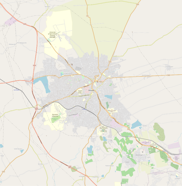
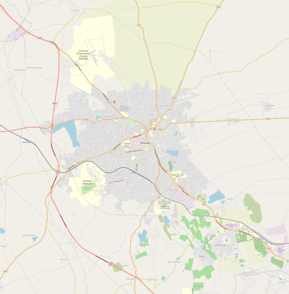
Dharwar map
| Description |
English: Map of en:Dharwar, India. Coordinates: top=15.4841, bottom=15.3036, left=74.9424, right=75.0505. |
| Date | 27 December 2022 (original upload date) |
| Source | openstreetmap.org |
| Author | Collaboratively created by the OpenStreetMap community using only free map sources and manual GPS surveying to build the map from scratch. |
| Permission (Reusing this file) |
See OpenStreetMap License for details. |
Summary
[edit]
Latitudes from 75.0013 to 75.0081
Longitude from 15.4636 to 15.4692
Licensing
[edit]
This file is licensed under the Creative Commons Attribution 2.0 Generic license.
- You are free:
- to share – to copy, distribute and transmit the work
- to remix – to adapt the work
- Under the following conditions:
- attribution – You must give appropriate credit, provide a link to the license, and indicate if changes were made. You may do so in any reasonable manner, but not in any way that suggests the licensor endorses you or your use.
File history
Click on a date/time to view the file as it appeared at that time.
| Date/Time | Thumbnail | Dimensions | User | Comment | |
|---|---|---|---|---|---|
| current | 11:25, 27 December 2022 | | 2,456 × 2,498 (8.55 MB) | Prashant sevu (talk | contribs) | Uploaded a work by https://www.openstreetmap.org from https://www.openstreetmap.org/#map=12/15.4525/75.0064 with UploadWizard |
You cannot overwrite this file.
File usage on Commons
There are no pages that use this file.