File:Dadra & Nagar Haveli.svg
Jump to navigation
Jump to search

Size of this PNG preview of this SVG file: 800 × 564 pixels. Other resolutions: 320 × 225 pixels | 640 × 451 pixels | 1,024 × 722 pixels | 1,280 × 902 pixels | 2,560 × 1,804 pixels | 1,063 × 749 pixels.
Original file (SVG file, nominally 1,063 × 749 pixels, file size: 610 KB)
Captions
Captions
Add a one-line explanation of what this file represents
Summary
[edit]| Description |
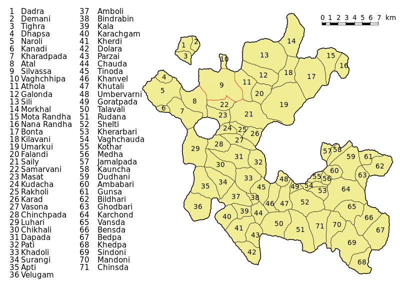
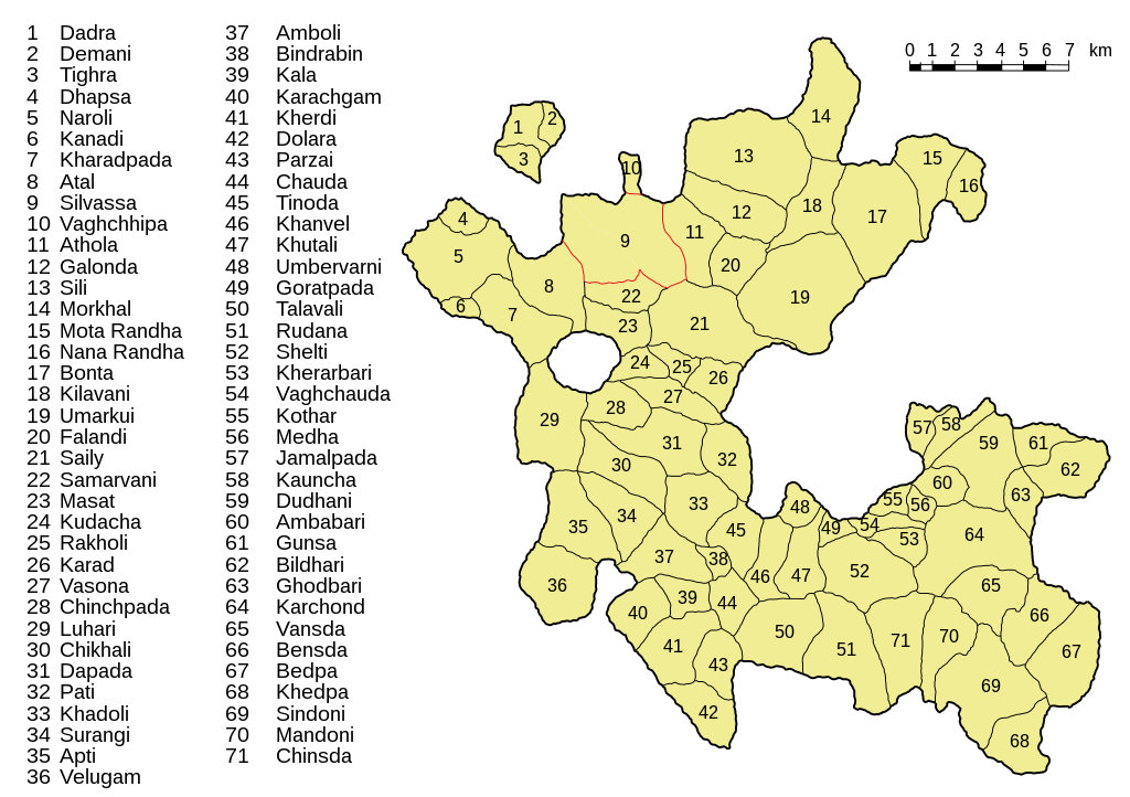
Deutsch: Administrative Einteilung von Dadra und Nagar Haveli (2011).
English: Administrative divisions in Dadra and Nagar Haveli, 2011. |
||
| Date | |||
| Source | Derived from maps published by the Census of India 2011 | ||
| Author | Furfur | ||
| Permission (Reusing this file) |
I, the copyright holder of this work, hereby publish it under the following licenses:
This file is licensed under the Creative Commons Attribution-Share Alike 4.0 International license.
You may select the license of your choice. |
||
| SVG development | This map was created with Adobe Illustrator. |

File history
Click on a date/time to view the file as it appeared at that time.
| Date/Time | Thumbnail | Dimensions | User | Comment | |
|---|---|---|---|---|---|
| current | 19:56, 10 April 2020 | | 1,063 × 749 (610 KB) | Furfur (talk | contribs) | == {{int:filedesc}} == {{Information |Description={{User:Medium69/Traduction}} {{de|1=Administrative Einteilung von Dadra und Nagar Haveli (2011).}} {{en|1=Administrative divisions in Dadra and Nagar Haveli, 2011.}} |Source=Derived from maps published by the Census of India 2011 |Date={{Other date |1= |2= }} |Author={{U|Furfur}} |Permission={{self|GFDL|cc-by-sa-4.0}} |Other versions= |Other fields={{Igen|A|+|%|s=m}} }} Category:Maps of Dadra and Nagar Haveli |
You cannot overwrite this file.
File usage on Commons
There are no pages that use this file.
File usage on other wikis
The following other wikis use this file:
- Usage on de.wikipedia.org