File:DOP40 - FC Bayern Campus 32692 5343 (Bayerische Vermessungsverwaltung).tif
Jump to navigation
Jump to search

Size of this PNG preview of this TIF file: 450 × 600 pixels. Other resolutions: 180 × 240 pixels | 360 × 480 pixels | 576 × 768 pixels | 768 × 1,024 pixels | 2,500 × 3,331 pixels.
Original file (2,500 × 3,331 pixels, file size: 18.08 MB, MIME type: image/tiff)
Captions
Captions
Add a one-line explanation of what this file represents
Summary
[edit]| Description |
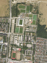
Deutsch: Ansicht eines digitalen Orthofotos von der Bayerischen Vermessungsverwaltung. Das Bild ist ein entzerrtes, maßstabsgetreues Luftbild auf Grundlage der Bayernbefliegung. Dieser Abschnitt zeigt den FC Bayern Campus in der Stadt München von oben.
English: View of a digital orthophoto from the Bavarian Survey Administration. The image is a rectified, scaled aerial photo based on the Bavarian survey. One pixel edge is 40cm long. The coordinate system used is UTM32, or EPSG:25832. This section shows FC Bayern Campus in the city of Munich from above. |
||
| Date | |||
| Source |
|
||
| Author | Bayerische Vermessungsverwaltung – www.geodaten.bayern.de | ||
| Other versions |
|


| Camera location | | View this and other nearby images on: OpenStreetMap |
|---|
Licensing
[edit]This file is licensed under the Creative Commons Attribution 4.0 International license.
- You are free:
- to share – to copy, distribute and transmit the work
- to remix – to adapt the work
- Under the following conditions:
- attribution – You must give appropriate credit, provide a link to the license, and indicate if changes were made. You may do so in any reasonable manner, but not in any way that suggests the licensor endorses you or your use.
File history
Click on a date/time to view the file as it appeared at that time.
| Date/Time | Thumbnail | Dimensions | User | Comment | |
|---|---|---|---|---|---|
| current | 11:59, 21 May 2024 |  | 2,500 × 3,331 (18.08 MB) | Derkoenig (talk | contribs) | == {{int:filedesc}} == {{Information |description={{de|1=Ansicht eines digitalen Orthofotos von der Bayerischen Vermessungsverwaltung. Das Bild ist ein entzerrtes, maßstabsgetreues Luftbild auf Grundlage der Bayernbefliegung. Dieser Abschnitt zeigt den {{w|FC Bayern Campus|3=de}} in der Stadt München von oben.}} {{en|1=View of a digital orthophoto from the Bavarian Survey Administration. The image is a rectified, scaled aerial photo based on the Bavarian survey. One pixel edge is 40cm long. T... |
You cannot overwrite this file.
File usage on Commons
The following 2 pages use this file:
File usage on other wikis
The following other wikis use this file:
- Usage on de.wikipedia.org