File:DC1 locator.svg
Jump to navigation
Jump to search

Size of this PNG preview of this SVG file: 800 × 545 pixels. Other resolutions: 320 × 218 pixels | 640 × 436 pixels | 1,024 × 697 pixels | 1,280 × 872 pixels | 2,560 × 1,743 pixels | 1,000 × 681 pixels.
Original file (SVG file, nominally 1,000 × 681 pixels, file size: 206 KB)
Captions
Captions
Add a one-line explanation of what this file represents

|
This file has been superseded by Map of the Western Cape with West Coast highlighted.svg. It is recommended to use the other file. Please note that deleting superseded images requires consent.
|
.svg&lang=en)
|
Summary
[edit]
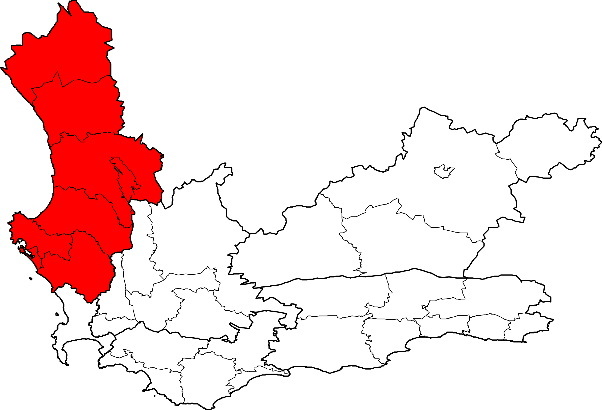
| Description | Map showing the West Coast District Municipality higlighted within the Western Cape. |
| Date | |
| Source | Created by me from Shapefile data from the Municipal Demarcation Board, South Africa. |
| Author | Adrian Frith (User:Htonl) |
| Permission (Reusing this file) |
Dual-licensed under the GFDL and CC-By-SA-2.5, 2.0, and 1.0. |
Licensing
[edit]
I, the copyright holder of this work, hereby publish it under the following licenses:

|
Permission is granted to copy, distribute and/or modify this document under the terms of the GNU Free Documentation License, Version 1.2 or any later version published by the Free Software Foundation; with no Invariant Sections, no Front-Cover Texts, and no Back-Cover Texts. A copy of the license is included in the section entitled GNU Free Documentation License. |
| This file is licensed under the Creative Commons Attribution-Share Alike 3.0 Unported license. | ||
| ||
| This licensing tag was added to this file as part of the GFDL licensing update. |
This file is licensed under the Creative Commons Attribution-Share Alike 2.5 Generic, 2.0 Generic and 1.0 Generic license.
- You are free:
- to share – to copy, distribute and transmit the work
- to remix – to adapt the work
- Under the following conditions:
- attribution – You must give appropriate credit, provide a link to the license, and indicate if changes were made. You may do so in any reasonable manner, but not in any way that suggests the licensor endorses you or your use.
- share alike – If you remix, transform, or build upon the material, you must distribute your contributions under the same or compatible license as the original.
You may select the license of your choice.
File history
Click on a date/time to view the file as it appeared at that time.
| Date/Time | Thumbnail | Dimensions | User | Comment | |
|---|---|---|---|---|---|
| current | 20:33, 11 March 2006 | | 1,000 × 681 (206 KB) | Htonl (talk | contribs) | Change DC borders to 2px |
| 18:56, 6 March 2006 |  | 1,000 × 681 (198 KB) | Htonl (talk | contribs) | Reverted to earlier revision | |
| 19:06, 1 March 2006 |  | 1,000 × 681 (130 KB) | Htonl (talk | contribs) | Reverted to earlier revision | |
| 19:04, 1 March 2006 |  | 500 × 341 (126 KB) | Htonl (talk | contribs) | Let's see if a smaller one will work. | |
| 18:52, 1 March 2006 |  | 1,000 × 681 (198 KB) | Htonl (talk | contribs) | New version with thicker lines for district borders. | |
| 13:27, 12 February 2006 |  | 1,000 × 681 (130 KB) | Htonl (talk | contribs) | Locator map for West Coast DM, Western Cape. |
You cannot overwrite this file.
File usage on Commons
There are no pages that use this file.