Category:Maps of Western Cape municipalities with 2006 borders
Jump to navigation
Jump to search
This category contains maps of municipalities in the Western Cape province of South Africa that show the the municipal borders as they were after the municipal election of 1 March 2006. The borders of many municipalities changed in 2011.
Media in category "Maps of Western Cape municipalities with 2006 borders"
The following 137 files are in this category, out of 137 total.
-
 Blank map of the Western Cape (2006).svg 805 × 621; 519 KB
-
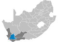
 Map of the Western Cape with Cape Town highlighted (2006).svg 849 × 676; 452 KB
-
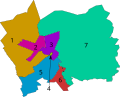
 Cape Town Subcouncils 2006 labelled.svg 800 × 1,000; 470 KB
-
 Cape Town subcouncils and wards 2006.svg 604 × 768; 142 KB
-
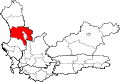
 Map of the Western Cape with Cape Winelands highlighted (2006).svg 849 × 676; 451 KB
-
 Map of the Western Cape with Central Karoo highlighted (2006).svg 849 × 676; 448 KB
-
 CPT locator.svg 1,000 × 681; 206 KB
-
 DC1 locals.svg 540 × 1,000; 63 KB
-
 DC1 locator.svg 1,000 × 681; 206 KB
-
 DC2 locals.svg 1,000 × 840; 31 KB
-
 DC2 locator.svg 1,000 × 681; 206 KB
-
 DC3 locator.svg 1,000 × 681; 206 KB
-
 DC4 locator.svg 1,000 × 681; 206 KB
-
 DC5 locator.svg 1,000 × 681; 206 KB
-
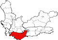
 Map of the Western Cape with Eden highlighted (2006).svg 849 × 676; 461 KB
-
 KaapseWijnlanden.png 423 × 295; 8 KB
-
 KaapstadMetropolitaanseMunisipaliteit.png 310 × 198; 5 KB
-
 Map No. 49 of Schedule 2 to Notice 1998 of 2005.png 2,800 × 1,950; 3.56 MB
-
 Map No. 50 of Schedule 2 to Notice 1998 of 2005.png 2,800 × 1,950; 3.68 MB
-
 Map No. 51 of Schedule 2 to Notice 1998 of 2005.png 2,800 × 1,950; 3.9 MB
-
 Map No. 52 of Schedule 2 to Notice 1998 of 2005.png 2,800 × 1,950; 3.93 MB
-
 Map No. 53 of Schedule 2 to Notice 1998 of 2005.png 2,800 × 1,950; 3.66 MB
-
 Map No. 54 of Schedule 2 to Notice 1998 of 2005.png 2,800 × 1,950; 3.85 MB
-

-

-
 Map of the Eden district with local municipalities labelled (2006).svg 1,040 × 481; 88 KB
-

-

-
 Map of the Western Cape with Beaufort West highlighted (2006).svg 849 × 676; 446 KB
-
 Map of the Western Cape with Bergrivier highlighted (2006).svg 849 × 676; 445 KB
-
 Map of the Western Cape with Bitou highlighted (2006).svg 849 × 676; 440 KB
-
 Map of the Western Cape with Breede Valley highlighted (2006).svg 849 × 676; 438 KB
-
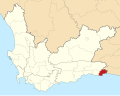
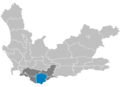
 Map of the Western Cape with Cape Agulhas highlighted (2006).svg 849 × 676; 441 KB
-
 Map of the Western Cape with Cederberg highlighted (2006).svg 849 × 676; 446 KB
-
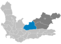
 Map of the Western Cape with Drakenstein highlighted (2006).svg 849 × 676; 441 KB
-
 Map of the Western Cape with George highlighted (2006).svg 849 × 676; 441 KB
-
 Map of the Western Cape with Hessequa highlighted (2006).svg 849 × 676; 449 KB
-
 Map of the Western Cape with Kannaland highlighted (2006).svg 849 × 676; 438 KB
-
 Map of the Western Cape with Knysna highlighted (2006).svg 849 × 676; 439 KB
-
 Map of the Western Cape with Laingsburg highlighted (2006).svg 849 × 676; 442 KB
-
 Map of the Western Cape with Langeberg highlighted (2006).svg 849 × 676; 438 KB
-
 Map of the Western Cape with Matzikama highlighted (2006).svg 849 × 676; 444 KB
-
 Map of the Western Cape with Mossel Bay highlighted (2006).svg 849 × 676; 444 KB
-
 Map of the Western Cape with municipalities blank (2006).svg 849 × 676; 961 KB
-
 Map of the Western Cape with municipalities labelled (2006).svg 849 × 676; 439 KB
-
 Map of the Western Cape with Oudtshoorn highlighted (2006).svg 849 × 676; 438 KB
-
 Map of the Western Cape with Overstrand highlighted (2006).svg 849 × 676; 447 KB
-
 Map of the Western Cape with Prince Albert highlighted (2006).svg 849 × 676; 439 KB
-
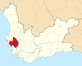
 Map of the Western Cape with Saldanha Bay highlighted (2006).svg 849 × 676; 445 KB
-
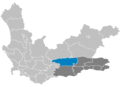
 Map of the Western Cape with Stellenbosch highlighted (2006).svg 849 × 676; 438 KB
-
 Map of the Western Cape with Swartland highlighted (2006).svg 849 × 676; 447 KB
-
 Map of the Western Cape with Swellendam highlighted (2006).svg 849 × 676; 443 KB
-

-

-
 Map of the Western Cape with the Eden DMA highlighted (2006).svg 849 × 676; 438 KB
-
 Map of the Western Cape with the Overberg DMA highlighted (2006).svg 849 × 676; 440 KB
-
 Map of the Western Cape with the West Coast DMA highlighted (2006).svg 849 × 676; 452 KB
-
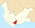
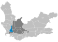
 Map of the Western Cape with Theewaterskloof highlighted (2006).svg 849 × 676; 439 KB
-
 Map of the Western Cape with Witzenberg highlighted (2006).svg 849 × 676; 438 KB
-
 Matzikama wards.svg 922 × 745; 36 KB
-
 Map of the Western Cape with Overberg highlighted (2006).svg 849 × 676; 460 KB
-
 South Africa Districts showing Cape Town.png 1,141 × 828; 26 KB
-
 South Africa Districts showing Cape Winelands.png 1,141 × 828; 26 KB
-
 South Africa Districts showing Central Karoo.png 1,141 × 828; 26 KB
-
 South Africa Districts showing Eden.png 1,141 × 828; 26 KB
-
 South Africa Districts showing Overberg.png 1,141 × 828; 26 KB
-
 South Africa Districts showing WC.png 1,141 × 828; 20 KB
-
 South Africa Districts showing West Coast.png 1,141 × 828; 26 KB
-
 Stellenboschmunisipaliteit.png 310 × 198; 5 KB
-
 WC011 locator.svg 1,000 × 681; 206 KB
-
 WC012 locator.svg 1,000 × 681; 206 KB
-
 WC013 locator.svg 1,000 × 681; 206 KB
-
 WC014 locator.svg 1,000 × 681; 206 KB
-
 WC015 locator.svg 1,000 × 681; 206 KB
-
 WC022 locator.svg 1,000 × 681; 206 KB
-
 WC023 locator.svg 1,000 × 681; 206 KB
-
 WC024 locator.svg 1,000 × 681; 206 KB
-
 WC025 locator.svg 1,000 × 681; 206 KB
-
 WC026 locator.svg 1,000 × 681; 206 KB
-
 WC031 locator.svg 1,000 × 681; 206 KB
-
 WC032 locator.svg 1,000 × 681; 206 KB
-
 WC033 locator.svg 1,000 × 681; 206 KB
-
 WC034 locator.svg 1,000 × 681; 206 KB
-
 WC041 locator.svg 1,000 × 681; 206 KB
-
 WC042 locator.svg 1,000 × 681; 206 KB
-
 WC043 locator.svg 1,000 × 681; 206 KB
-
 WC044 locator.svg 1,000 × 681; 206 KB
-
 WC045 locator.svg 1,000 × 681; 206 KB
-
 WC047 locator.svg 1,000 × 681; 206 KB
-
 WC048 locator.svg 1,000 × 681; 206 KB
-
 WC051 locator.svg 1,000 × 681; 206 KB
-
 WC052 locator.svg 1,000 × 681; 206 KB
-
 WC053 locator.svg 1,000 × 681; 206 KB
-
 WCDMA01 locator.svg 1,000 × 681; 206 KB
-
 WCDMA02 locator.svg 1,000 × 681; 206 KB
-
 WCDMA03 locator.svg 1,000 × 681; 206 KB
-
 WCDMA04 locator.svg 1,000 × 681; 206 KB
-
 WCDMA05 locator.svg 1,000 × 681; 206 KB
-
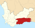
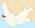
 Map of the Western Cape with West Coast highlighted (2006).svg 849 × 676; 479 KB
-
 Western Cape DistrictOverberg Municipalities.png 379 × 217; 4 KB
-
 Western Cape Municipalities showing Beaufort West.png 1,147 × 828; 14 KB
-
 Western Cape Municipalities showing Bergrivier.png 1,147 × 828; 14 KB
-
 Western Cape Municipalities showing Bitou.png 1,147 × 828; 14 KB
-
 Western Cape Municipalities showing Breede River Winelands.png 1,147 × 828; 15 KB
-
 Western Cape Municipalities showing Breede Valley.png 1,147 × 828; 15 KB
-
 Western Cape Municipalities showing Cape Agulhas.png 1,147 × 828; 14 KB
-
 Western Cape Municipalities showing Cape Town.png 1,147 × 828; 14 KB
-
 Western Cape Municipalities showing Cape Winelands DMA.png 1,147 × 828; 15 KB
-
 Western Cape Municipalities showing Cape Winelands.png 1,147 × 828; 14 KB
-
 Western Cape Municipalities showing Cederberg.png 1,147 × 828; 14 KB
-
 Western Cape Municipalities showing Central Karoo DMA.png 1,147 × 828; 14 KB
-
 Western Cape Municipalities showing Central Karoo.png 1,147 × 828; 14 KB
-
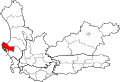
 Western Cape Municipalities showing Drakenstein.png 1,147 × 828; 15 KB
-
 Western Cape Municipalities showing Eden DMA.png 1,147 × 828; 14 KB
-
 Western Cape Municipalities showing Eden.png 1,147 × 828; 14 KB
-
 Western Cape Municipalities showing George.png 1,147 × 828; 14 KB
-
 Western Cape Municipalities showing Hessequa.png 1,147 × 828; 14 KB
-
 Western Cape Municipalities showing Kannaland.png 1,147 × 828; 14 KB
-
 Western Cape Municipalities showing Knysna.png 1,147 × 828; 14 KB
-
 Western Cape Municipalities showing Laingsburg.png 1,147 × 828; 14 KB
-
 Western Cape Municipalities showing Matzikama.png 1,147 × 828; 14 KB
-
 Western Cape Municipalities showing Mossel Bay.png 1,147 × 828; 14 KB
-
 Western Cape Municipalities showing Oudtshoorn.png 1,147 × 828; 14 KB
-
 Western Cape Municipalities showing Overberg DMA.png 1,147 × 828; 14 KB
-
 Western Cape Municipalities showing Overberg.png 1,147 × 828; 14 KB
-
 Western Cape Municipalities showing Overstrand.png 1,147 × 828; 14 KB
-
 Western Cape Municipalities showing Prince Albert.png 1,147 × 828; 14 KB
-
 Western Cape Municipalities showing Saldanha Bay.png 1,147 × 828; 14 KB
-
 Western Cape Municipalities showing Stellenbosch.png 1,147 × 828; 15 KB
-
 Western Cape Municipalities showing Swartland.png 1,147 × 828; 14 KB
-
 Western Cape Municipalities showing Swellendam.png 1,147 × 828; 14 KB
-
 Western Cape Municipalities showing Theewaterskloof.png 1,147 × 828; 14 KB
-
 Western Cape Municipalities showing West Coast DMA.png 1,147 × 828; 14 KB
-
 Western Cape Municipalities showing West Coast.png 1,147 × 828; 14 KB
-
 Western Cape Municipalities showing Witzenberg.png 1,147 × 828; 15 KB
-
 Western Cape Municipalities Template.png 1,147 × 828; 14 KB
-
 Western Cape Municipalities.png 1,147 × 828; 14 KB
.svg)


.svg)
.svg)


.svg)


.svg)
.svg)
.svg)
.svg)
.svg)
.svg)
.svg)
.svg)
.svg)
.svg)
.svg)
.svg)
.svg)
.svg)
.svg)
.svg)
.svg)
.svg)
.svg)
.svg)
.svg)
.svg)
.svg)
.svg)
.svg)
.svg)
.svg)
.svg)
.svg)
.svg)
.svg)
.svg)
.svg)
.svg)
.svg)

.svg)


.svg)


.svg)
.svg)