File:Dörfer im Tagebau Schlabendorf 1908.tif
Jump to navigation
Jump to search

Size of this JPG preview of this TIF file: 800 × 567 pixels. Other resolutions: 320 × 227 pixels | 640 × 454 pixels | 1,024 × 726 pixels | 1,280 × 907 pixels | 2,364 × 1,676 pixels.
Original file (2,364 × 1,676 pixels, file size: 11.36 MB, MIME type: image/tiff)
Captions
Captions
Add a one-line explanation of what this file represents
Summary
[edit]| Description |
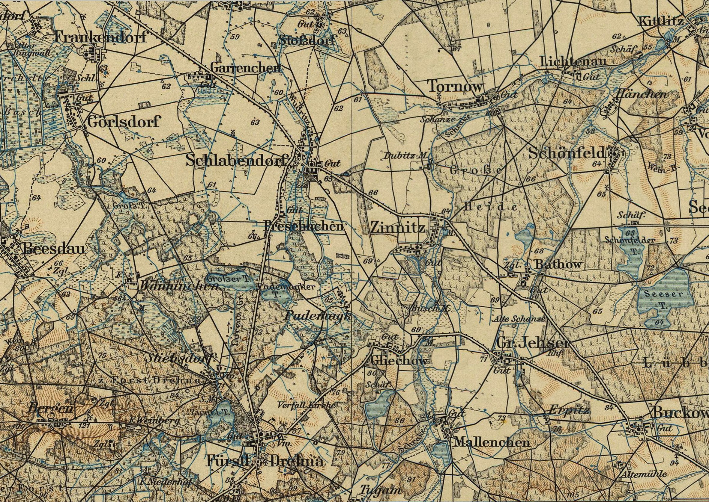
Deutsch: Die geografische Lage vor der Inanspruchnahme durch den Tagebau Schlabendorf-Süd mit den devastierten Dörfern Wanninchen, Stiebsdorf, Pademack, Presenchen und Gliechow im Jahre 1908. |
| Date | |
| Source | Karte des Deutschen Reichs 1:100 000, 342 Luckau 1908 und 343 Lübben/Spreewald 1908. |
| Author | Topografische Abteilung der Königlich-Preußischen Landesaufnahme 1908. |
Licensing
[edit]|
This work is in the public domain in its country of origin and other countries and areas where the copyright term is the author's life plus 70 years or fewer. This work is in the public domain in the United States because it was published (or registered with the U.S. Copyright Office) before January 1, 1929. | |
| This file has been identified as being free of known restrictions under copyright law, including all related and neighboring rights. | |
File history
Click on a date/time to view the file as it appeared at that time.
| Date/Time | Thumbnail | Dimensions | User | Comment | |
|---|---|---|---|---|---|
| current | 12:50, 14 July 2017 |  | 2,364 × 1,676 (11.36 MB) | Mehssow (talk | contribs) | User created page with UploadWizard |
You cannot overwrite this file.
File usage on Commons
The following page uses this file:
File usage on other wikis
The following other wikis use this file:
- Usage on de.wikipedia.org
- Usage on ky.wikipedia.org