File:Cycling routes at Lakoma (Cottbus).png
Jump to navigation
Jump to search
Size of this preview: 800 × 534 pixels. Other resolutions: 320 × 214 pixels | 640 × 427 pixels | 1,024 × 684 pixels | 1,280 × 854 pixels | 2,346 × 1,566 pixels.
Original file (2,346 × 1,566 pixels, file size: 6.45 MB, MIME type: image/png)
Captions
Captions
Add a one-line explanation of what this file represents
Summary
[edit].png&action=edit§ion=1)
| Description |
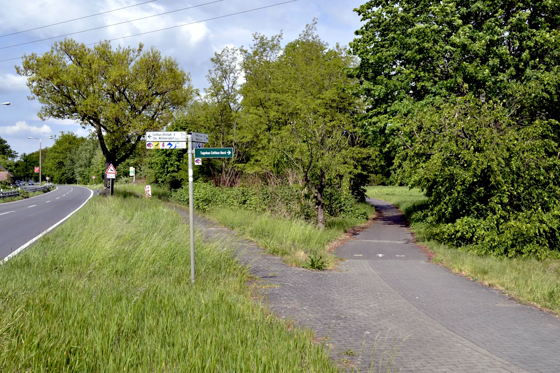
English: Several long-distance cycling routes pass by Lakoma. This section runs alongside Hammergraben between Maust and Lakoma, crosses Federal Highway 168 here and then continues westward to Cottbus-Saspow and eventually south to downtown Cottbus after following the river Spree for several kilometers. |
| Date | |
| Source | Own work |
| Author | Trio3D |
| Camera location | | View this and other nearby images on: OpenStreetMap |
|---|
.png¶ms=051.796131_N_0014.380550_E_globe:Earth_type:camera_heading:45.00&language=en)
This file is licensed under the Creative Commons Attribution-Share Alike 4.0 International license.
- You are free:
- to share – to copy, distribute and transmit the work
- to remix – to adapt the work
- Under the following conditions:
- attribution – You must give appropriate credit, provide a link to the license, and indicate if changes were made. You may do so in any reasonable manner, but not in any way that suggests the licensor endorses you or your use.
- share alike – If you remix, transform, or build upon the material, you must distribute your contributions under the same or compatible license as the original.
File history
Click on a date/time to view the file as it appeared at that time.
| Date/Time | Thumbnail | Dimensions | User | Comment | |
|---|---|---|---|---|---|
| current | 11:55, 18 June 2023 | | 2,346 × 1,566 (6.45 MB) | Trio3D (talk | contribs) | Touched up. |
| 14:55, 11 May 2019 |  | 2,377 × 1,612 (7.07 MB) | Trio3D (talk | contribs) | Color temperature was off slightly. | |
| 14:12, 11 May 2019 |  | 2,377 × 1,612 (7.04 MB) | Trio3D (talk | contribs) | Cropping mishap. | |
| 14:08, 11 May 2019 |  | 2,384 × 1,632 (7.11 MB) | Trio3D (talk | contribs) | {{Information |description ={{en|1=Several long-distance cycling routes pass by Lakoma. This section runs alongside Hammergraben between Maust and Lakoma, crosses Federal Highway 168 here and then continues westward to Cottbus-Saspow and eventually south to downtown Cottbus after following the river Spree for several kilometers.}} |date =2019-05-10 |source ={{own}} |author =User:Trio3D }} {{Location|51|47|46.07|N|14|22|49.98|E|heading:NE}} {{cc-by-sa-4.0}} [[Cate... |
You cannot overwrite this file.
File usage on Commons
The following 4 pages use this file:
.png&oldid=872383002)