File:Current Pakistani Provincial Governments.png
Jump to navigation
Jump to search
Size of this preview: 800 × 563 pixels. Other resolutions: 320 × 225 pixels | 640 × 451 pixels | 1,024 × 721 pixels | 1,280 × 901 pixels | 2,560 × 1,803 pixels | 3,488 × 2,456 pixels.
Original file (3,488 × 2,456 pixels, file size: 30 KB, MIME type: image/png)
Captions
Captions
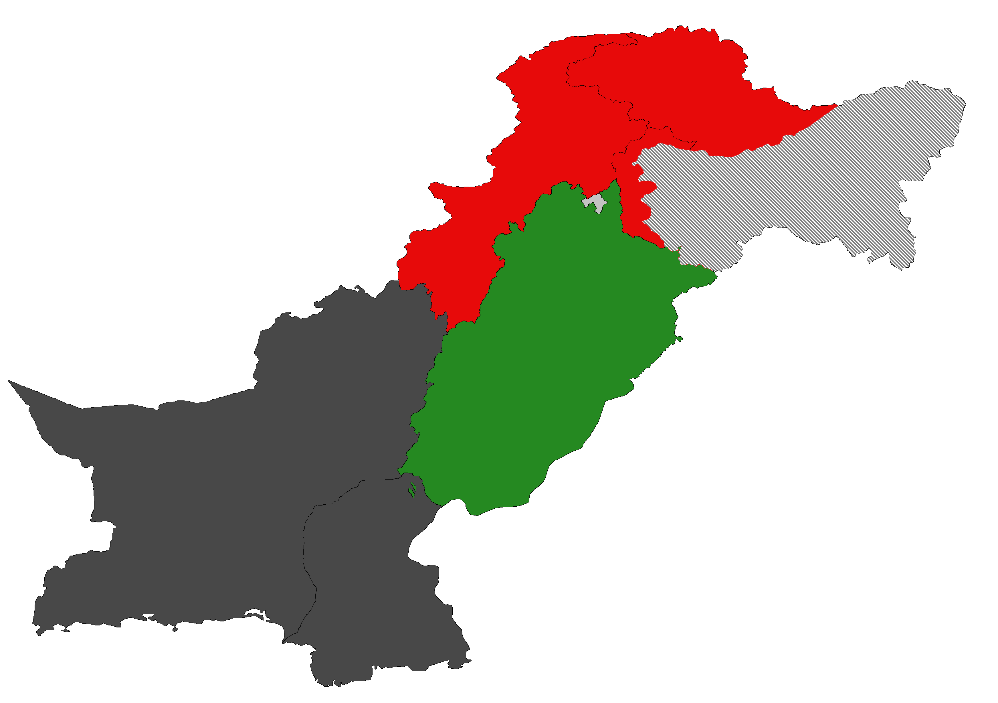
Map of Pakistan showing provinces and currently ruling parties.
Any autoconfirmed user can overwrite this file from the same source. Please ensure that overwrites comply with the guideline.
Summary
[edit]
| Description |
English: Map of Pakistan showing provinces and currently ruling parties. ▇ Pakistan Tehreek-e-Insaf ▇ Pakistan People's Party ▇ Pakistan Muslim League (N) ▇ Vacant/Caretaker |
| Date | |
| Source | Own work |
| Author | Saad Ali Khan Pakistan |
Licensing
[edit]
I, the copyright holder of this work, hereby publish it under the following license:
This file is licensed under the Creative Commons Attribution-Share Alike 4.0 International license.
- You are free:
- to share – to copy, distribute and transmit the work
- to remix – to adapt the work
- Under the following conditions:
- attribution – You must give appropriate credit, provide a link to the license, and indicate if changes were made. You may do so in any reasonable manner, but not in any way that suggests the licensor endorses you or your use.
- share alike – If you remix, transform, or build upon the material, you must distribute your contributions under the same or compatible license as the original.
File history
Click on a date/time to view the file as it appeared at that time.
| Date/Time | Thumbnail | Dimensions | User | Comment | |
|---|---|---|---|---|---|
| current | 15:43, 18 July 2024 | | 3,488 × 2,456 (30 KB) | Obscure2020 (talk | contribs) | The previous version was encoded as 32-bits-per-pixel RGBA. This unnecessarily inflated the size of this file, as not only is this image completely opaque, it also happens to be composed of only 10 distinct colors. This means we can re-encode the image in 4-bits-per-pixel Palette mode. I performed this re-encoding with OxiPNG and ZopfliPNG. This results in massive file size savings while the image still looks the exact same. |
| 16:50, 15 July 2024 |  | 3,488 × 2,456 (258 KB) | Titan2456 (talk | contribs) | Updated for 2024 | |
| 16:15, 29 November 2023 |  | 3,488 × 2,456 (97 KB) | Saad Ali Khan Pakistan (talk | contribs) | Sindh and Balochistan governments dissolved and caretaker setup started | |
| 13:25, 25 January 2023 |  | 3,488 × 2,456 (207 KB) | Saad Ali Khan Pakistan (talk | contribs) | Khyber Pakhtunkhwa and Punjab Assemblies dissolved for polls | |
| 23:36, 15 November 2022 |  | 1,997 × 1,525 (639 KB) | Eupakistani (talk | contribs) | Reverted to version as of 07:24, 28 September 2022 (UTC) Pakistan gov didn't think aksaichin is part of Kashmir | |
| 19:59, 5 October 2022 |  | 3,488 × 2,456 (210 KB) | Saad Ali Khan Pakistan (talk | contribs) | Reverted to version as of 12:11, 6 September 2022 (UTC) Dont change map. this map shows whole disputed region of Jammu and Kashmir | |
| 07:24, 28 September 2022 |  | 1,997 × 1,525 (639 KB) | Eupakistani (talk | contribs) | Reverted to version as of 15:56, 1 August 2022 (UTC) | |
| 12:11, 6 September 2022 |  | 3,488 × 2,456 (210 KB) | Saad Ali Khan Pakistan (talk | contribs) | Reverted to version as of 06:41, 27 July 2022 (UTC) | |
| 15:56, 1 August 2022 |  | 1,997 × 1,525 (639 KB) | Eupakistani (talk | contribs) | http://surveyofpakistan.gov.pk/Detail/MTUzYWU5ZGItNTA4NS00MDlkLWFlODctNTRkY2JmNWI0Mjg2 Pak official map didn't include Chinese ruled Aksai chin | |
| 06:41, 27 July 2022 |  | 3,488 × 2,456 (210 KB) | Saad Ali Khan Pakistan (talk | contribs) | Uploaded own work with UploadWizard |
You cannot overwrite this file.
File usage on Commons
There are no pages that use this file.
File usage on other wikis
The following other wikis use this file:
- Usage on ur.wikipedia.org