File:Credit USAF, ca. 1945. Original housed in the Muroc Flight Test Base, Unit History, 1 September 1942 - 30 June 1945. Alfred F. Simpson Historical Research Agency. United HAER CAL,15-BORON.V,2S-9.tif
Jump to navigation
Jump to search

Size of this JPG preview of this TIF file: 479 × 599 pixels. Other resolutions: 192 × 240 pixels | 384 × 480 pixels | 614 × 768 pixels | 819 × 1,024 pixels | 1,637 × 2,048 pixels | 4,445 × 5,560 pixels.
Original file (4,445 × 5,560 pixels, file size: 23.57 MB, MIME type: image/tiff)
Captions
Captions
Add a one-line explanation of what this file represents
Summary
[edit]| Photographer |
Related names:
|
|||
| Title |
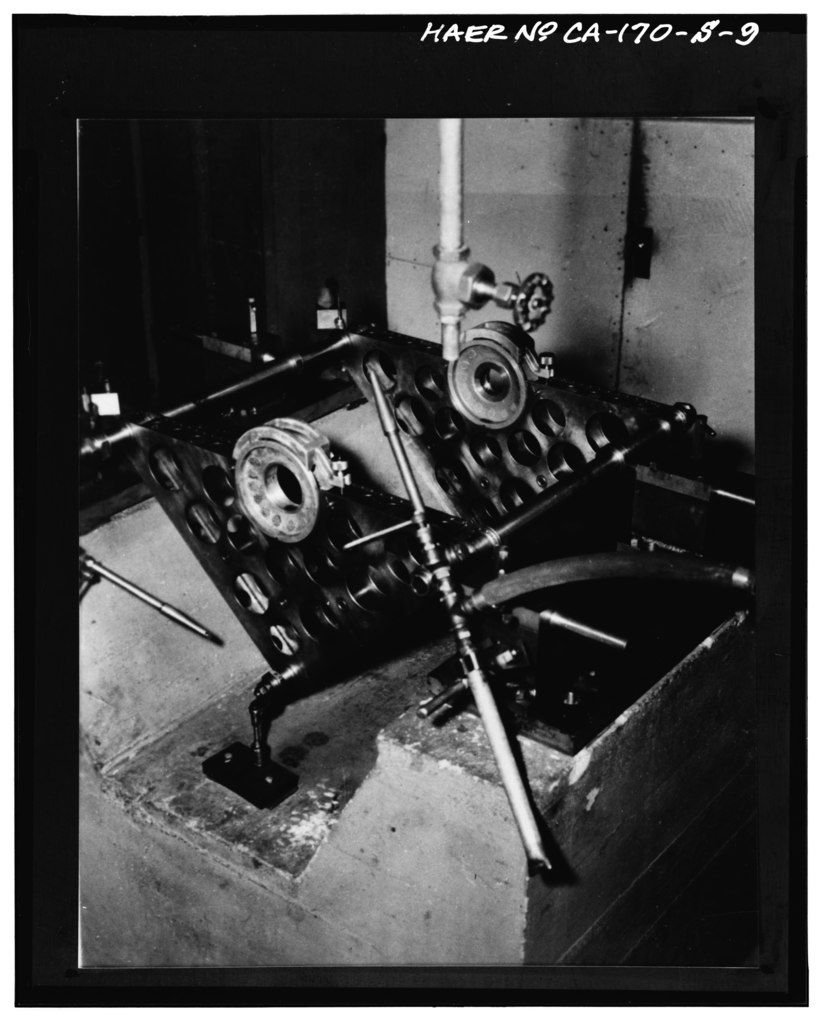
Credit USAF, ca. 1945. Original housed in the Muroc Flight Test Base, Unit History, 1 September 1942 - 30 June 1945. Alfred F. Simpson Historical Research Agency. United States Air Force. Maxwell AFB, Alabama. View of concrete base and brackets of jet engine rotor balancing machine. Location where photograph was taken not determined, but presumed to be in shops of Building 4505. - Edwards Air Force Base, North Base, Hangar, End of North Base Road, Boron, Kern County, CA |
|||
| Depicted place | California; Kern County; Boron | |||
| Date | Documentation compiled after 1968 | |||
| Dimensions | 4 x 5 in. | |||
| Current location |
Library of Congress Prints and Photographs Division Washington, D.C. 20540 USA http://hdl.loc.gov/loc.pnp/pp.print |
|||
| Accession number |
HAER CAL,15-BORON.V,2S-9 |
|||
| Credit line |
|
|||
| Notes |
|
|||
| Source | https://www.loc.gov/pictures/item/ca2952.photos.382380p | |||
| Permission (Reusing this file) |
|

| Object location | | View this and other nearby images on: OpenStreetMap |
|---|
File history
Click on a date/time to view the file as it appeared at that time.
| Date/Time | Thumbnail | Dimensions | User | Comment | |
|---|---|---|---|---|---|
| current | 00:44, 6 July 2014 |  | 4,445 × 5,560 (23.57 MB) | Fæ (talk | contribs) | GWToolset: Creating mediafile for Fæ. HABS 05 July 2014 (501:600) |
You cannot overwrite this file.
File usage on Commons
The following page uses this file: