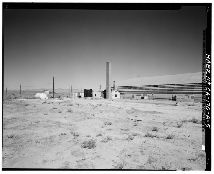
File:Credit PSR. View northwest at south facade of Unicon Portable Hangar. The Boiler House (Building 4306) appears at far corner of hangar. In left foreground are remains of HAER CAL,15-BORON.V,2A-5.tif
Jump to navigation
Jump to search

Size of this JPG preview of this TIF file: 740 × 600 pixels. Other resolutions: 296 × 240 pixels | 592 × 480 pixels | 947 × 768 pixels | 1,263 × 1,024 pixels | 2,526 × 2,048 pixels | 5,560 × 4,508 pixels.
Original file (5,560 × 4,508 pixels, file size: 23.91 MB, MIME type: image/tiff)
Captions
Captions
Add a one-line explanation of what this file represents
Summary
[edit]| Photographer |
Rittermann, Philipp S. Related names:
|
|||
| Title |
Credit PSR. View northwest at south facade of Unicon Portable Hangar. The Boiler House (Building 4306) appears at far corner of hangar. In left foreground are remains of concrete foundation of T57, and in the right foreground is the concrete foundation for the former Inflammable Materials Storage structure. The black tank in the distance stores diesel fuel, contents of white tank in left background are undetermined. - Edwards Air Force Base, North Base, Unicon Portable Hangar, First and C Streets, Boron, Kern County, CA |
|||
| Depicted place | California; Kern County; Boron | |||
| Date | 1995 | |||
| Dimensions | 4 x 5 in. | |||
| Current location |
Library of Congress Prints and Photographs Division Washington, D.C. 20540 USA http://hdl.loc.gov/loc.pnp/pp.print |
|||
| Accession number |
HAER CAL,15-BORON.V,2A-5 |
|||
| Credit line |
|
|||
| Notes |
|
|||
| Source | https://www.loc.gov/pictures/item/ca2934.photos.382323p | |||
| Permission (Reusing this file) |
|

| Object location | | View this and other nearby images on: OpenStreetMap |
|---|
File history
Click on a date/time to view the file as it appeared at that time.
| Date/Time | Thumbnail | Dimensions | User | Comment | |
|---|---|---|---|---|---|
| current | 00:14, 6 July 2014 |  | 5,560 × 4,508 (23.91 MB) | Fæ (talk | contribs) | GWToolset: Creating mediafile for Fæ. HABS 05 July 2014 (501:600) |
You cannot overwrite this file.
File usage on Commons
The following page uses this file: