File:Charles Mill Dam P6240076 Mifflin Lake.jpg
Jump to navigation
Jump to search

Size of this preview: 800 × 600 pixels. Other resolutions: 320 × 240 pixels | 640 × 480 pixels | 1,024 × 768 pixels | 1,280 × 960 pixels | 2,560 × 1,920 pixels | 3,072 × 2,304 pixels.
Original file (3,072 × 2,304 pixels, file size: 1.56 MB, MIME type: image/jpeg)
Captions
Captions
Add a one-line explanation of what this file represents
Summary
[edit]
| Description |
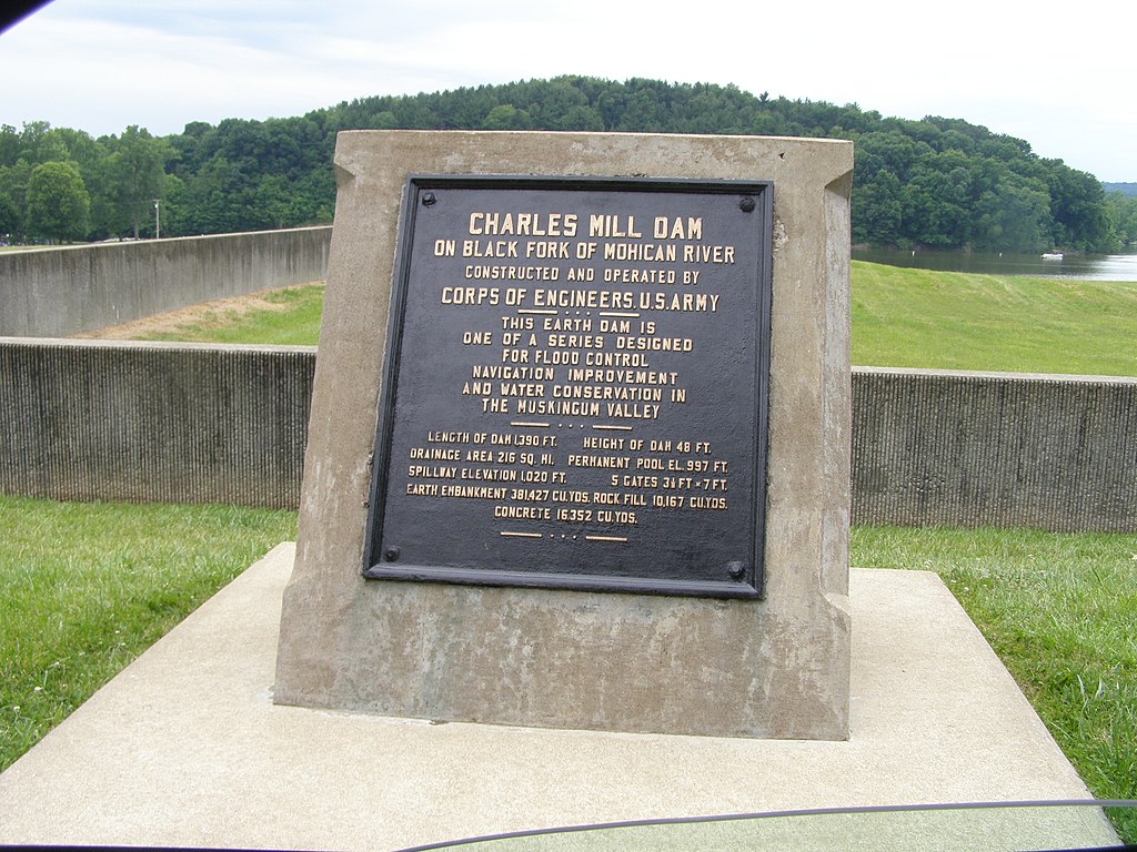
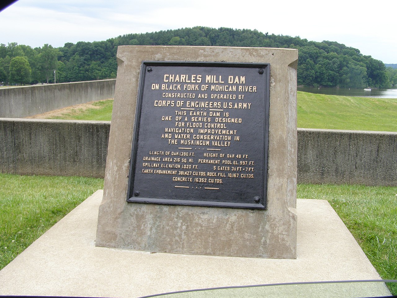
English: Charles Mill Dam is an Earth dam near Mansfield, Ohio. |
| Date | |
| Source | Own work |
| Author | Chris Light |
Charles Mill Dam on Black Fork of Mohican River, constructed and operated by Corps of Engineers U.S. Army
This Earth Dam is one of a series designed for Flood control, Navigation improvement, and Water Conservation in the Muskingum Valley.
- Length of Dam 1,390 Ft; Height of Dam 48 FT
- Drainage area 216 sq. Mi. Permanent Pool El. 997 Ft
- Spillway Elevation 1,020 Ft 5 Gates 3 1/2 Ft x 7 Ft
- Earth embankment 381,427 cu. yds, Rock Fill 10.167 cu yds, Concrete 16352 cu yds.
Licensing
[edit]
I, the copyright holder of this work, hereby publish it under the following license:
This file is licensed under the Creative Commons Attribution-Share Alike 4.0 International license.
- You are free:
- to share – to copy, distribute and transmit the work
- to remix – to adapt the work
- Under the following conditions:
- attribution – You must give appropriate credit, provide a link to the license, and indicate if changes were made. You may do so in any reasonable manner, but not in any way that suggests the licensor endorses you or your use.
- share alike – If you remix, transform, or build upon the material, you must distribute your contributions under the same or compatible license as the original.
File history
Click on a date/time to view the file as it appeared at that time.
| Date/Time | Thumbnail | Dimensions | User | Comment | |
|---|---|---|---|---|---|
| current | 20:17, 26 May 2018 | | 3,072 × 2,304 (1.56 MB) | Chris Light (talk | contribs) | User created page with UploadWizard |
You cannot overwrite this file.
File usage on Commons
There are no pages that use this file.