File:Central America - DPLA - c064c10c210db844c87cf29eece190f4.jpg
Jump to navigation
Jump to search

Size of this preview: 770 × 600 pixels. Other resolutions: 308 × 240 pixels | 617 × 480 pixels | 986 × 768 pixels | 1,280 × 997 pixels | 2,560 × 1,993 pixels | 3,280 × 2,554 pixels.
Original file (3,280 × 2,554 pixels, file size: 1.05 MB, MIME type: image/jpeg)
Captions
Captions
Add a one-line explanation of what this file represents
Summary
[edit]| Central America
( |
||||||||||||||
|---|---|---|---|---|---|---|---|---|---|---|---|---|---|---|
| Author |
Central Intelligence Agency |
|||||||||||||
| Creator | Central Intelligence Agency. 12/4/1981 | |||||||||||||
| Title |
Central America |
|||||||||||||
| Description |
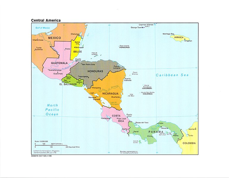
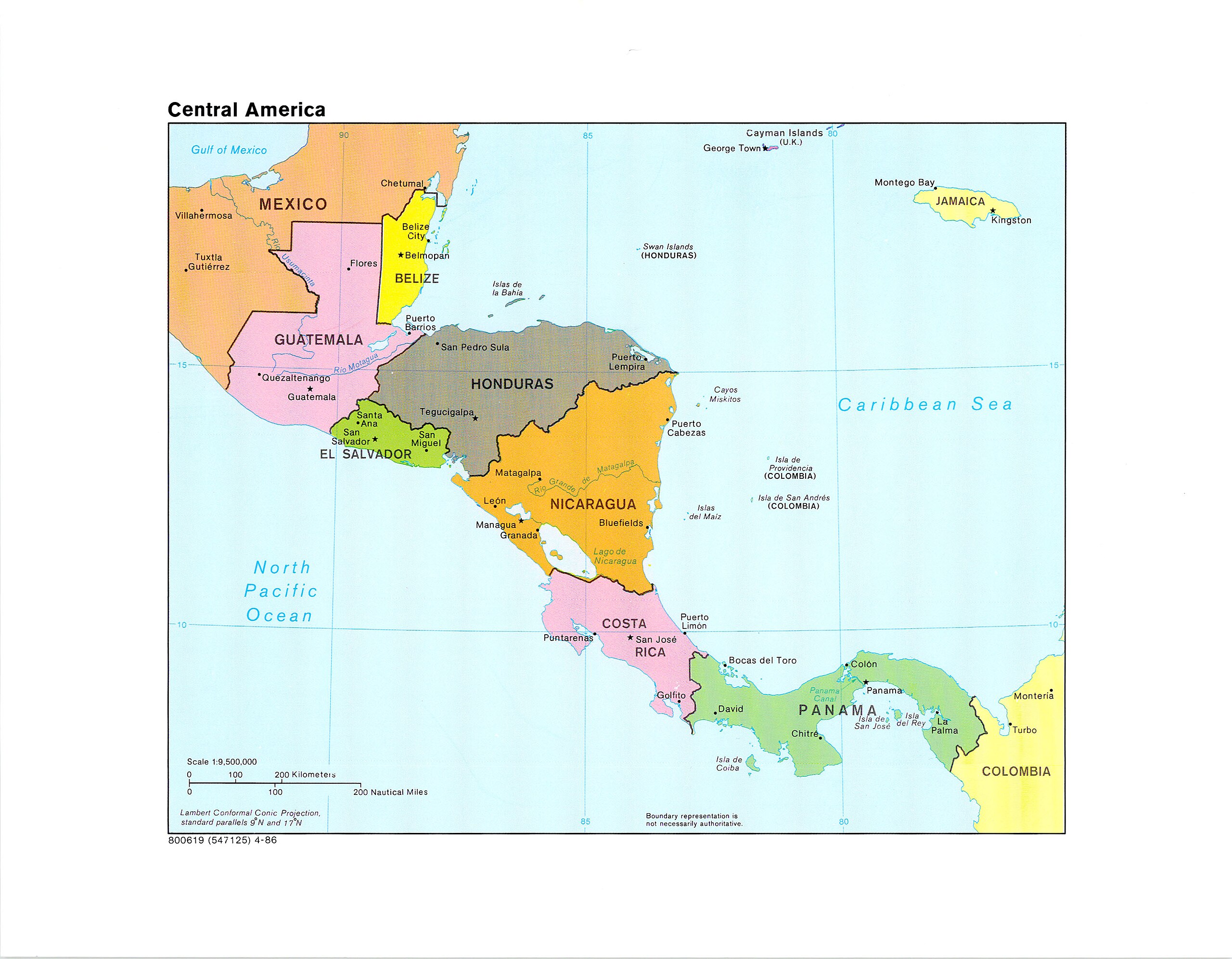
Lambert Conformal Conic Projection standard parallels 9N and 17N. Includes Mexico, Guatemala, Belize, El Salvador, Honduras (Islas de la Bahia and Swan Islands), Nicaragua (Isla del Maiz and Cayos Miskitos), Costa Rica, Panama (Isla de Coiba, Isla de San Jose, and Isla del Rey), Columbia (Isla de Providencia and Isla de San Andres), Jamaica, and Cayman Islands (United Kingdom). |
|||||||||||||
| Collection |
|
|||||||||||||
| Source/Photographer |
|
|||||||||||||
| Permission (Reusing this file) |
|
|||||||||||||
| Standardized rights statement |
|
|||||||||||||

File history
Click on a date/time to view the file as it appeared at that time.
| Date/Time | Thumbnail | Dimensions | User | Comment | |
|---|---|---|---|---|---|
| current | 07:04, 8 March 2023 | | 3,280 × 2,554 (1.05 MB) | DPLA bot (talk | contribs) | Uploading DPLA ID dpla:c064c10c210db844c87cf29eece190f4 |
You cannot overwrite this file.
File usage on Commons
The following page uses this file: