File:Carte réduite des isles de la Guadeloupe, Marie Galante, et les Saintes. LOC 75693283.tif
Jump to navigation
Jump to search

Size of this JPG preview of this TIF file: 800 × 551 pixels. Other resolutions: 320 × 220 pixels | 640 × 441 pixels | 1,024 × 706 pixels | 1,280 × 882 pixels | 2,560 × 1,764 pixels | 10,492 × 7,229 pixels.
Original file (10,492 × 7,229 pixels, file size: 217 MB, MIME type: image/tiff)
Captions
Captions
Add a one-line explanation of what this file represents
Summary
[edit]| Description |
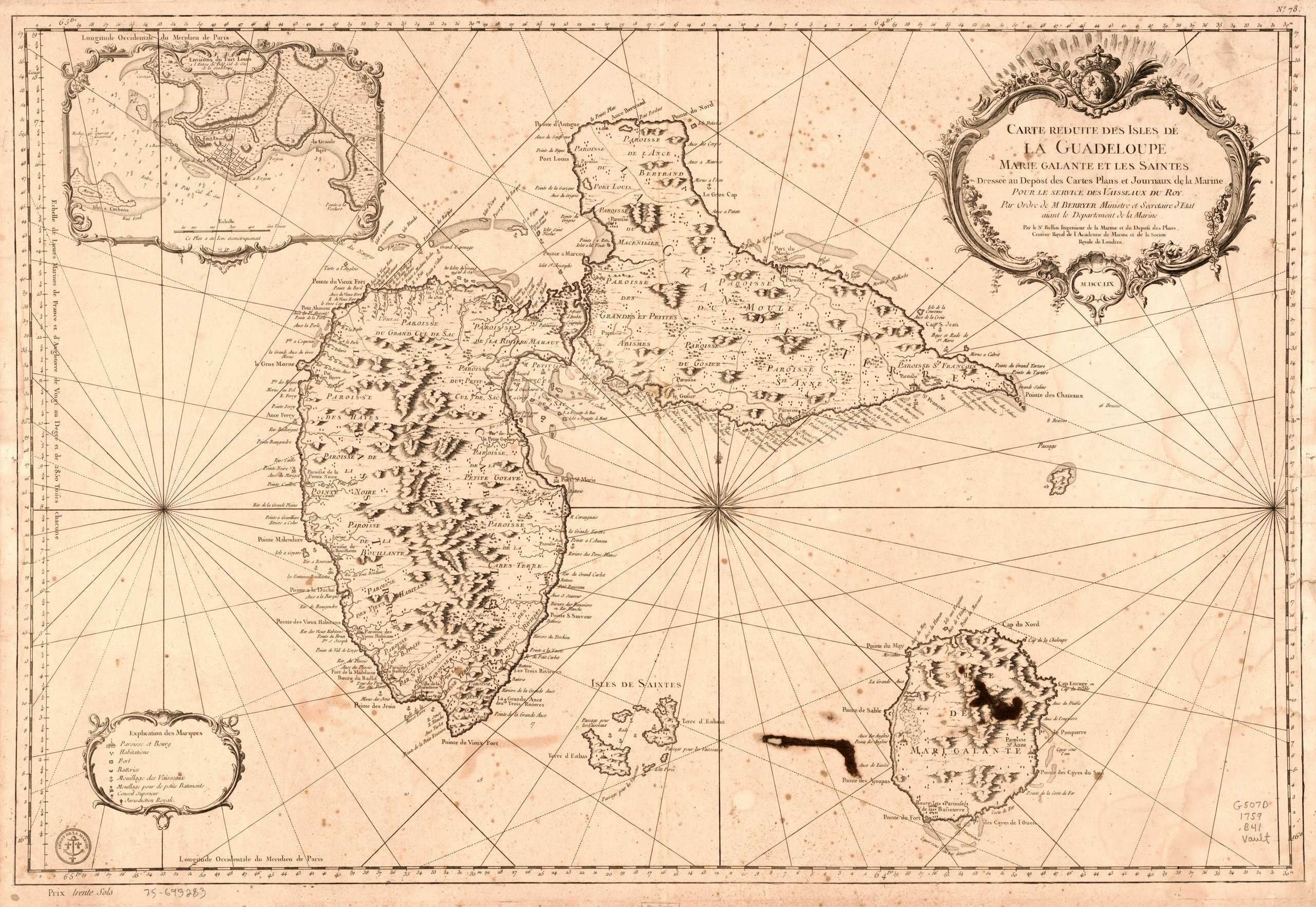
English: Scale ca. 1:100,000. Relief shown by hachures. Depths shown by soundings. "Longitude occidentale du méridien de Paris." "No. 78." Seal of "Dépôt de la marine" on lower left corner. From the author's Hydrographie françoise. 1737-1791. v. 2. Inset: Environs du Fort Louis à l'entree du petit cul de sac de la Guadeloupe. LC Maps of North America, 1750-1789, 2011 Available also through the Library of Congress Web site as a raster image. Vault AACR2 |
||
| Title | Carte réduite des isles de la Guadeloupe, Marie Galante, et les Saintes. | ||
| Shelf ID | G5070 1759 .B41 | ||
| Date | |||
| Source | https://www.loc.gov/item/75693283/ | ||
| Author | Bellin, Jacques Nicolas; France. Dépôt Des Cartes Et Plans De La Marine | ||
| Permission (Reusing this file) |
|
||
| Other versions |
|
||
| Location | Guadeloupe · Marie-Galante · Guadeloupe. · Galante · Marie-Galante. · Marie | ||
| Part of | Military Battles And Campaigns · American Memory · Catalog · Geography And Map Division · American Revolution And Its Era: Maps And Charts Of North America And The West Indies, 1750-1789 | ||
| Subject | Maps · Early Works To 1800 · Guadeloupe · Marie-Galante · Marie-Galante (Guadeloupe) |


Licensing
[edit]| This work is from the Library of Congress. According to the library, there are no known copyright restrictions on the use of this work. |  |
File history
Click on a date/time to view the file as it appeared at that time.
| Date/Time | Thumbnail | Dimensions | User | Comment | |
|---|---|---|---|---|---|
| current | 10:36, 9 February 2019 |  | 10,492 × 7,229 (217 MB) | Fæ (talk | contribs) | LOC Maps https://www.loc.gov/item/75693283/ #9358 |
You cannot overwrite this file.
File usage on Commons
The following page uses this file: