File:Carte generale des chemins de fer de l'Europe Centrale 1853.pdf
Jump to navigation
Jump to search

Size of this JPG preview of this PDF file: 478 × 599 pixels. Other resolutions: 191 × 240 pixels | 383 × 480 pixels | 613 × 768 pixels | 817 × 1,024 pixels | 1,635 × 2,048 pixels | 9,895 × 12,395 pixels.

Original file (9,895 × 12,395 pixels, file size: 2.68 MB, MIME type: application/pdf, 2 pages)
Captions
Captions
Add a one-line explanation of what this file represents
Summary
[edit]| Description |
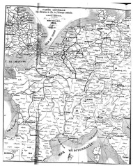
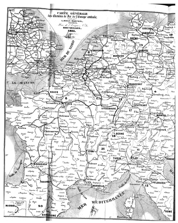
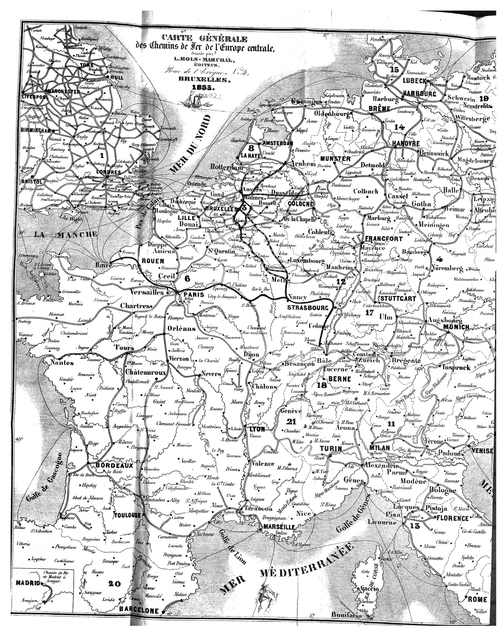
Français : Carte des chemins de fer de l'Europe centrale, vers 1853.
Numéro 4008 Titre Carte générale des chemins de fer de l'Europe centrale
Editeur Mols-Marchal
Lieu d'édition Bruxelles
Année d'édition 1853
Mot(s) Clé(s) Flandre Orientale Localités Diverse
Cote II 87.973 A 1 / 28 |
| Date | |
| Source | Belgica, Bibliotheque royale de Belgique, http://opteron1.kbr.be/cgi-bin/cgilot.cgi?P0=QFICLOT&NR=1484 |
| Author | Mols-Marchal |
Licensing
[edit]|
This work is in the public domain in its country of origin and other countries and areas where the copyright term is the author's life plus 70 years or fewer. This work is in the public domain in the United States because it was published (or registered with the U.S. Copyright Office) before January 1, 1929. | |
| This file has been identified as being free of known restrictions under copyright law, including all related and neighboring rights. | |
File history
Click on a date/time to view the file as it appeared at that time.
| Date/Time | Thumbnail | Dimensions | User | Comment | |
|---|---|---|---|---|---|
| current | 04:32, 20 March 2015 |  | 9,895 × 12,395, 2 pages (2.68 MB) | Oaktree b (talk | contribs) | User created page with UploadWizard |
You cannot overwrite this file.
File usage on Commons
There are no pages that use this file.