File:Carte de la Louisiane et du cours du Mississipi, avec les colonies anglaises.jpg
Jump to navigation
Jump to search

Size of this preview: 797 × 600 pixels. Other resolutions: 319 × 240 pixels | 638 × 480 pixels | 1,021 × 768 pixels | 1,280 × 963 pixels | 2,560 × 1,926 pixels | 3,771 × 2,837 pixels.
Original file (3,771 × 2,837 pixels, file size: 2.21 MB, MIME type: image/jpeg)
Captions
Captions
Add a one-line explanation of what this file represents
Summary
[edit]
| Description |
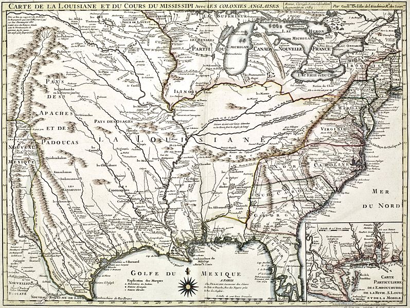
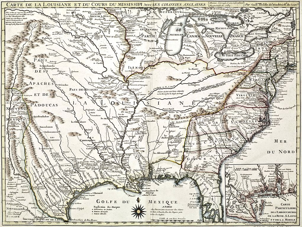
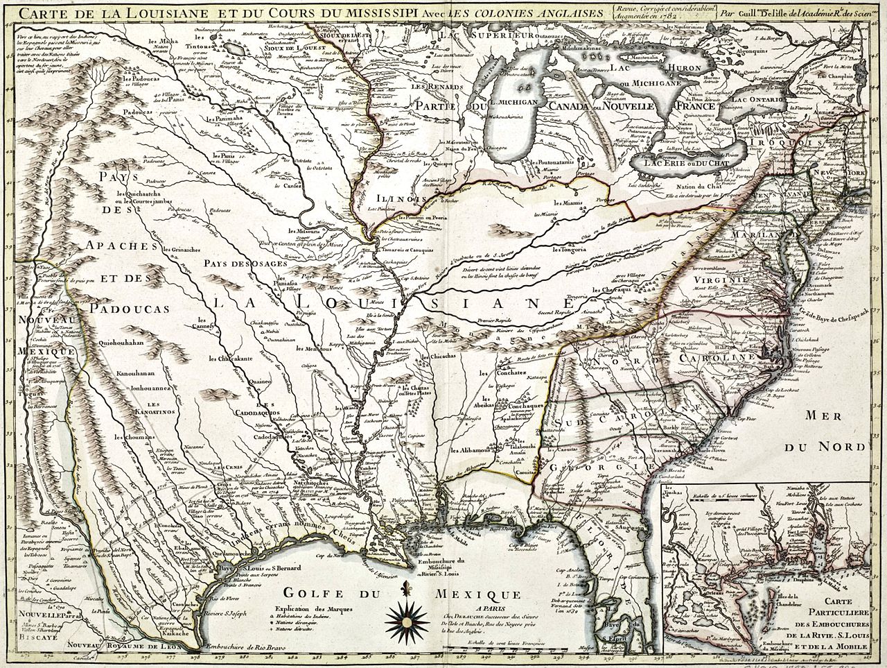
Français : Carte de la Louisiane et du cours du Mississipi avec les colonies anglaises revue, corrigée et considérablement augmentée en 1782 |
| Date | |
| Source | http://services.banq.qc.ca/sdx/cep/document.xsp?id=0003805781 |
| Author | Philippe Buache (1700-1773) - Guillaume Delisle ou de L'Isle (1675-1726) |
Voir: Une superbe carte de la Louisiane
Licensing
[edit]
|
This work is in the public domain in its country of origin and other countries and areas where the copyright term is the author's life plus 70 years or fewer. This work is in the public domain in the United States because it was published (or registered with the U.S. Copyright Office) before January 1, 1929. | |
| This file has been identified as being free of known restrictions under copyright law, including all related and neighboring rights. | |
File history
Click on a date/time to view the file as it appeared at that time.
| Date/Time | Thumbnail | Dimensions | User | Comment | |
|---|---|---|---|---|---|
| current | 22:41, 20 February 2015 | | 3,771 × 2,837 (2.21 MB) | Jeangagnon (talk | contribs) | User created page with UploadWizard |
You cannot overwrite this file.
File usage on Commons
There are no pages that use this file.
File usage on other wikis
The following other wikis use this file:
- Usage on el.wikipedia.org
- Usage on fr.wikipedia.org