File:Carte de France 1789.jpg

Original file (1,789 × 1,240 pixels, file size: 275 KB, MIME type: image/jpeg)
Captions
Captions
Summary
[edit]
| Description |
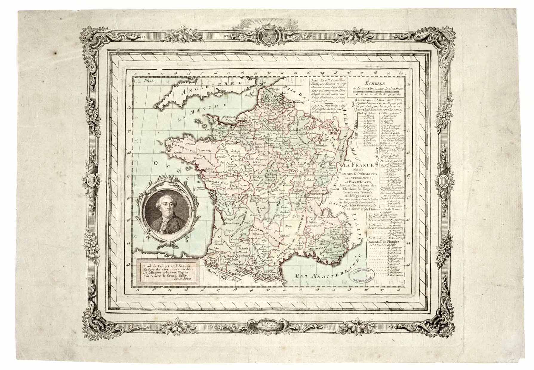
Français : Carte intitulée "La France divisée en ses généralités ou intendances et pays d'Etats avec les chefs-lieux des élections, bailliages, territoires, prévôtés, subdélégations etc. Pour être insérée dans la lettre du roi pour la convocation des Etats généraux, du 24 janvier 1789."
Gravure rehaussée de couleurs. Hors carte, à droite, liste des villes administratives des zones frontières du Nord et de l'Est, et à gauche, portrait anonyme du ministre Necker en médaillon, souligné de quatre vers de P.-L. Moline. "A Paris, chez Desnos, ingénieur géographe du roi, rue Saint-Jacques, au Globe." |
| Date | |
| Source | http://www.culture.gouv.fr:80/Wave/image/archim/0003/dafanch01_pc45002373_2.jpg |
| Author | Yann |
| Other versions | Derivative works of this file: Carte de France 1789 Bretagne.jpg |
Licensing
[edit]
|
This work is in the public domain in its country of origin and other countries and areas where the copyright term is the author's life plus 70 years or fewer.
| |
| This file has been identified as being free of known restrictions under copyright law, including all related and neighboring rights. | |
File history
Click on a date/time to view the file as it appeared at that time.
| Date/Time | Thumbnail | Dimensions | User | Comment | |
|---|---|---|---|---|---|
| current | 22:21, 27 June 2005 | | 1,789 × 1,240 (275 KB) | Yann (talk | contribs) | Carte intitulée "La France divisée en ses généralités ou intendances et pays d'Etats avec les chefs-lieux des élections, bailliages, territoires, prévôtés, subdélégations etc. Pour être insérée dans la lettre du roi pour la convocation des E |
You cannot overwrite this file.
File usage on Commons
The following page uses this file:
File usage on other wikis
The following other wikis use this file:
- Usage on fr.wikipedia.org
- Usage on nrm.wikipedia.org