File:Carte Etat-majorr Montpont-en-Bresse.svg
Jump to navigation
Jump to search

Size of this PNG preview of this SVG file: 730 × 599 pixels. Other resolutions: 292 × 240 pixels | 585 × 480 pixels | 935 × 768 pixels | 1,247 × 1,024 pixels | 2,494 × 2,048 pixels | 1,174 × 964 pixels.
Original file (SVG file, nominally 1,174 × 964 pixels, file size: 3.79 MB)
Captions
Captions
Add a one-line explanation of what this file represents
Summary
[edit]
| Description |
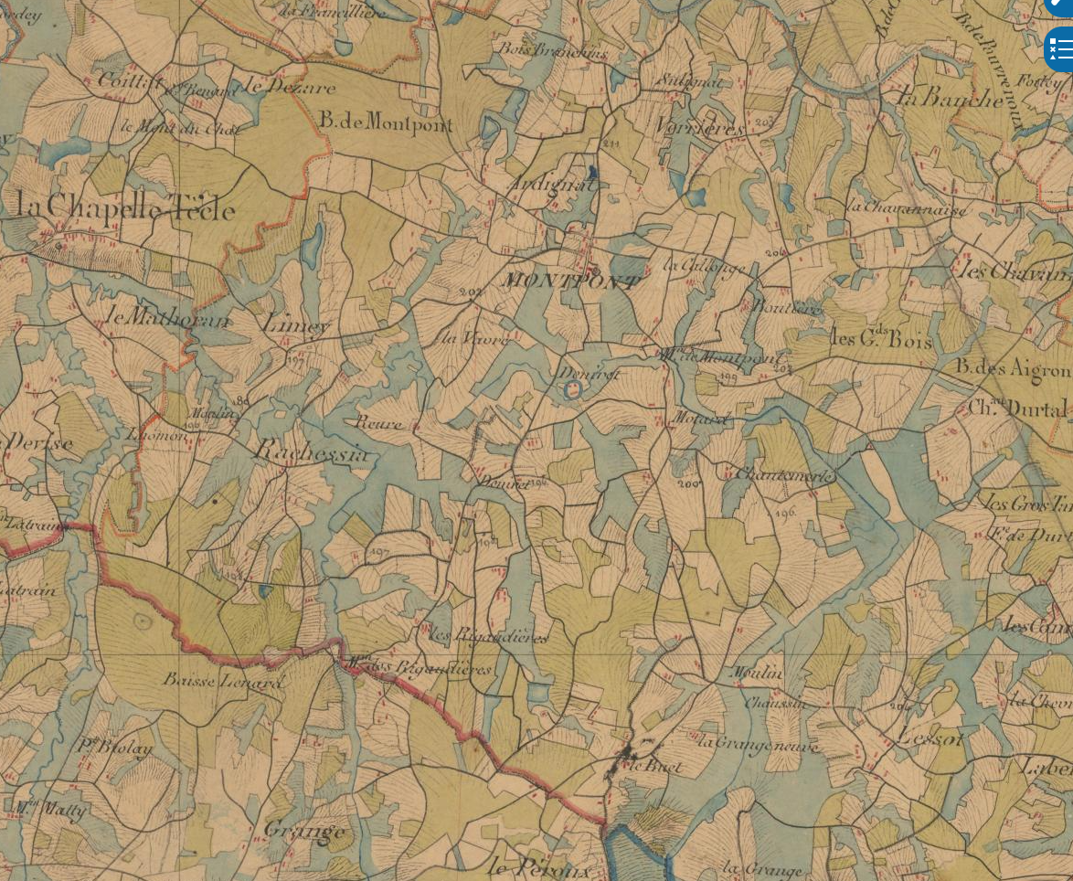
Deutsch: Die Karte zeigt die grosse Anzahl an Étangs, die zu Beginn des 19. Jahrhunderts existierten
Français : La carte montre le grand nombre d'étangs qui existaient au début du IXX siècle |
| Date | |
| Source |
Geoportail, IGN. https://www.geoportail.gouv.fr/donnees/carte-de-letat-major-1820-1866 Carte de l'Etat-Major 1820-1866 |
| Author |
Geoportail, ign. https://www.geoportail.gouv.fr/donnees/carte-de-letat-major-1820-1866 Carte de l'Etat-Major 1820-1866 |
Licensing
[edit]
|
This work is in the public domain in its country of origin and other countries and areas where the copyright term is the author's life plus 70 years or fewer. This work is in the public domain in the United States because it was published (or registered with the U.S. Copyright Office) before January 1, 1929. | |
| This file has been identified as being free of known restrictions under copyright law, including all related and neighboring rights. | |
File history
Click on a date/time to view the file as it appeared at that time.
| Date/Time | Thumbnail | Dimensions | User | Comment | |
|---|---|---|---|---|---|
| current | 19:10, 13 February 2024 | | 1,174 × 964 (3.79 MB) | H.p.frei (talk | contribs) | Uploaded own work with UploadWizard |
You cannot overwrite this file.
File usage on Commons
There are no pages that use this file.
File usage on other wikis
The following other wikis use this file:
- Usage on de.wikipedia.org