File:Captain Cushing House.tif
Jump to navigation
Jump to search

Size of this JPG preview of this TIF file: 800 × 580 pixels. Other resolutions: 320 × 232 pixels | 640 × 464 pixels | 1,024 × 742 pixels | 1,280 × 928 pixels | 2,560 × 1,856 pixels | 5,000 × 3,625 pixels.
Original file (5,000 × 3,625 pixels, file size: 17.29 MB, MIME type: image/tiff)
Captions
Captions
Add a one-line explanation of what this file represents
Summary
[edit]| English: Captain Cushing House
( |
||||||||||||||||||||||||
|---|---|---|---|---|---|---|---|---|---|---|---|---|---|---|---|---|---|---|---|---|---|---|---|---|
| Author |
|
|||||||||||||||||||||||
| Title |
English: Captain Cushing House |
|||||||||||||||||||||||
| Description |
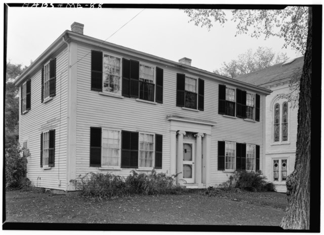
English: Front of the Captain Cushing House, located at 31 Chestnut Street in Camden, a town in Knox County, Maine, United States. Built in 1799, it is part of the Chestnut Street Historic District, a historic district that is listed on the National Register of Historic Places. |
|||||||||||||||||||||||
| Date | July 1960 | |||||||||||||||||||||||
| Collection |
|
|||||||||||||||||||||||
| Notes |
Survey number: HABS ME-88 Building/structure dates: 1799 Initial Construction Building/structure dates: ca. 1845 Subsequent Work |
|||||||||||||||||||||||
| Source |
|
|||||||||||||||||||||||
| Permission (Reusing this file) |
HABS | |||||||||||||||||||||||
| Other versions |
|
|||||||||||||||||||||||


| Camera location | | View this and other nearby images on: OpenStreetMap |
|---|
Licensing
[edit]
|
This file comes from the Historic American Buildings Survey (HABS), Historic American Engineering Record (HAER) or Historic American Landscapes Survey (HALS). These are programs of the National Park Service established for the purpose of documenting historic places. Records consist of measured drawings, archival photographs, and written reports.
|
| This image or media file contains material based on a work of a National Park Service employee, created as part of that person's official duties. As a work of the U.S. federal government, such work is in the public domain in the United States. See the NPS website and NPS copyright policy for more information. |
File history
Click on a date/time to view the file as it appeared at that time.
| Date/Time | Thumbnail | Dimensions | User | Comment | |
|---|---|---|---|---|---|
| current | 21:46, 22 February 2013 |  | 5,000 × 3,625 (17.29 MB) | Slowking4 (talk | contribs) | User created page with UploadWizard |
You cannot overwrite this file.
File usage on Commons
The following page uses this file: