File:Canonbie former station geograph-3099710-by-Ben-Brooksbank.jpg
Jump to navigation
Jump to search
Size of this preview: 800 × 488 pixels. Other resolutions: 320 × 195 pixels | 640 × 391 pixels | 1,024 × 625 pixels | 1,280 × 782 pixels | 2,252 × 1,375 pixels.
Original file (2,252 × 1,375 pixels, file size: 2.84 MB, MIME type: image/jpeg)
Captions
Captions
Add a one-line explanation of what this file represents
Summary
[edit]
| Description |
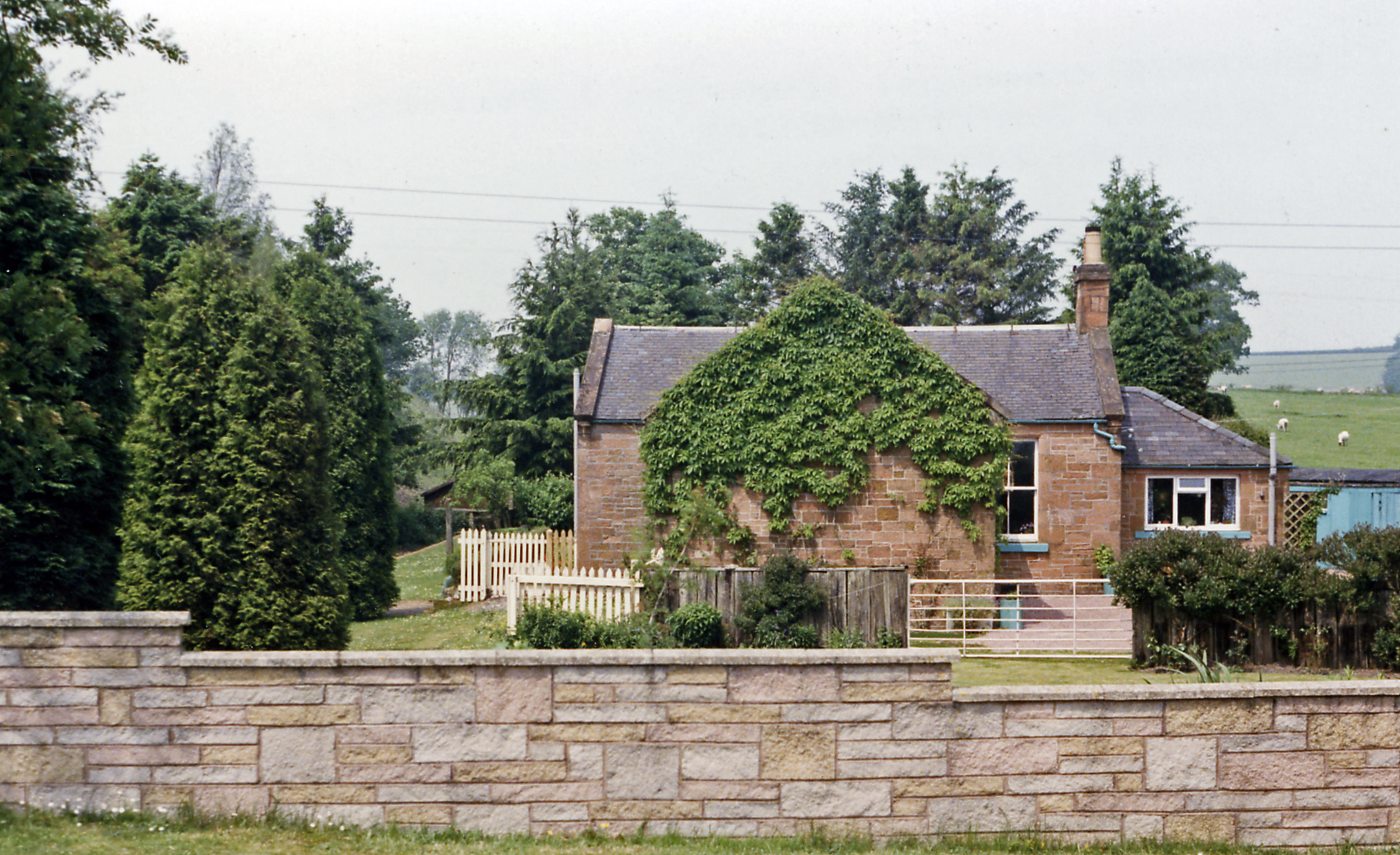
English: Former station at Canonbie, 1986. View eastward, Langholm left, Riddings right: ex-NBR Riddings - Langholm branch off the Carlisle - Edinburgh Waverley Route. The branch and station had been closed 15/6/64 and about 20 years later the station had been converted into a charming house and garden - see NY4077 : Former station at Canonbie, 1986. |
| Date | |
| Source | From geograph.org.uk |
| Author | Ben Brooksbank |
| Permission (Reusing this file) |
Creative Commons Attribution Share-alike license 2.0 |
| Attribution (required by the license) | Ben Brooksbank / Former station at Canonbie, 1986 / |
| Camera location | | View this and other nearby images on: OpenStreetMap |
|---|
Taken on 27 June 1986
Licensing
[edit]

|
This image was taken from the Geograph project collection. See this photograph's page on the Geograph website for the photographer's contact details. The copyright on this image is owned by Ben Brooksbank and is licensed for reuse under the Creative Commons Attribution-ShareAlike 2.0 license.
|
This file is licensed under the Creative Commons Attribution-Share Alike 2.0 Generic license.
Attribution: Ben Brooksbank
- You are free:
- to share – to copy, distribute and transmit the work
- to remix – to adapt the work
- Under the following conditions:
- attribution – You must give appropriate credit, provide a link to the license, and indicate if changes were made. You may do so in any reasonable manner, but not in any way that suggests the licensor endorses you or your use.
- share alike – If you remix, transform, or build upon the material, you must distribute your contributions under the same or compatible license as the original.
File history
Click on a date/time to view the file as it appeared at that time.
| Date/Time | Thumbnail | Dimensions | User | Comment | |
|---|---|---|---|---|---|
| current | 17:47, 1 September 2012 | | 2,252 × 1,375 (2.84 MB) | Chevin (talk | contribs) | == {{int:filedesc}} == {{Information |Description={{en|1='''Former station at Canonbie, 1986.'''<br/> View eastward, Langholm left, Riddings right: ex-NBR Riddings - Langholm branch off the Carlisle - Edinburgh Waverley Route. The branch and station ha... |
You cannot overwrite this file.
File usage on Commons
The following page uses this file: