File:Ca. 1713 Plan of the Bendery Fortress on the Dniester River, between Moldavia and Western Nogai and Bessarabia.jpg
Jump to navigation
Jump to search

Size of this preview: 800 × 504 pixels. Other resolutions: 320 × 202 pixels | 640 × 403 pixels | 1,024 × 645 pixels | 1,280 × 806 pixels | 2,560 × 1,613 pixels | 7,785 × 4,904 pixels.
Original file (7,785 × 4,904 pixels, file size: 7.85 MB, MIME type: image/jpeg)
Captions
Captions
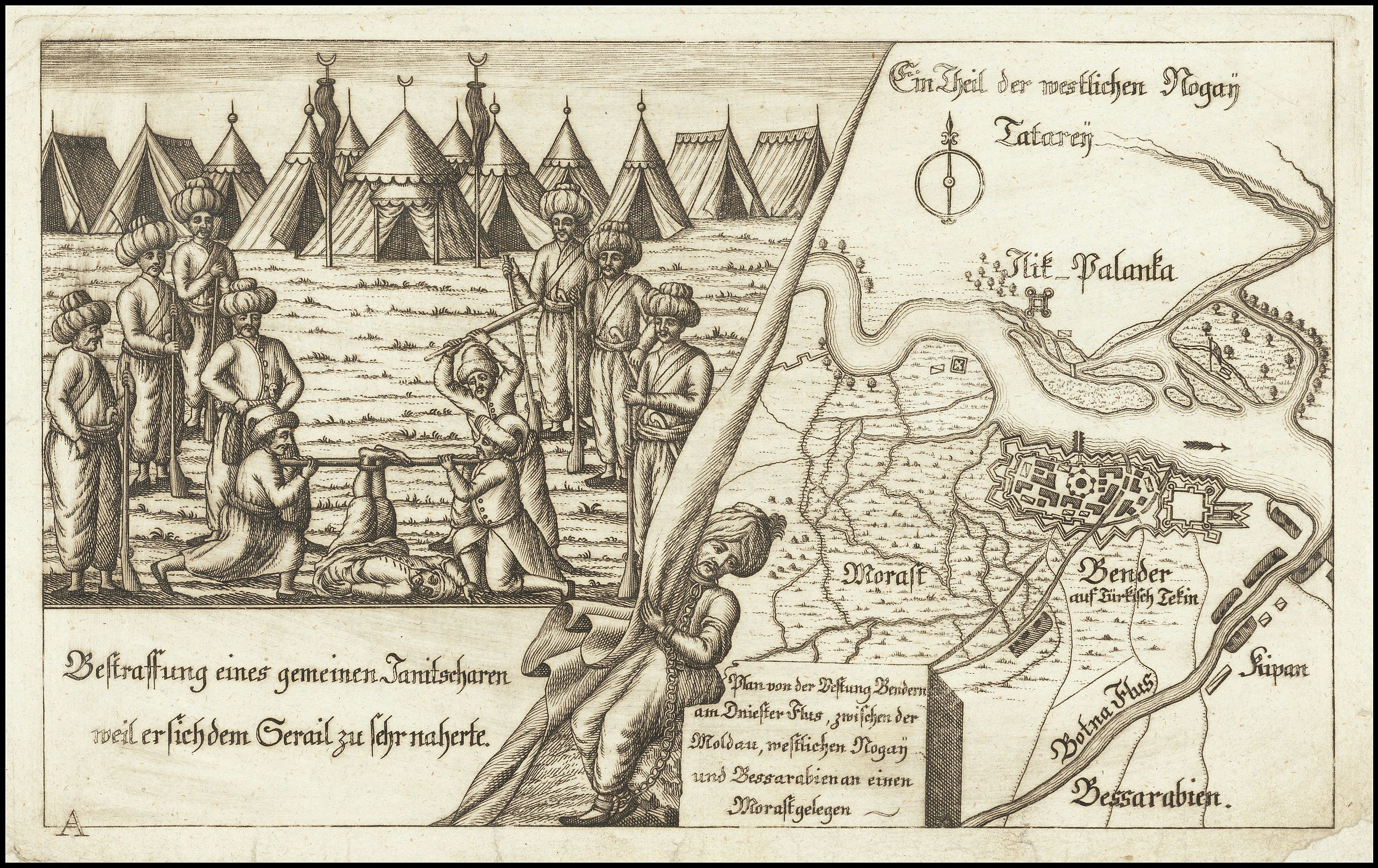
ca. 1713 Plan of the Bendery Fortress on the Dniester River, between Moldavia and Western Nogai and Bessarabia
Summary
[edit]
| Description |
Deutsch: Plan von der Festung Bendern am Dniester Flus, zwischen der Moldau, westlichen Nogai und Bessarabien an einen Morast gelegen
English: ca. 1713 Plan of the Bendery Fortress on the Dniester River, between Moldavia and Western Nogai and Bessarabia |
| Date | circa 1713 |
| Source | https://www.raremaps.com/gallery/detail/61819/tighina-bender-moldavia-dniester-river-plan-von-der-anonymous |
| Author | Anonymous |
Licensing
[edit]
|
This work is in the public domain in its country of origin and other countries and areas where the copyright term is the author's life plus 70 years or fewer. This work is in the public domain in the United States because it was published (or registered with the U.S. Copyright Office) before January 1, 1929. | |
| This file has been identified as being free of known restrictions under copyright law, including all related and neighboring rights. | |
File history
Click on a date/time to view the file as it appeared at that time.
| Date/Time | Thumbnail | Dimensions | User | Comment | |
|---|---|---|---|---|---|
| current | 18:48, 21 March 2020 | | 7,785 × 4,904 (7.85 MB) | Balkanique (talk | contribs) | Uploaded a work by Anonymous from https://www.raremaps.com/gallery/detail/61819/tighina-bender-moldavia-dniester-river-plan-von-der-anonymous with UploadWizard |
You cannot overwrite this file.
File usage on Commons
There are no pages that use this file.