Category:Old maps of Bessarabia
Jump to navigation
Jump to search
Media in category "Old maps of Bessarabia"
The following 38 files are in this category, out of 38 total.
-

-
-

-

-
 Basarabia, Harta etnografică întocmită de Alexis Nour.jpg 2,497 × 2,989; 1.55 MB
-
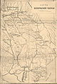
 Bessarab gub Orhei.png 1,185 × 1,356; 25 KB
-
 Bessarabia 1896.jpg 566 × 674; 402 KB
-
 Bessarabia bw map.png 1,978 × 2,483; 912 KB
-
 Bessarabia ethnographical map (in Romanian) 1919.jpg 6,166 × 7,336; 9.48 MB
-
 Bessarabia ethnographical map 1919.jpg 784 × 950; 148 KB
-
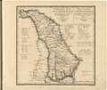
 Bessarabia governorate 1821.jpg 4,876 × 4,722; 4.6 MB
-
 Bessarabia map BE.JPG 2,552 × 3,472; 1.79 MB
-
 Bessarabia.jpg 469 × 509; 52 KB
-
 Bessarabia.png 544 × 607; 49 KB
-
 Bessarabien und Moldawien.jpg 2,894 × 2,902; 2.48 MB
-
 Brockhaus and Efron Encyclopedic Dictionary b6 602-0.jpg 2,552 × 3,472; 2.88 MB
-
 Brockhaus and Efron Jewish Encyclopedia e4 371-0.jpg 1,143 × 1,705; 487 KB
-
 Cahul Ismail si Bolgrad.PNG 2,259 × 2,886; 3.07 MB
-
 Carte des nouvelles limites de la Russie (33745437194).jpg 2,699 × 4,282; 6.51 MB
-
 Flămânda (Oxanovka).png 710 × 474; 505 KB
-
 FMIB 43858 Salt Marshes of Bessarabia.jpeg 848 × 705; 173 KB
-

-

-
-
 Județul Cahul (interbelic).jpg 2,994 × 4,028; 2.94 MB
-
 Județul Ismail (interbelic).jpg 1,024 × 700; 528 KB
-
 KartaZemelNovorossiyskogoKW 1858.jpg 6,748 × 4,536; 7.48 MB
-
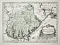
 Karte-von-der-walachei-moldau-und-bessarabien.jpg 4,772 × 3,776; 2.43 MB
-
 Lev S. Berg - Ethnographic map of Bessarabia.jpg 4,556 × 6,816; 12.53 MB
-
 Map of Bessarabia in 1791 by Reilly 011.jpg 1,184 × 899; 472 KB
-
 Map of RDM-1917.jpg 9,342 × 11,115; 5.92 MB
-
 Moldawien BV043420615.jpg 1,493 × 2,424; 270 KB
-
 Russia in Europe, Edward Stanford, 1864.jpg 1,088 × 1,558; 496 KB
-
 Russian Bessarabia, 1883.jpg 2,262 × 3,497; 1.43 MB
-
 Southern Bessarabia.tif 2,791 × 4,133; 44.03 MB
-
 Vsya Rossiya 1902 page 46 Bessarabskaya Guberniya.jpg 1,365 × 2,012; 345 KB
-
 Бессарабия 1856.jpg 986 × 1,276; 621 KB
-
 Карта Бессарабской области 1843.GIF 3,398 × 2,463; 3.1 MB

_With_numerous_maps_and_notes%27_(11110682553).jpg)
_With_numerous_maps_and_notes%27_(11110861536).jpg)
_With_numerous_maps_and_notes%27_(11108372034).jpg)


_1919.jpg)


.jpg)
.png)


.jpg)
.jpg)


