File:C. nipisiquit - Chaleur Bay numbers small.png
Jump to navigation
Jump to search

Size of this preview: 761 × 599 pixels. Other resolutions: 305 × 240 pixels | 610 × 480 pixels | 975 × 768 pixels | 1,078 × 849 pixels.
Original file (1,078 × 849 pixels, file size: 225 KB, MIME type: image/png)
Captions
Captions
Add a one-line explanation of what this file represents
Summary
[edit]
| Description |
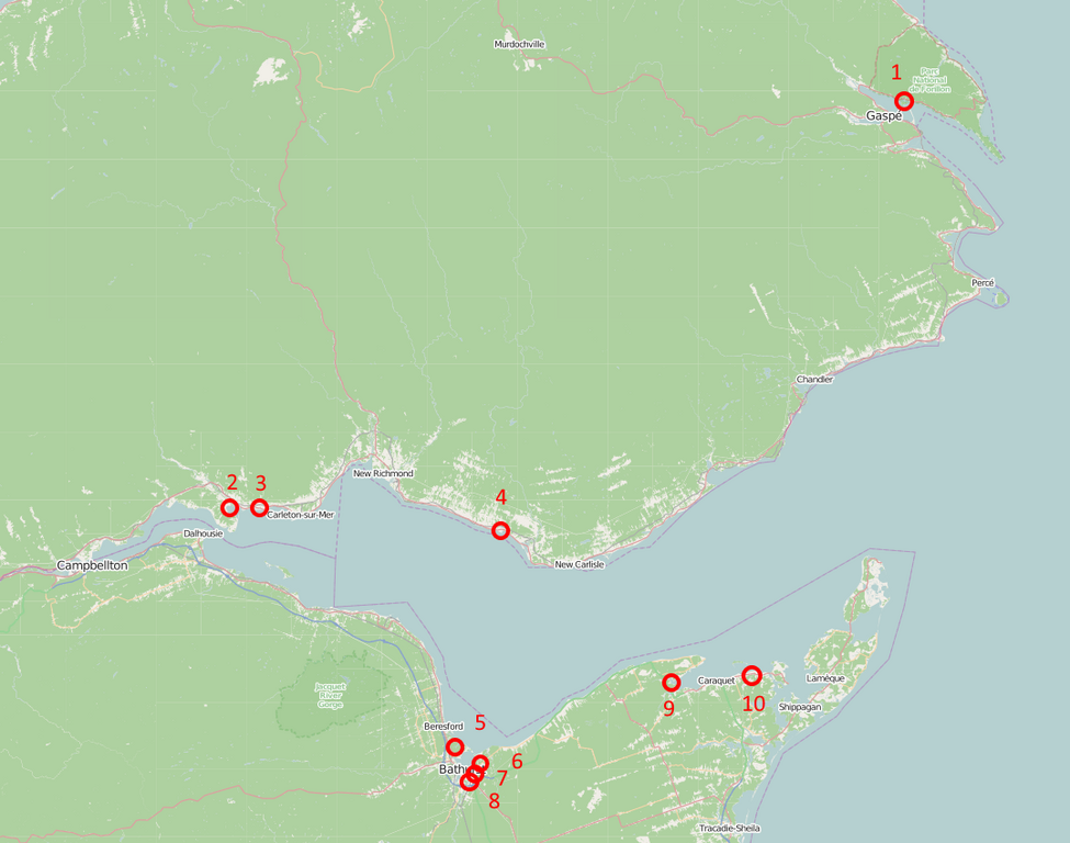
English: Distribution of the Maritime Ringlet (Coenonympha nipisiquit)
Deutsch: Vorkommen von Coenonympha nipisiquit
Locations from: Environment Canada. 2012. Recovery Strategy for the Maritime Ringlet (Coenonympha nipisiquit) in Canada. Species at Risk Act Recovery Strategy Series. Environment Canada, Ottawa. page 3 |
| Source | Own work |
| Author | Harald Süpfle |
Licensing
[edit]
This file is licensed under the Creative Commons Attribution-Share Alike 3.0 Unported license.
Attribution: Harald Süpfle
- You are free:
- to share – to copy, distribute and transmit the work
- to remix – to adapt the work
- Under the following conditions:
- attribution – You must give appropriate credit, provide a link to the license, and indicate if changes were made. You may do so in any reasonable manner, but not in any way that suggests the licensor endorses you or your use.
- share alike – If you remix, transform, or build upon the material, you must distribute your contributions under the same or compatible license as the original.
File history
Click on a date/time to view the file as it appeared at that time.
| Date/Time | Thumbnail | Dimensions | User | Comment | |
|---|---|---|---|---|---|
| current | 15:01, 5 July 2014 | | 1,078 × 849 (225 KB) | Hsuepfle (talk | contribs) | VicuñaUploader 1.20 |
You cannot overwrite this file.
File usage on Commons
The following 2 pages use this file: