Category:Lepidoptera distribution maps of North America
Jump to navigation
Jump to search
Subcategories
This category has only the following subcategory.
Media in category "Lepidoptera distribution maps of North America"
The following 70 files are in this category, out of 70 total.
-
 A. lyciades map.jpg 1,655 × 983; 76 KB
-
 Ancyloxypha numitor range map.PNG 524 × 605; 40 KB
-
 Annotated checklist of the butterflies of Illinois (1973) (17802166683).jpg 2,164 × 1,284; 472 KB
-
 Annotated checklist of the butterflies of Illinois (1973) (18418661232).jpg 2,162 × 1,278; 480 KB
-
 Annual report of the Fruit Growers' Association of Ontario, 1896 (1897) (14774278864).jpg 3,392 × 2,140; 1.31 MB
-
 Anthocharis midea range map.JPG 524 × 605; 24 KB
-
 Antispila oinophylla - ZooKeys-170-029-g007.jpg 1,512 × 1,198; 340 KB
-
 Asterocampa celtis range map.PNG 524 × 605; 40 KB
-
 Asterocampa clyton range map.PNG 524 × 605; 41 KB
-
 Battus philenor range map.JPG 524 × 605; 29 KB
-
 Boloria bellona range map.JPG 516 × 570; 25 KB
-
 Bulletin (1910) (19804130004).jpg 2,864 × 3,092; 2.91 MB
-
 Bulletin of the U.S. Department of Agriculture (1098) (20313037130).jpg 3,088 × 3,276; 2.18 MB
-
 C. interior map.jpeg 1,273 × 779; 74 KB
-
 C. nipisiquit - Chaleur Bay Label.png 1,078 × 849; 246 KB
-
 C. nipisiquit - Chaleur Bay numbers small.png 1,078 × 849; 225 KB
-
 C. nipisiquit - Chaleur Bay numbers.png 1,078 × 849; 226 KB
-
 Calephelis mutica range map.PNG 524 × 605; 41 KB
-
 Callophrys henrici range map.PNG 524 × 605; 41 KB
-
 Carte Coenonympha nipisiquit.svg 792 × 612; 84 KB
-
 Cercyonis pegala range map.JPG 493 × 571; 27 KB
-
 Coenonympha tullia - North America.png 480 × 512; 47 KB
-
 Colias philodice range map.JPG 524 × 605; 36 KB
-
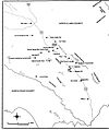 Coyote Ridge Map.JPG 600 × 716; 47 KB
-
 Distribution of Neopalpa species.jpg 1,512 × 1,591; 1.76 MB
-
 Distributionpussymoth.jpg 557 × 600; 50 KB
-
 Eastern Comma range map01.JPG 469 × 492; 40 KB
-
 Eumaeus atala range map.JPG 365 × 345; 7 KB
-
 Eurytides marcellus range map.PNG 524 × 605; 41 KB
-
 Hypaurotis crysalus range map.JPG 495 × 571; 17 KB
-
 Limenitis arthemis range map.PNG 524 × 604; 40 KB
-
 Lycaena epixanthe range map.PNG 524 × 604; 40 KB
-
 Lycaena hermes range map.JPG 530 × 433; 10 KB
-

-

-

-

-

-

-

-
-

-

-

-

-

-

-

-

-

-

-
 Papilio brevicauda range map.PNG 524 × 605; 41 KB
-
 Papilio eurymedon range map.JPG 494 × 571; 19 KB
-
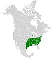
 Papilio glaucus range map.JPG 524 × 605; 51 KB
-
 Papilio palamedes range map.PNG 524 × 605; 41 KB
-
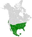
 Papilio rutulus range map.PNG 524 × 605; 41 KB
-
 Papilio troilus range map.PNG 524 × 605; 40 KB
-
 Parides alopius range map.JPG 524 × 605; 21 KB
-
 PcanadensisMap.jpg 1,024 × 787; 115 KB
-
 Pieris virginiensis range map.JPG 495 × 571; 18 KB
-
 Polites themistocles range map.PNG 524 × 605; 40 KB
-
 Polygonia comma range map.JPG 572 × 565; 26 KB
-
 Pontia protodice range map.JPG 524 × 605; 33 KB
-
 Satyrium calanus range map.PNG 524 × 605; 40 KB
-
 Satyrium titus range map.JPG 492 × 571; 25 KB
-
 Speyeria idalia range map.JPG 561 × 563; 25 KB
-
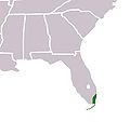
 St francis satyr nc dist.png 3,228 × 1,292; 76 KB
-

-
 Thorybes bathyllus range map.PNG 524 × 605; 41 KB
-
 Zebra Swallowtail range map03.JPG 198 × 134; 6 KB


_(17802166683).jpg)
_(18418661232).jpg)
_(14774278864).jpg)


_(19804130004).jpg)
_(20313037130).jpg)


_(14595736350).jpg)
_(14595740500).jpg)
_(14595742380).jpg)
_(14595748880).jpg)
_(14595779239).jpg)
_(14595787369).jpg)
_(14595788739).jpg)
_(14759458416).jpg)
_(14759464896).jpg)
_(14779305591).jpg)
_(14780090544).jpg)
_(14780101134).jpg)
_(14780102954).jpg)
_(14780103554).jpg)
_(14780104854).jpg)
_(14782111552).jpg)
_(14802309453).jpg)
_(14802314683).jpg)