File:Bus and tram routes in Ghent 1954-01-01.pdf
Jump to navigation
Jump to search

Size of this JPG preview of this PDF file: 632 × 599 pixels. Other resolutions: 253 × 240 pixels | 506 × 480 pixels | 810 × 768 pixels | 1,080 × 1,024 pixels | 2,161 × 2,048 pixels | 12,806 × 12,139 pixels.
Original file (12,806 × 12,139 pixels, file size: 21.57 MB, MIME type: application/pdf)
Captions
Captions
Add a one-line explanation of what this file represents
Summary
[edit]| Title |
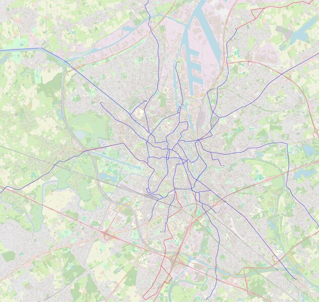
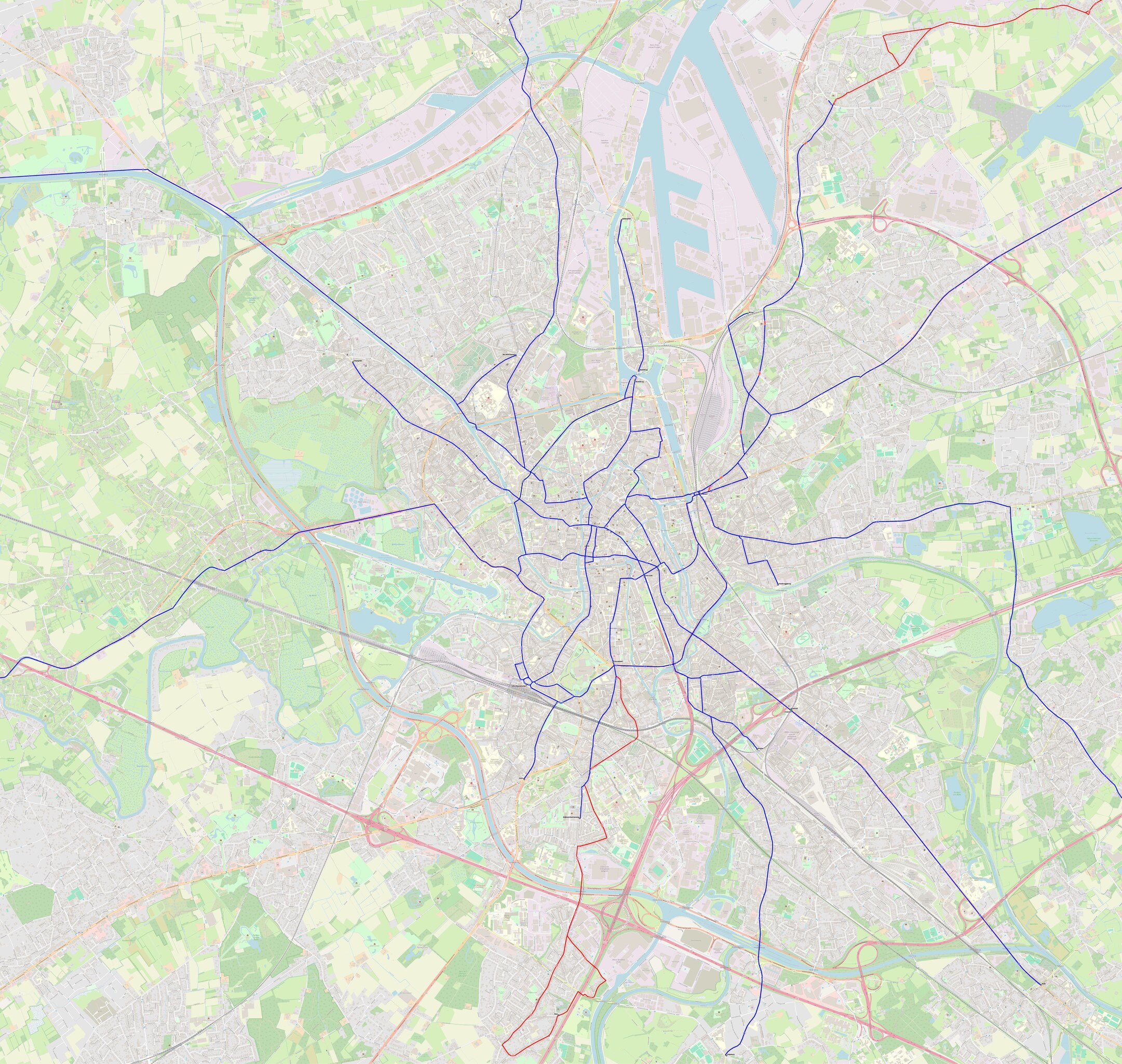
English: Bus and tram routes in Ghent 1954-01-01. |
|||
| Description |
English: Map border for QGIS export (clockwise) : 6640968,8919; 424628,4014; 6620410,7669; 402919,3389. |
|||
| Date | ||||
| Source |
Own work
|
|||
| Creator | ||||
| Permission (Reusing this file) |
All OpenStreetMap data and maps are Creative Commons "CC-BY-SA 2.0" licensed | |||
| Geotemporal data | ||||
| Date depicted | ||||
| Scale | 1:10,000 | |||
| Georeferencing | If inappropriate please set warp_status = skip to hide. | |||
Licensing
[edit]This file is licensed under the Creative Commons Attribution-Share Alike 4.0 International license.
- You are free:
- to share – to copy, distribute and transmit the work
- to remix – to adapt the work
- Under the following conditions:
- attribution – You must give appropriate credit, provide a link to the license, and indicate if changes were made. You may do so in any reasonable manner, but not in any way that suggests the licensor endorses you or your use.
- share alike – If you remix, transform, or build upon the material, you must distribute your contributions under the same or compatible license as the original.
File history
Click on a date/time to view the file as it appeared at that time.
| Date/Time | Thumbnail | Dimensions | User | Comment | |
|---|---|---|---|---|---|
| current | 01:12, 27 January 2024 |  | 12,806 × 12,139 (21.57 MB) | Arflhn (talk | contribs) | maj |
| 00:58, 27 January 2024 |  | 12,816 × 12,137 (21.55 MB) | Arflhn (talk | contribs) | == {{int:filedesc}} == {{Map |title ={{en|Bus and tram routes in Ghent 1962-01-01.}} |description ={{en|Map border for QGIS export (clockwise) : 6640968,8919; 424628,4014; 6620410,7669; 402919,3389.}} |legend = |author =Arflhn |image = |date =1962-01-01 |source ={{own}}<br>{{ODbL OpenStreetMap}} |permission =All OpenStreetMap data and maps are Creative Commons "CC-BY-SA 2.0" licensed |m... |
You cannot overwrite this file.
File usage on Commons
The following 2 pages use this file: