File:British Columbia and the North West Territory in the Dominion of Canada. (IA bp 2875).pdf
Jump to navigation
Jump to search

Size of this JPG preview of this PDF file: 775 × 599 pixels. Other resolutions: 311 × 240 pixels | 621 × 480 pixels | 993 × 768 pixels | 1,280 × 990 pixels | 2,560 × 1,980 pixels | 4,141 × 3,202 pixels.
Original file (4,141 × 3,202 pixels, file size: 4.35 MB, MIME type: application/pdf)
Captions
Captions
Add a one-line explanation of what this file represents
Summary
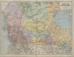
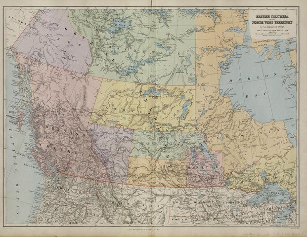
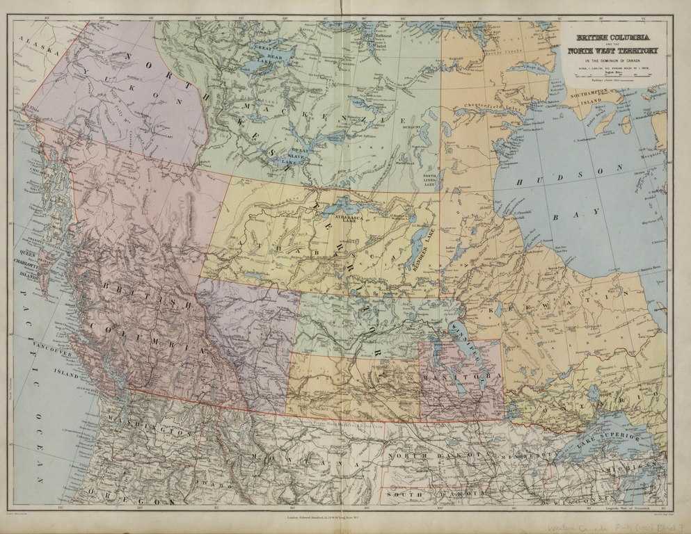
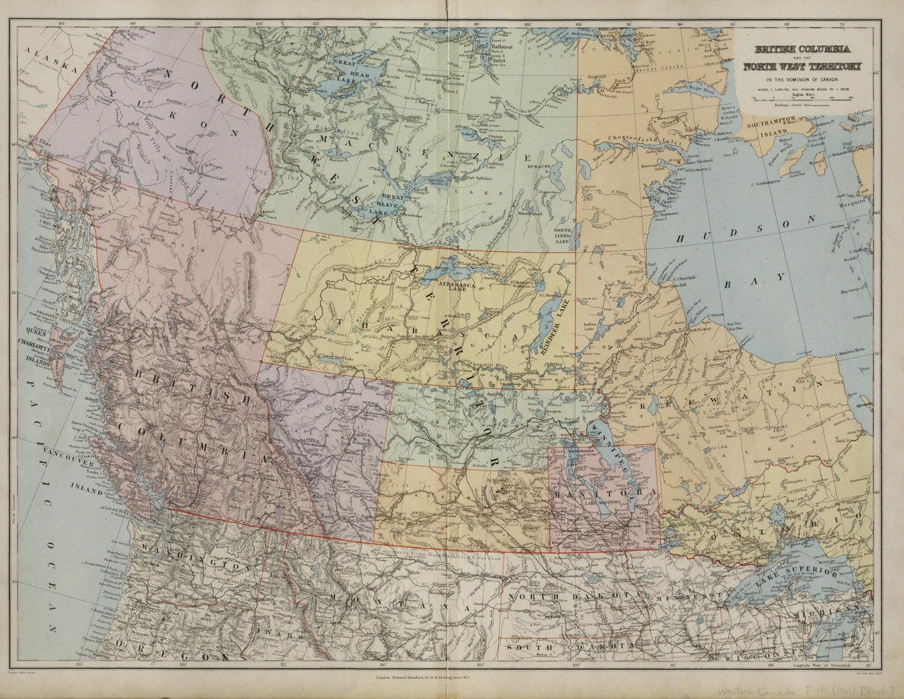
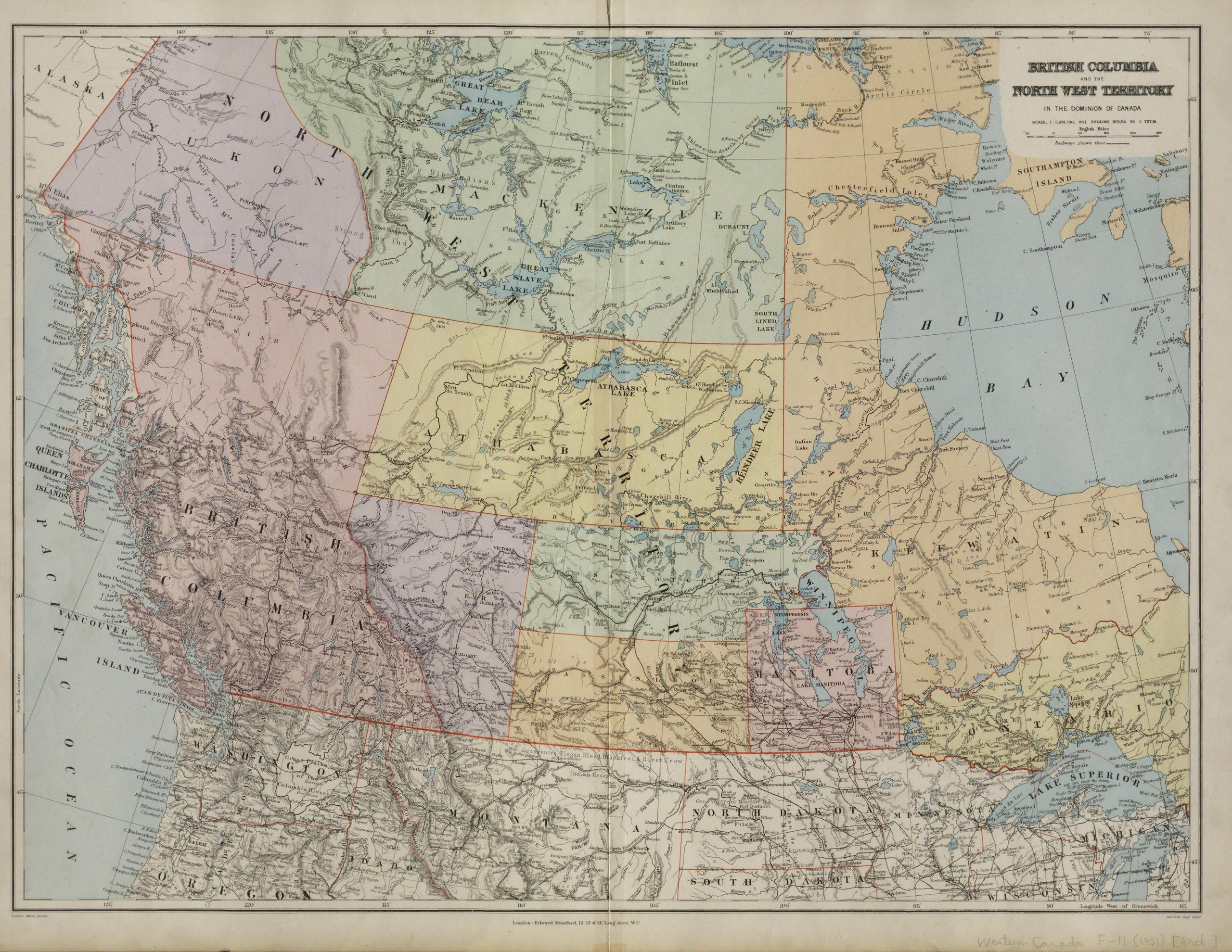
[edit]| British Columbia and the North West Territory in the Dominion of Canada.
( |
|
|---|---|
| Title |
British Columbia and the North West Territory in the Dominion of Canada. |
| Publisher |
Dept. of Interior, Canada |
| Description |
Edmonton is still "Ft. Edmonton". "Coal District" is shown west of Edmonton and north of Pigeon Lake.;Scanned in Peel's Prairie Provinces database: Map 296: http://peel.library.ualberta.ca/maps/M000296.html;From Stanford's London Atlas (London: Edward Stanford, 19--?).; 1 map : col. ; 50.6 x 68.1 cm. on sheet 55.6 x 74.4 cm Subjects: Western Canada--Political geography |
| Language | English |
| Publication date | [1896] |
| Current location |
IA Collections: wcw_gale; wcw; university_of_alberta_libraries; toronto |
| Accession number |
bp_2875 |
| Notes | Scale: 1:5,284,720. |
| Source | |
Licensing
[edit]|
This work is in the public domain in its country of origin and other countries and areas where the copyright term is the author's life plus 70 years or fewer. | |
| This file has been identified as being free of known restrictions under copyright law, including all related and neighboring rights. | |
File history
Click on a date/time to view the file as it appeared at that time.
| Date/Time | Thumbnail | Dimensions | User | Comment | |
|---|---|---|---|---|---|
| current | 12:36, 27 August 2021 |  | 4,141 × 3,202 (4.35 MB) | Fæ (talk | contribs) | IA Query "collection:(wcw) date:[1000 TO 1899]" bp_2875 Category:William C. Wonders Map Collection (COM:IA books#query) (1896 #219) |
You cannot overwrite this file.
File usage on Commons
The following page uses this file: