File:Bristol ag csb map.png
Jump to navigation
Jump to search
No higher resolution available.
Bristol_ag_csb_map.png (538 × 372 pixels, file size: 78 KB, MIME type: image/png)
Captions
Captions
Add a one-line explanation of what this file represents
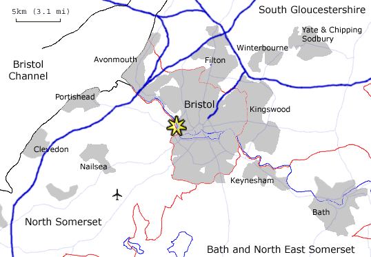
| Description | Map showing location of the Avon Gorge / Clifton Suspension Bridge within Bristol. | ||
| Source | Own work | ||
| Author | Steinsky | ||
| Permission (Reusing this file) |
|
| Camera location | | View this and other nearby images on: OpenStreetMap |
|---|
File history
Click on a date/time to view the file as it appeared at that time.
| Date/Time | Thumbnail | Dimensions | User | Comment | |
|---|---|---|---|---|---|
| current | 22:25, 14 May 2006 | | 538 × 372 (78 KB) | Steinsky (talk | contribs) | Avon Gorge / Clifton Suspension Bridge. |
You cannot overwrite this file.
File usage on Commons
There are no pages that use this file.